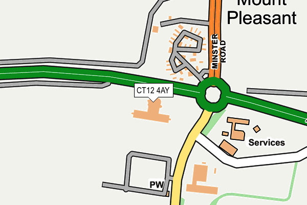
CT12 4AY is located in the Thanet Villages electoral ward, within the local authority district of Thanet and the English Parliamentary constituency of North Thanet. The Sub Integrated Care Board (ICB) Location is NHS Kent and Medway ICB - 91Q and the police force is Kent. This postcode has been in use since November 2005.


GetTheData
Source: OS OpenMap – Local (Ordnance Survey)
Source: OS VectorMap District (Ordnance Survey)
Licence: Open Government Licence (requires attribution)
| Easting | 631178 |
| Northing | 165688 |
| Latitude | 51.343242 |
| Longitude | 1.318059 |
GetTheData
Source: Open Postcode Geo
Licence: Open Government Licence
| Country | England |
| Postcode District | CT12 |
| ➜ CT12 open data dashboard ➜ See where CT12 is on a map ➜ Where is Minster? | |
GetTheData
Source: Land Registry Price Paid Data
Licence: Open Government Licence
Elevation or altitude of CT12 4AY as distance above sea level:
| Metres | Feet | |
|---|---|---|
| Elevation | 50m | 164ft |
Elevation is measured from the approximate centre of the postcode, to the nearest point on an OS contour line from OS Terrain 50, which has contour spacing of ten vertical metres.
➜ How high above sea level am I? Find the elevation of your current position using your device's GPS.
GetTheData
Source: Open Postcode Elevation
Licence: Open Government Licence
| Ward | Thanet Villages |
| Constituency | North Thanet |
GetTheData
Source: ONS Postcode Database
Licence: Open Government Licence
| June 2022 | Other theft | On or near Southall Close | 224m |
| June 2022 | Shoplifting | On or near Southall Close | 224m |
| June 2022 | Shoplifting | On or near Southall Close | 224m |
| ➜ Get more crime data in our Crime section | |||
GetTheData
Source: data.police.uk
Licence: Open Government Licence
| Smugglers Leap Caravan Park (Minster Road) | Minster | 187m |
| Smugglers Leap Caravan Park (Minster Road) | Minster | 197m |
| Cemetery (Tothill Street) | Minster | 224m |
| Cemetery (Tothill Street) | Minster | 271m |
| Foxborough Lane (Tothill Street) | Minster | 680m |
| Minster Station | 1.6km |
| Birchington-on-Sea Station | 4km |
| Westgate-on-Sea Station | 4.5km |
GetTheData
Source: NaPTAN
Licence: Open Government Licence
GetTheData
Source: ONS Postcode Database
Licence: Open Government Licence


➜ Get more ratings from the Food Standards Agency
GetTheData
Source: Food Standards Agency
Licence: FSA terms & conditions
| Last Collection | |||
|---|---|---|---|
| Location | Mon-Fri | Sat | Distance |
| Hill House | 16:30 | 09:00 | 265m |
| Greenhill Gardens | 16:30 | 10:00 | 751m |
| Pinks Corner | 16:30 | 09:00 | 928m |
GetTheData
Source: Dracos
Licence: Creative Commons Attribution-ShareAlike
| Facility | Distance |
|---|---|
| King George V Park (Minster) St Mildreds Road, Minster, Ramsgate Grass Pitches, Artificial Grass Pitch, Outdoor Tennis Courts | 1.3km |
| Birchington Vale Shottendane Road, Birchington Swimming Pool | 2.7km |
| Monkton Recreation Ground Monkton Street, Monkton, Ramsgate Grass Pitches | 2.8km |
GetTheData
Source: Active Places
Licence: Open Government Licence
| School | Phase of Education | Distance |
|---|---|---|
| Minster Church of England Primary School Molineux Road, Minster-in-Thanet, Ramsgate, CT12 4PS | Primary | 1.2km |
| Monkton Church of England Primary School Monkton Street, Monkton, Ramsgate, CT12 4JQ | Primary | 2.6km |
| The Llewellyn School and Nursery Quex Park Estate, Birchington, Kent, Margate, CT7 0BB | Not applicable | 2.7km |
GetTheData
Source: Edubase
Licence: Open Government Licence
The below table lists the International Territorial Level (ITL) codes (formerly Nomenclature of Territorial Units for Statistics (NUTS) codes) and Local Administrative Units (LAU) codes for CT12 4AY:
| ITL 1 Code | Name |
|---|---|
| TLJ | South East (England) |
| ITL 2 Code | Name |
| TLJ4 | Kent |
| ITL 3 Code | Name |
| TLJ44 | East Kent |
| LAU 1 Code | Name |
| E07000114 | Thanet |
GetTheData
Source: ONS Postcode Directory
Licence: Open Government Licence
The below table lists the Census Output Area (OA), Lower Layer Super Output Area (LSOA), and Middle Layer Super Output Area (MSOA) for CT12 4AY:
| Code | Name | |
|---|---|---|
| OA | E00125389 | |
| LSOA | E01024701 | Thanet 014A |
| MSOA | E02005145 | Thanet 014 |
GetTheData
Source: ONS Postcode Directory
Licence: Open Government Licence
| CT12 4AU | Mount Pleasant | 197m |
| CT12 4AR | Southall Close | 213m |
| CT12 4BF | Semple Close | 249m |
| CT12 4AS | Hill House Drive | 285m |
| CT12 4BE | Hill House Drive | 285m |
| CT12 4BD | Burgess Close | 331m |
| CT12 4AP | Tothill Street | 357m |
| CT12 4AW | Fairfield Road | 447m |
| CT12 4AN | Tothill Street | 453m |
| CT12 4AE | Laurensfield | 499m |
GetTheData
Source: Open Postcode Geo; Land Registry Price Paid Data
Licence: Open Government Licence