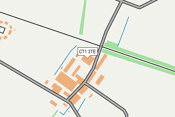
CT1 3TE is located in the Barton electoral ward, within the local authority district of Canterbury and the English Parliamentary constituency of Canterbury. The Sub Integrated Care Board (ICB) Location is NHS Kent and Medway ICB - 91Q and the police force is Kent. This postcode has been in use since December 2000.


GetTheData
Source: OS OpenMap – Local (Ordnance Survey)
Source: OS VectorMap District (Ordnance Survey)
Licence: Open Government Licence (requires attribution)
| Easting | 616816 |
| Northing | 156982 |
| Latitude | 51.270729 |
| Longitude | 1.106891 |
GetTheData
Source: Open Postcode Geo
Licence: Open Government Licence
| Country | England |
| Postcode District | CT1 |
| ➜ CT1 open data dashboard ➜ See where CT1 is on a map ➜ Where is Canterbury? | |
GetTheData
Source: Land Registry Price Paid Data
Licence: Open Government Licence
Elevation or altitude of CT1 3TE as distance above sea level:
| Metres | Feet | |
|---|---|---|
| Elevation | 40m | 131ft |
Elevation is measured from the approximate centre of the postcode, to the nearest point on an OS contour line from OS Terrain 50, which has contour spacing of ten vertical metres.
➜ How high above sea level am I? Find the elevation of your current position using your device's GPS.
GetTheData
Source: Open Postcode Elevation
Licence: Open Government Licence
| Ward | Barton |
| Constituency | Canterbury |
GetTheData
Source: ONS Postcode Database
Licence: Open Government Licence
| June 2022 | Violence and sexual offences | On or near Dorset Road | 322m |
| June 2022 | Violence and sexual offences | On or near Dorset Road | 322m |
| June 2022 | Anti-social behaviour | On or near Dorset Road | 322m |
| ➜ Get more crime data in our Crime section | |||
GetTheData
Source: data.police.uk
Licence: Open Government Licence
| Hampshire Road | Spring Lane Estate | 311m |
| Surrey Road (Spring Lane) | Spring Lane Estate | 359m |
| Pilgrims Way (Barton Road) | Barton Estate | 402m |
| Cumberland Avenue (Sussex Avenue) | Spring Lane Estate | 451m |
| Sussex Avenue | Spring Lane Estate | 521m |
| Canterbury East Station | 2.2km |
| Bekesbourne Station | 2.3km |
| Canterbury West Station | 2.7km |
GetTheData
Source: NaPTAN
Licence: Open Government Licence
GetTheData
Source: ONS Postcode Database
Licence: Open Government Licence


➜ Get more ratings from the Food Standards Agency
GetTheData
Source: Food Standards Agency
Licence: FSA terms & conditions
| Last Collection | |||
|---|---|---|---|
| Location | Mon-Fri | Sat | Distance |
| Pilgrims Way | 17:45 | 12:00 | 403m |
| Kent Avenue | 18:00 | 12:00 | 513m |
| Collard House | 18:00 | 12:00 | 706m |
GetTheData
Source: Dracos
Licence: Creative Commons Attribution-ShareAlike
| Facility | Distance |
|---|---|
| Spring Lane Football Pitches Spring Lane, Canterbury Grass Pitches | 327m |
| Barton Manor School Spring Lane, Canterbury Sports Hall | 613m |
| Chaucer Technology School (Closed) Spring Lane, Canterbury Grass Pitches, Sports Hall, Studio | 638m |
GetTheData
Source: Active Places
Licence: Open Government Licence
| School | Phase of Education | Distance |
|---|---|---|
| Pilgrims' Way Primary School Pilgrims Way, Canterbury, CT1 1XU | Primary | 603m |
| Barton Manor School Spring Lane, Canterbury, CT1 1SU | Secondary | 613m |
| The Worthgate School 68 New Dover Road, Canterbury, CT1 3LQ | Not applicable | 941m |
GetTheData
Source: Edubase
Licence: Open Government Licence
The below table lists the International Territorial Level (ITL) codes (formerly Nomenclature of Territorial Units for Statistics (NUTS) codes) and Local Administrative Units (LAU) codes for CT1 3TE:
| ITL 1 Code | Name |
|---|---|
| TLJ | South East (England) |
| ITL 2 Code | Name |
| TLJ4 | Kent |
| ITL 3 Code | Name |
| TLJ44 | East Kent |
| LAU 1 Code | Name |
| E07000106 | Canterbury |
GetTheData
Source: ONS Postcode Directory
Licence: Open Government Licence
The below table lists the Census Output Area (OA), Lower Layer Super Output Area (LSOA), and Middle Layer Super Output Area (MSOA) for CT1 3TE:
| Code | Name | |
|---|---|---|
| OA | E00122097 | |
| LSOA | E01024045 | Canterbury 016B |
| MSOA | E02005025 | Canterbury 016 |
GetTheData
Source: ONS Postcode Directory
Licence: Open Government Licence
| CT1 1XY | Mount Pleasant Cottages | 162m |
| CT1 1YB | Little Barton Farm Cottages | 173m |
| CT1 1SG | Spring Lane | 243m |
| CT1 1SH | Spring Lane | 300m |
| CT1 1SJ | Hampshire Road | 341m |
| CT1 1SF | Dorset Road | 345m |
| CT1 1YA | Pilgrims Way | 361m |
| CT1 1SS | Surrey Road | 373m |
| CT1 1SL | Cumberland Avenue | 381m |
| CT1 1XZ | Chaucer Close | 389m |
GetTheData
Source: Open Postcode Geo; Land Registry Price Paid Data
Licence: Open Government Licence