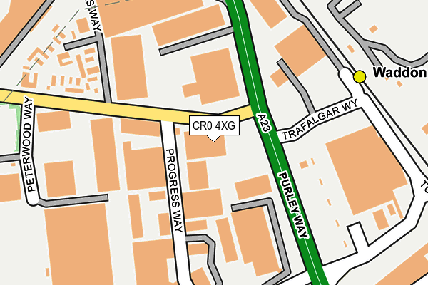
CR0 4XG is located in the Waddon electoral ward, within the London borough of Croydon and the English Parliamentary constituency of Croydon North. The Sub Integrated Care Board (ICB) Location is NHS South West London ICB - 36L and the police force is Metropolitan Police. This postcode has been in use since January 1980.


GetTheData
Source: OS OpenMap – Local (Ordnance Survey)
Source: OS VectorMap District (Ordnance Survey)
Licence: Open Government Licence (requires attribution)
| Easting | 530884 |
| Northing | 165803 |
| Latitude | 51.376202 |
| Longitude | -0.120843 |
GetTheData
Source: Open Postcode Geo
Licence: Open Government Licence
| Country | England |
| Postcode District | CR0 |
➜ See where CR0 is on a map ➜ Where is London? | |
GetTheData
Source: Land Registry Price Paid Data
Licence: Open Government Licence
Elevation or altitude of CR0 4XG as distance above sea level:
| Metres | Feet | |
|---|---|---|
| Elevation | 40m | 131ft |
Elevation is measured from the approximate centre of the postcode, to the nearest point on an OS contour line from OS Terrain 50, which has contour spacing of ten vertical metres.
➜ How high above sea level am I? Find the elevation of your current position using your device's GPS.
GetTheData
Source: Open Postcode Elevation
Licence: Open Government Licence
| Ward | Waddon |
| Constituency | Croydon North |
GetTheData
Source: ONS Postcode Database
Licence: Open Government Licence
| Purley Way Beddington Farm Rd | Waddon | 104m |
| Purley Way Beddington Farm Rd | Waddon | 110m |
| Commerce Way | Waddon | 147m |
| Waddon Marsh Tram Stop (Trafalgar Way) | Waddon | 183m |
| The Purley Way Centre (Drury Crescent) | Waddon | 276m |
| Waddon Marsh Tram Stop (Off Gurney Crescent) | Waddon | 221m |
| Wandle Park Tram Stop (Vicarage Road) | Waddon | 613m |
| Ampere Way Tram Stop (Ampere Way) | Broad Green | 705m |
| Reeves Corner Tram Stop (Cairo New Road) | Croydon | 1,012m |
| Centrale Tram Stop (Tamworth Road) | Croydon | 1,181m |
| Waddon Station | 1km |
| West Croydon Station | 1.3km |
| East Croydon Station | 2km |
GetTheData
Source: NaPTAN
Licence: Open Government Licence
| Median download speed | 6.4Mbps |
| Average download speed | 5.9Mbps |
| Maximum download speed | 8.48Mbps |
| Median upload speed | 0.7Mbps |
| Average upload speed | 0.7Mbps |
| Maximum upload speed | 1.09Mbps |
GetTheData
Source: Ofcom
Licence: Ofcom Terms of Use (requires attribution)
GetTheData
Source: ONS Postcode Database
Licence: Open Government Licence


➜ Get more ratings from the Food Standards Agency
GetTheData
Source: Food Standards Agency
Licence: FSA terms & conditions
| Last Collection | |||
|---|---|---|---|
| Location | Mon-Fri | Sat | Distance |
| Beddington Farm Rd/Purley Way | 19:00 | 12:00 | 62m |
| Sainsbury | 19:00 | 12:00 | 204m |
| Commerce Way/Purley Way | 19:00 | 12:00 | 227m |
GetTheData
Source: Dracos
Licence: Creative Commons Attribution-ShareAlike
| Risk of CR0 4XG flooding from rivers and sea | Low |
| ➜ CR0 4XG flood map | |
GetTheData
Source: Open Flood Risk by Postcode
Licence: Open Government Licence
The below table lists the International Territorial Level (ITL) codes (formerly Nomenclature of Territorial Units for Statistics (NUTS) codes) and Local Administrative Units (LAU) codes for CR0 4XG:
| ITL 1 Code | Name |
|---|---|
| TLI | London |
| ITL 2 Code | Name |
| TLI6 | Outer London - South |
| ITL 3 Code | Name |
| TLI62 | Croydon |
| LAU 1 Code | Name |
| E09000008 | Croydon |
GetTheData
Source: ONS Postcode Directory
Licence: Open Government Licence
The below table lists the Census Output Area (OA), Lower Layer Super Output Area (LSOA), and Middle Layer Super Output Area (MSOA) for CR0 4XG:
| Code | Name | |
|---|---|---|
| OA | E00005026 | |
| LSOA | E01001010 | Croydon 019D |
| MSOA | E02000212 | Croydon 019 |
GetTheData
Source: ONS Postcode Directory
Licence: Open Government Licence
| CR0 4XR | Broadfield Close | 148m |
| CR0 4XA | Commerce Way | 243m |
| CR0 4WT | Ampere Way | 262m |
| CR0 3JQ | Martin Crescent | 316m |
| CR0 4YA | Hesterman Way | 332m |
| CR0 4WH | Whitestone Way | 355m |
| CR0 4WJ | Whitestone Way | 384m |
| CR0 4WL | Whitestone Way | 384m |
| CR0 4WN | Whitestone Way | 384m |
| CR0 3JR | Gurney Crescent | 403m |
GetTheData
Source: Open Postcode Geo; Land Registry Price Paid Data
Licence: Open Government Licence