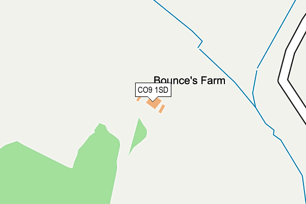
CO9 1SD is located in the Gosfield & Greenstead Green electoral ward, within the local authority district of Braintree and the English Parliamentary constituency of Braintree. The Sub Integrated Care Board (ICB) Location is NHS Mid and South Essex ICB - 06Q and the police force is Essex. This postcode has been in use since August 1993.


GetTheData
Source: OS OpenMap – Local (Ordnance Survey)
Source: OS VectorMap District (Ordnance Survey)
Licence: Open Government Licence (requires attribution)
| Easting | 576254 |
| Northing | 230860 |
| Latitude | 51.948308 |
| Longitude | 0.563177 |
GetTheData
Source: Open Postcode Geo
Licence: Open Government Licence
| Country | England |
| Postcode District | CO9 |
| ➜ CO9 open data dashboard ➜ See where CO9 is on a map | |
GetTheData
Source: Land Registry Price Paid Data
Licence: Open Government Licence
Elevation or altitude of CO9 1SD as distance above sea level:
| Metres | Feet | |
|---|---|---|
| Elevation | 80m | 262ft |
Elevation is measured from the approximate centre of the postcode, to the nearest point on an OS contour line from OS Terrain 50, which has contour spacing of ten vertical metres.
➜ How high above sea level am I? Find the elevation of your current position using your device's GPS.
GetTheData
Source: Open Postcode Elevation
Licence: Open Government Licence
| Ward | Gosfield & Greenstead Green |
| Constituency | Braintree |
GetTheData
Source: ONS Postcode Database
Licence: Open Government Licence
GetTheData
Source: ONS Postcode Database
Licence: Open Government Licence


➜ Get more ratings from the Food Standards Agency
GetTheData
Source: Food Standards Agency
Licence: FSA terms & conditions
| Last Collection | |||
|---|---|---|---|
| Location | Mon-Fri | Sat | Distance |
| Church Road Gosfield | 17:30 | 10:30 | 2,106m |
| Gosfield Caravan Park | 16:30 | 10:30 | 2,140m |
| Rotten End | 16:00 | 08:00 | 3,223m |
GetTheData
Source: Dracos
Licence: Creative Commons Attribution-ShareAlike
| Facility | Distance |
|---|---|
| Gosfield Lake Golf Club Gosfield Hall Park, Gosfield, Halstead Golf | 1.3km |
| St Margarets Prep School Gosfield Hall Park, Gosfield, Halstead Grass Pitches | 1.6km |
| Blackmore End Playing Fields School Road, Blackmore End, Braintree Grass Pitches | 2.1km |
GetTheData
Source: Active Places
Licence: Open Government Licence
| School | Phase of Education | Distance |
|---|---|---|
| St Margaret's Preparatory School Gosfield Hall Park, Gosfield, Halstead, CO9 1SE | Not applicable | 1.6km |
| Gosfield Community Primary School The Street, Gosfield, Halstead, CO9 1ST | Primary | 2.2km |
| Gosfield School Cut Hedge Park, Halstead Road, Halstead, CO9 1PF | Not applicable | 2.7km |
GetTheData
Source: Edubase
Licence: Open Government Licence
The below table lists the International Territorial Level (ITL) codes (formerly Nomenclature of Territorial Units for Statistics (NUTS) codes) and Local Administrative Units (LAU) codes for CO9 1SD:
| ITL 1 Code | Name |
|---|---|
| TLH | East |
| ITL 2 Code | Name |
| TLH3 | Essex |
| ITL 3 Code | Name |
| TLH34 | Essex Haven Gateway |
| LAU 1 Code | Name |
| E07000067 | Braintree |
GetTheData
Source: ONS Postcode Directory
Licence: Open Government Licence
The below table lists the Census Output Area (OA), Lower Layer Super Output Area (LSOA), and Middle Layer Super Output Area (MSOA) for CO9 1SD:
| Code | Name | |
|---|---|---|
| OA | E00108609 | |
| LSOA | E01021381 | Braintree 007F |
| MSOA | E02004452 | Braintree 007 |
GetTheData
Source: ONS Postcode Directory
Licence: Open Government Licence
| CO9 1SB | Gosfield Aerodrome | 590m |
| CM7 4DJ | 1061m | |
| CO9 1RZ | Gosfield Hall Park | 1183m |
| CO9 1SG | Park Hall Cottages | 1221m |
| CM7 4DH | 1350m | |
| CM7 4DW | 1473m | |
| CO9 1SE | Gosfield Hall Park | 1619m |
| CM7 4DQ | 1757m | |
| CO9 3RN | Southey Green | 1766m |
| CO9 1SQ | Park Hall Road | 1876m |
GetTheData
Source: Open Postcode Geo; Land Registry Price Paid Data
Licence: Open Government Licence