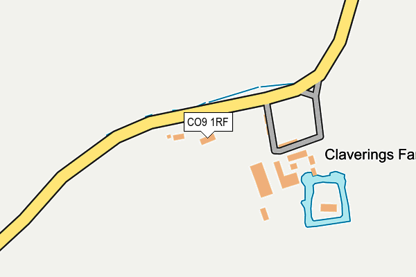
CO9 1RF lies on Lucas Cottages in Greenstead Green, Halstead. CO9 1RF is located in the Gosfield & Greenstead Green electoral ward, within the local authority district of Braintree and the English Parliamentary constituency of Braintree. The Sub Integrated Care Board (ICB) Location is NHS Mid and South Essex ICB - 06Q and the police force is Essex. This postcode has been in use since January 1980.


GetTheData
Source: OS OpenMap – Local (Ordnance Survey)
Source: OS VectorMap District (Ordnance Survey)
Licence: Open Government Licence (requires attribution)
| Easting | 581933 |
| Northing | 226859 |
| Latitude | 51.910557 |
| Longitude | 0.643631 |
GetTheData
Source: Open Postcode Geo
Licence: Open Government Licence
| Street | Lucas Cottages |
| Locality | Greenstead Green |
| Town/City | Halstead |
| Country | England |
| Postcode District | CO9 |
| ➜ CO9 open data dashboard ➜ See where CO9 is on a map | |
GetTheData
Source: Land Registry Price Paid Data
Licence: Open Government Licence
Elevation or altitude of CO9 1RF as distance above sea level:
| Metres | Feet | |
|---|---|---|
| Elevation | 60m | 197ft |
Elevation is measured from the approximate centre of the postcode, to the nearest point on an OS contour line from OS Terrain 50, which has contour spacing of ten vertical metres.
➜ How high above sea level am I? Find the elevation of your current position using your device's GPS.
GetTheData
Source: Open Postcode Elevation
Licence: Open Government Licence
| Ward | Gosfield & Greenstead Green |
| Constituency | Braintree |
GetTheData
Source: ONS Postcode Database
Licence: Open Government Licence
| The Hare & Hounds (Brook Farm Road) | Greenstead Green | 1,008m |
| The Hare & Hounds (Brook Farm Road) | Greenstead Green | 1,015m |
GetTheData
Source: NaPTAN
Licence: Open Government Licence
| Percentage of properties with Next Generation Access | 100.0% |
| Percentage of properties with Superfast Broadband | 0.0% |
| Percentage of properties with Ultrafast Broadband | 0.0% |
| Percentage of properties with Full Fibre Broadband | 0.0% |
Superfast Broadband is between 30Mbps and 300Mbps
Ultrafast Broadband is > 300Mbps
| Percentage of properties unable to receive 2Mbps | 0.0% |
| Percentage of properties unable to receive 5Mbps | 0.0% |
| Percentage of properties unable to receive 10Mbps | 0.0% |
| Percentage of properties unable to receive 30Mbps | 100.0% |
GetTheData
Source: Ofcom
Licence: Ofcom Terms of Use (requires attribution)
GetTheData
Source: ONS Postcode Database
Licence: Open Government Licence


➜ Get more ratings from the Food Standards Agency
GetTheData
Source: Food Standards Agency
Licence: FSA terms & conditions
| Last Collection | |||
|---|---|---|---|
| Location | Mon-Fri | Sat | Distance |
| Pennypot | 16:30 | 10:30 | 2,597m |
| Firwoods Road | 17:00 | 11:45 | 2,816m |
| Bentall Close Highfields | 17:00 | 11:45 | 2,843m |
GetTheData
Source: Dracos
Licence: Creative Commons Attribution-ShareAlike
| Facility | Distance |
|---|---|
| Kings Lane Playing Field Kings Lane, Stisted, Braintree Grass Pitches | 2.9km |
| The Essex Golf & Country Club Airfield, Earls Colne, Colchester Swimming Pool, Health and Fitness Gym, Indoor Tennis Centre, Golf, Studio, Outdoor Tennis Courts | 3km |
| Braintree Golf Club Kings Lane, Stisted, Braintree Golf | 3.4km |
GetTheData
Source: Active Places
Licence: Open Government Licence
| School | Phase of Education | Distance |
|---|---|---|
| Stisted Church of England Primary Academy The Street, Stisted, Braintree, CM77 8AN | Primary | 2.8km |
| Richard de Clare Community Academy Parsonage Street, Halstead, CO9 2JT | Primary | 3.6km |
| Holy Trinity Church of England Voluntary Controlled Primary School, Halstead Beridge Road, Halstead, CO9 1JH | Primary | 3.8km |
GetTheData
Source: Edubase
Licence: Open Government Licence
The below table lists the International Territorial Level (ITL) codes (formerly Nomenclature of Territorial Units for Statistics (NUTS) codes) and Local Administrative Units (LAU) codes for CO9 1RF:
| ITL 1 Code | Name |
|---|---|
| TLH | East |
| ITL 2 Code | Name |
| TLH3 | Essex |
| ITL 3 Code | Name |
| TLH34 | Essex Haven Gateway |
| LAU 1 Code | Name |
| E07000067 | Braintree |
GetTheData
Source: ONS Postcode Directory
Licence: Open Government Licence
The below table lists the Census Output Area (OA), Lower Layer Super Output Area (LSOA), and Middle Layer Super Output Area (MSOA) for CO9 1RF:
| Code | Name | |
|---|---|---|
| OA | E00108615 | |
| LSOA | E01021382 | Braintree 003A |
| MSOA | E02004448 | Braintree 003 |
GetTheData
Source: ONS Postcode Directory
Licence: Open Government Licence
| CO9 1RB | Stisted Road | 602m |
| CO9 1RJ | 618m | |
| CO9 1RH | 810m | |
| CO9 1QZ | Grange Hill | 944m |
| CO9 1RG | Burtons Green Road | 1071m |
| CO9 1RQ | Burtons Green Road | 1082m |
| CM77 8BA | 1147m | |
| CO9 1QY | Crocklands | 1213m |
| CO9 1QT | Stone Cottages | 1330m |
| CO9 1QX | 1351m |
GetTheData
Source: Open Postcode Geo; Land Registry Price Paid Data
Licence: Open Government Licence