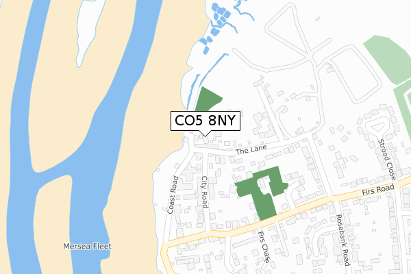
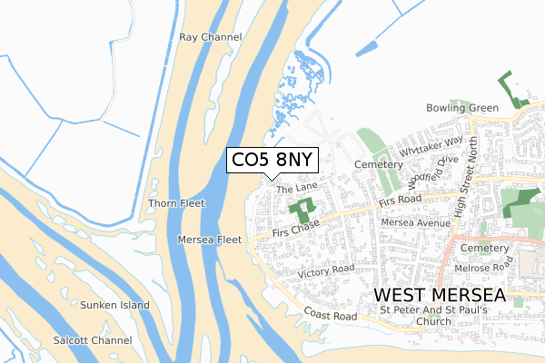
CO5 8NY lies on Carriers Close in West Mersea, Colchester. CO5 8NY is located in the Mersea and Pyefleet electoral ward, within the local authority district of Colchester and the English Parliamentary constituency of Harwich and North Essex. The Sub Integrated Care Board (ICB) Location is NHS Suffolk and North East Essex ICB - 06T and the police force is Essex. This postcode has been in use since April 1987.


GetTheData
Source: OS Open Zoomstack (Ordnance Survey)
Licence: Open Government Licence (requires attribution)
Attribution: Contains OS data © Crown copyright and database right 2025
Source: Open Postcode Geo
Licence: Open Government Licence (requires attribution)
Attribution: Contains OS data © Crown copyright and database right 2025; Contains Royal Mail data © Royal Mail copyright and database right 2025; Source: Office for National Statistics licensed under the Open Government Licence v.3.0
| Easting | 600174 |
| Northing | 213129 |
| Latitude | 51.781010 |
| Longitude | 0.900504 |
GetTheData
Source: Open Postcode Geo
Licence: Open Government Licence
| Street | Carriers Close |
| Locality | West Mersea |
| Town/City | Colchester |
| Country | England |
| Postcode District | CO5 |
➜ See where CO5 is on a map ➜ Where is West Mersea? | |
GetTheData
Source: Land Registry Price Paid Data
Licence: Open Government Licence
Elevation or altitude of CO5 8NY as distance above sea level:
| Metres | Feet | |
|---|---|---|
| Elevation | 10m | 33ft |
Elevation is measured from the approximate centre of the postcode, to the nearest point on an OS contour line from OS Terrain 50, which has contour spacing of ten vertical metres.
➜ How high above sea level am I? Find the elevation of your current position using your device's GPS.
GetTheData
Source: Open Postcode Elevation
Licence: Open Government Licence
| Ward | Mersea And Pyefleet |
| Constituency | Harwich And North Essex |
GetTheData
Source: ONS Postcode Database
Licence: Open Government Licence
2, CARRIERS CLOSE, WEST MERSEA, COLCHESTER, CO5 8NY 2016 31 OCT £390,000 |
2, CARRIERS CLOSE, WEST MERSEA, COLCHESTER, CO5 8NY 2007 19 OCT £362,500 |
GetTheData
Source: HM Land Registry Price Paid Data
Licence: Contains HM Land Registry data © Crown copyright and database right 2025. This data is licensed under the Open Government Licence v3.0.
| High Street | West Mersea | 910m |
| Church (Barfield Road) | West Mersea | 942m |
| Melrose Road (Barfield Road) | West Mersea | 1,171m |
| Yorick Road | West Mersea | 1,233m |
| Underwoods Garage (Kingsland Road) | West Mersea | 1,333m |
GetTheData
Source: NaPTAN
Licence: Open Government Licence
| Percentage of properties with Next Generation Access | 100.0% |
| Percentage of properties with Superfast Broadband | 0.0% |
| Percentage of properties with Ultrafast Broadband | 0.0% |
| Percentage of properties with Full Fibre Broadband | 0.0% |
Superfast Broadband is between 30Mbps and 300Mbps
Ultrafast Broadband is > 300Mbps
| Percentage of properties unable to receive 2Mbps | 0.0% |
| Percentage of properties unable to receive 5Mbps | 0.0% |
| Percentage of properties unable to receive 10Mbps | 0.0% |
| Percentage of properties unable to receive 30Mbps | 100.0% |
GetTheData
Source: Ofcom
Licence: Ofcom Terms of Use (requires attribution)
GetTheData
Source: ONS Postcode Database
Licence: Open Government Licence


➜ Get more ratings from the Food Standards Agency
GetTheData
Source: Food Standards Agency
Licence: FSA terms & conditions
| Last Collection | |||
|---|---|---|---|
| Location | Mon-Fri | Sat | Distance |
| Coast Road West Mersea | 17:00 | 10:30 | 305m |
| Mersea Avenue West Mersea | 17:00 | 10:30 | 561m |
| West Mersea Post Office | 17:30 | 12:00 | 923m |
GetTheData
Source: Dracos
Licence: Creative Commons Attribution-ShareAlike
| Risk of CO5 8NY flooding from rivers and sea | Low |
| ➜ CO5 8NY flood map | |
GetTheData
Source: Open Flood Risk by Postcode
Licence: Open Government Licence
The below table lists the International Territorial Level (ITL) codes (formerly Nomenclature of Territorial Units for Statistics (NUTS) codes) and Local Administrative Units (LAU) codes for CO5 8NY:
| ITL 1 Code | Name |
|---|---|
| TLH | East |
| ITL 2 Code | Name |
| TLH3 | Essex |
| ITL 3 Code | Name |
| TLH34 | Essex Haven Gateway |
| LAU 1 Code | Name |
| E07000071 | Colchester |
GetTheData
Source: ONS Postcode Directory
Licence: Open Government Licence
The below table lists the Census Output Area (OA), Lower Layer Super Output Area (LSOA), and Middle Layer Super Output Area (MSOA) for CO5 8NY:
| Code | Name | |
|---|---|---|
| OA | E00110382 | |
| LSOA | E01021734 | Colchester 021D |
| MSOA | E02004526 | Colchester 021 |
GetTheData
Source: ONS Postcode Directory
Licence: Open Government Licence
| CO5 8NU | The Lane | 26m |
| CO5 8NX | Coast Road | 30m |
| CO5 8NT | The Lane | 105m |
| CO5 8PA | Coast Road | 136m |
| CO5 8NE | City Road | 137m |
| CO5 8NS | The Lane | 181m |
| CO5 8NR | The Lane | 230m |
| CO5 8NQ | Stonehill Way | 235m |
| CO5 8ND | Firs Chase | 254m |
| CO5 8NN | Firs Chase | 265m |
GetTheData
Source: Open Postcode Geo; Land Registry Price Paid Data
Licence: Open Government Licence