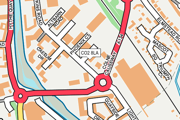
CO2 8LA is located in the Greenstead electoral ward, within the local authority district of Colchester and the English Parliamentary constituency of Colchester. The Sub Integrated Care Board (ICB) Location is NHS Suffolk and North East Essex ICB - 06T and the police force is Essex. This postcode has been in use since January 1995.


GetTheData
Source: OS OpenMap – Local (Ordnance Survey)
Source: OS VectorMap District (Ordnance Survey)
Licence: Open Government Licence (requires attribution)
| Easting | 601775 |
| Northing | 224357 |
| Latitude | 51.881254 |
| Longitude | 0.930222 |
GetTheData
Source: Open Postcode Geo
Licence: Open Government Licence
| Country | England |
| Postcode District | CO2 |
➜ See where CO2 is on a map ➜ Where is Colchester? | |
GetTheData
Source: Land Registry Price Paid Data
Licence: Open Government Licence
Elevation or altitude of CO2 8LA as distance above sea level:
| Metres | Feet | |
|---|---|---|
| Elevation | 10m | 33ft |
Elevation is measured from the approximate centre of the postcode, to the nearest point on an OS contour line from OS Terrain 50, which has contour spacing of ten vertical metres.
➜ How high above sea level am I? Find the elevation of your current position using your device's GPS.
GetTheData
Source: Open Postcode Elevation
Licence: Open Government Licence
| Ward | Greenstead |
| Constituency | Colchester |
GetTheData
Source: ONS Postcode Database
Licence: Open Government Licence
| Mascot Square (Elmstead Road) | Colchester | 262m |
| Colne Causeway (Hythe Hill) | The Hythe | 271m |
| Mascot Square (Elmstead Road) | Colchester | 276m |
| Tesco Store (Colne Causeway) | The Hythe | 291m |
| Albany Gardens (Haven Road) | Colchester | 351m |
| Hythe (Essex) Station | 0.5km |
| Colchester Town Station | 1.8km |
| Wivenhoe Station | 3.3km |
GetTheData
Source: NaPTAN
Licence: Open Government Licence
GetTheData
Source: ONS Postcode Database
Licence: Open Government Licence


➜ Get more ratings from the Food Standards Agency
GetTheData
Source: Food Standards Agency
Licence: FSA terms & conditions
| Last Collection | |||
|---|---|---|---|
| Location | Mon-Fri | Sat | Distance |
| Elmstead Road | 17:30 | 12:10 | 283m |
| Whitehall Road | 539m | ||
| Whitehall Road | 18:15 | 11:30 | 545m |
GetTheData
Source: Dracos
Licence: Creative Commons Attribution-ShareAlike
| Risk of CO2 8LA flooding from rivers and sea | Very Low |
| ➜ CO2 8LA flood map | |
GetTheData
Source: Open Flood Risk by Postcode
Licence: Open Government Licence
The below table lists the International Territorial Level (ITL) codes (formerly Nomenclature of Territorial Units for Statistics (NUTS) codes) and Local Administrative Units (LAU) codes for CO2 8LA:
| ITL 1 Code | Name |
|---|---|
| TLH | East |
| ITL 2 Code | Name |
| TLH3 | Essex |
| ITL 3 Code | Name |
| TLH34 | Essex Haven Gateway |
| LAU 1 Code | Name |
| E07000071 | Colchester |
GetTheData
Source: ONS Postcode Directory
Licence: Open Government Licence
The below table lists the Census Output Area (OA), Lower Layer Super Output Area (LSOA), and Middle Layer Super Output Area (MSOA) for CO2 8LA:
| Code | Name | |
|---|---|---|
| OA | E00176421 | |
| LSOA | E01033719 | Colchester 008G |
| MSOA | E02004513 | Colchester 008 |
GetTheData
Source: ONS Postcode Directory
Licence: Open Government Licence
| CO2 8JT | Hawkins Road | 32m |
| CO2 8LE | Hawkins Road | 116m |
| CO2 8FN | Caelum Drive | 138m |
| CO2 8GT | Quayside Drive | 156m |
| CO2 8GQ | Quayside Drive | 158m |
| CO2 8FP | Caelum Drive | 159m |
| CO2 8JY | Hawkins Road | 161m |
| CO2 8FR | Lightship Way | 175m |
| CO2 8FX | Quayside Drive | 190m |
| CO4 3GH | Capstan Place | 190m |
GetTheData
Source: Open Postcode Geo; Land Registry Price Paid Data
Licence: Open Government Licence