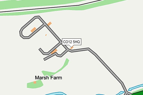
CO12 5HQ is located in the Stour Valley electoral ward, within the local authority district of Tendring and the English Parliamentary constituency of Harwich and North Essex. The Sub Integrated Care Board (ICB) Location is NHS Suffolk and North East Essex ICB - 06T and the police force is Essex. This postcode has been in use since July 1995.


GetTheData
Source: OS OpenMap – Local (Ordnance Survey)
Source: OS VectorMap District (Ordnance Survey)
Licence: Open Government Licence (requires attribution)
| Easting | 621925 |
| Northing | 231467 |
| Latitude | 51.937429 |
| Longitude | 1.227083 |
GetTheData
Source: Open Postcode Geo
Licence: Open Government Licence
| Country | England |
| Postcode District | CO12 |
| ➜ CO12 open data dashboard ➜ See where CO12 is on a map | |
GetTheData
Source: Land Registry Price Paid Data
Licence: Open Government Licence
Elevation or altitude of CO12 5HQ as distance above sea level:
| Metres | Feet | |
|---|---|---|
| Elevation | 10m | 33ft |
Elevation is measured from the approximate centre of the postcode, to the nearest point on an OS contour line from OS Terrain 50, which has contour spacing of ten vertical metres.
➜ How high above sea level am I? Find the elevation of your current position using your device's GPS.
GetTheData
Source: Open Postcode Elevation
Licence: Open Government Licence
| Ward | Stour Valley |
| Constituency | Harwich And North Essex |
GetTheData
Source: ONS Postcode Database
Licence: Open Government Licence
| Michaelstowe Drive (Ramsey Road) | Upper Dovercourt | 959m |
| Michaelstowe Drive (Ramsey Road) | Upper Dovercourt | 968m |
| Church (Ramsey Road) | Ramsey | 1,039m |
| Clayton Road (Ramsey Road) | Upper Dovercourt | 1,051m |
| Clayton Road (Ramsey Road) | Upper Dovercourt | 1,062m |
| Harwich International Station | 2.2km |
| Dovercourt Station | 3.7km |
| Wrabness Station | 3.8km |
GetTheData
Source: NaPTAN
Licence: Open Government Licence
GetTheData
Source: ONS Postcode Database
Licence: Open Government Licence


➜ Get more ratings from the Food Standards Agency
GetTheData
Source: Food Standards Agency
Licence: FSA terms & conditions
| Last Collection | |||
|---|---|---|---|
| Location | Mon-Fri | Sat | Distance |
| Clayton Road | 17:20 | 11:30 | 950m |
| Michaelstowe Ramsey Road | 17:20 | 09:00 | 966m |
| The Street Ramsey | 17:20 | 09:00 | 1,260m |
GetTheData
Source: Dracos
Licence: Creative Commons Attribution-ShareAlike
| Facility | Distance |
|---|---|
| Harwich & District Indoor Bowls Centre Stour Close, Harwich Indoor Bowls | 862m |
| Chase Lane Primary School Chase Lane, Harwich Swimming Pool, Artificial Grass Pitch | 1.6km |
| Harwich And Dovercourt Golf Club Station Road Parkeston, Harwich Golf | 1.6km |
GetTheData
Source: Active Places
Licence: Open Government Licence
| School | Phase of Education | Distance |
|---|---|---|
| Two Village Church of England Primary School Mayes Lane, Ramsey, Harwich, CO12 5EL | Primary | 1.4km |
| Chase Lane Primary School and Nursery Chase Lane, Dovercourt, Harwich, CO12 4NB | Primary | 1.6km |
| All Saints' Church of England Voluntary Aided Primary School, Dovercourt Main Road, Dovercourt, Harwich, CO12 4HT | Primary | 2.1km |
GetTheData
Source: Edubase
Licence: Open Government Licence
The below table lists the International Territorial Level (ITL) codes (formerly Nomenclature of Territorial Units for Statistics (NUTS) codes) and Local Administrative Units (LAU) codes for CO12 5HQ:
| ITL 1 Code | Name |
|---|---|
| TLH | East |
| ITL 2 Code | Name |
| TLH3 | Essex |
| ITL 3 Code | Name |
| TLH34 | Essex Haven Gateway |
| LAU 1 Code | Name |
| E07000076 | Tendring |
GetTheData
Source: ONS Postcode Directory
Licence: Open Government Licence
The below table lists the Census Output Area (OA), Lower Layer Super Output Area (LSOA), and Middle Layer Super Output Area (MSOA) for CO12 5HQ:
| Code | Name | |
|---|---|---|
| OA | E00111916 | |
| LSOA | E01022028 | Tendring 004F |
| MSOA | E02004576 | Tendring 004 |
GetTheData
Source: ONS Postcode Directory
Licence: Open Government Licence
| CO12 5HD | Ray Lane | 379m |
| CO12 5ER | Michaelstowe Drive | 739m |
| CO12 5ES | Michaelstowe Close | 769m |
| CO12 4TP | Chevy Court | 882m |
| CO12 4TH | Clayton Road | 886m |
| CO12 4TJ | Clayton Road | 963m |
| CO12 4TF | Ramsey Road | 965m |
| CO12 4TL | Stour Close | 974m |
| CO12 5EW | Ramsey Road | 985m |
| CO12 4TE | Ramsey Road | 1031m |
GetTheData
Source: Open Postcode Geo; Land Registry Price Paid Data
Licence: Open Government Licence