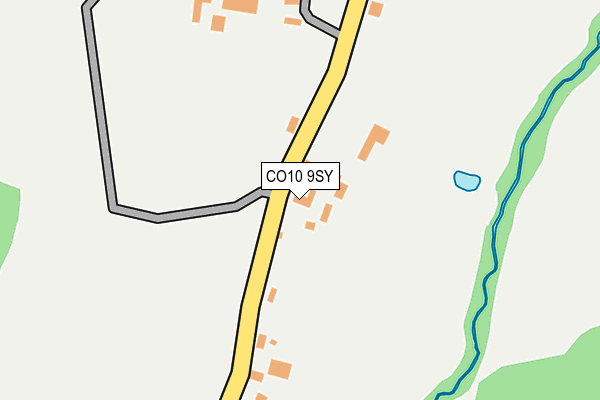
CO10 9SY lies on Windmill Place in Stanstead, Sudbury. CO10 9SY is located in the Chadacre electoral ward, within the local authority district of Babergh and the English Parliamentary constituency of South Suffolk. The Sub Integrated Care Board (ICB) Location is NHS Suffolk and North East Essex ICB - 07K and the police force is Suffolk. This postcode has been in use since September 2003.


GetTheData
Source: OS OpenMap – Local (Ordnance Survey)
Source: OS VectorMap District (Ordnance Survey)
Licence: Open Government Licence (requires attribution)
| Easting | 584399 |
| Northing | 249021 |
| Latitude | 52.108784 |
| Longitude | 0.691362 |
GetTheData
Source: Open Postcode Geo
Licence: Open Government Licence
| Street | Windmill Place |
| Locality | Stanstead |
| Town/City | Sudbury |
| Country | England |
| Postcode District | CO10 |
| ➜ CO10 open data dashboard ➜ See where CO10 is on a map ➜ Where is Stanstead? | |
GetTheData
Source: Land Registry Price Paid Data
Licence: Open Government Licence
Elevation or altitude of CO10 9SY as distance above sea level:
| Metres | Feet | |
|---|---|---|
| Elevation | 60m | 197ft |
Elevation is measured from the approximate centre of the postcode, to the nearest point on an OS contour line from OS Terrain 50, which has contour spacing of ten vertical metres.
➜ How high above sea level am I? Find the elevation of your current position using your device's GPS.
GetTheData
Source: Open Postcode Elevation
Licence: Open Government Licence
| Ward | Chadacre |
| Constituency | South Suffolk |
GetTheData
Source: ONS Postcode Database
Licence: Open Government Licence
| June 2022 | Possession of weapons | On or near Valley View | 305m |
| June 2022 | Possession of weapons | On or near Valley View | 305m |
| June 2022 | Violence and sexual offences | On or near Valley View | 305m |
| ➜ Get more crime data in our Crime section | |||
GetTheData
Source: data.police.uk
Licence: Open Government Licence
| Village Sign (Upper Street) | Stanstead | 289m |
| Village Sign (Upper Street) | Stanstead | 292m |
| White Hart (Lower Street) | Stanstead | 379m |
| White Hart (Lower Street) | Stanstead | 397m |
| Scotchford Bridge (B1066) | Glemsford | 539m |
GetTheData
Source: NaPTAN
Licence: Open Government Licence
| Percentage of properties with Next Generation Access | 100.0% |
| Percentage of properties with Superfast Broadband | 100.0% |
| Percentage of properties with Ultrafast Broadband | 0.0% |
| Percentage of properties with Full Fibre Broadband | 0.0% |
Superfast Broadband is between 30Mbps and 300Mbps
Ultrafast Broadband is > 300Mbps
| Percentage of properties unable to receive 2Mbps | 0.0% |
| Percentage of properties unable to receive 5Mbps | 0.0% |
| Percentage of properties unable to receive 10Mbps | 0.0% |
| Percentage of properties unable to receive 30Mbps | 0.0% |
GetTheData
Source: Ofcom
Licence: Ofcom Terms of Use (requires attribution)
GetTheData
Source: ONS Postcode Database
Licence: Open Government Licence


➜ Get more ratings from the Food Standards Agency
GetTheData
Source: Food Standards Agency
Licence: FSA terms & conditions
| Last Collection | |||
|---|---|---|---|
| Location | Mon-Fri | Sat | Distance |
| Windmill Hill Long Melford | 16:30 | 10:30 | 2,676m |
| High Street Long Melford | 16:45 | 10:30 | 3,041m |
| Long Melford Church | 16:45 | 10:30 | 3,187m |
GetTheData
Source: Dracos
Licence: Creative Commons Attribution-ShareAlike
| Facility | Distance |
|---|---|
| Glemsford Sports Ground Tye Green, Glemsford Grass Pitches | 2.1km |
| Stoneylands Stadium New Road, Long Melford, Sudbury Grass Pitches | 4km |
| Cavendish Sports Club Lower Street, Cavendish Grass Pitches | 4.1km |
GetTheData
Source: Active Places
Licence: Open Government Licence
| School | Phase of Education | Distance |
|---|---|---|
| Glemsford Primary Academy Lion Road, Glemsford, Sudbury, CO10 7RF | Primary | 1.9km |
| Hartest Church of England Primary School The Row, Hartest, Bury St Edmunds, IP29 4DL | Primary | 3.6km |
| Long Melford Church of England Primary School Cordell Road, Long Melford, Sudbury, CO10 9ED | Primary | 4.2km |
GetTheData
Source: Edubase
Licence: Open Government Licence
The below table lists the International Territorial Level (ITL) codes (formerly Nomenclature of Territorial Units for Statistics (NUTS) codes) and Local Administrative Units (LAU) codes for CO10 9SY:
| ITL 1 Code | Name |
|---|---|
| TLH | East |
| ITL 2 Code | Name |
| TLH1 | East Anglia |
| ITL 3 Code | Name |
| TLH14 | Suffolk CC |
| LAU 1 Code | Name |
| E07000200 | Babergh |
GetTheData
Source: ONS Postcode Directory
Licence: Open Government Licence
The below table lists the Census Output Area (OA), Lower Layer Super Output Area (LSOA), and Middle Layer Super Output Area (MSOA) for CO10 9SY:
| Code | Name | |
|---|---|---|
| OA | E00152294 | |
| LSOA | E01029885 | Babergh 002C |
| MSOA | E02006228 | Babergh 002 |
GetTheData
Source: ONS Postcode Directory
Licence: Open Government Licence
| CO10 9AP | The Hill | 100m |
| CO10 9AR | Valley View | 319m |
| CO10 9AS | The Green | 344m |
| CO10 9AN | Alston Crescent | 418m |
| CO10 9AW | Lower Street | 420m |
| CO10 9AH | Lower Street | 435m |
| CO10 9AT | Upper Street | 570m |
| CO10 9AJ | Lower Street | 831m |
| CO10 9AU | Upper Street | 965m |
| CO10 7QF | Low Street | 979m |
GetTheData
Source: Open Postcode Geo; Land Registry Price Paid Data
Licence: Open Government Licence