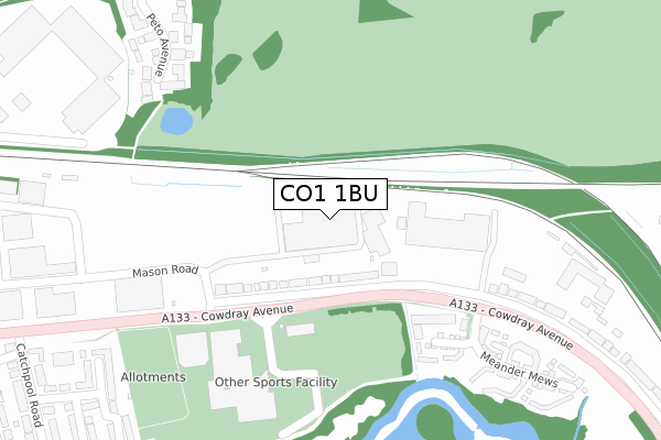
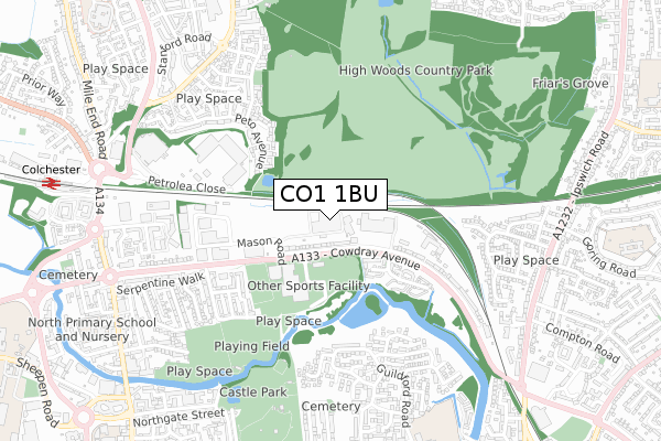
CO1 1BU is located in the Castle electoral ward, within the local authority district of Colchester and the English Parliamentary constituency of Colchester. The Sub Integrated Care Board (ICB) Location is NHS Suffolk and North East Essex ICB - 06T and the police force is Essex. This postcode has been in use since February 1984.


GetTheData
Source: OS Open Zoomstack (Ordnance Survey)
Licence: Open Government Licence (requires attribution)
Attribution: Contains OS data © Crown copyright and database right 2024
Source: Open Postcode Geo
Licence: Open Government Licence (requires attribution)
Attribution: Contains OS data © Crown copyright and database right 2024; Contains Royal Mail data © Royal Mail copyright and database right 2024; Source: Office for National Statistics licensed under the Open Government Licence v.3.0
| Easting | 600142 |
| Northing | 226258 |
| Latitude | 51.898911 |
| Longitude | 0.907631 |
GetTheData
Source: Open Postcode Geo
Licence: Open Government Licence
| Country | England |
| Postcode District | CO1 |
| ➜ CO1 open data dashboard ➜ See where CO1 is on a map | |
GetTheData
Source: Land Registry Price Paid Data
Licence: Open Government Licence
Elevation or altitude of CO1 1BU as distance above sea level:
| Metres | Feet | |
|---|---|---|
| Elevation | 10m | 33ft |
Elevation is measured from the approximate centre of the postcode, to the nearest point on an OS contour line from OS Terrain 50, which has contour spacing of ten vertical metres.
➜ How high above sea level am I? Find the elevation of your current position using your device's GPS.
GetTheData
Source: Open Postcode Elevation
Licence: Open Government Licence
| Ward | Castle |
| Constituency | Colchester |
GetTheData
Source: ONS Postcode Database
Licence: Open Government Licence
| June 2022 | Anti-social behaviour | On or near Cowdray Avenue | 173m |
| June 2022 | Anti-social behaviour | On or near Cowdray Avenue | 173m |
| June 2022 | Violence and sexual offences | On or near Cowdray Avenue | 173m |
| ➜ Get more crime data in our Crime section | |||
GetTheData
Source: data.police.uk
Licence: Open Government Licence
| Leisureworld (Cowdray Avenue) | Colchester | 187m |
| Leisure Centre (Leisure Centre Access Road) | Colchester | 221m |
| Leisure Centre (Leisure Centre Access Road) | Colchester | 229m |
| Dart Cowdray Avenue North (Mason Road) | Colchester | 277m |
| Colneview Retail Park (Cowdray Avenue) | Colchester | 282m |
| Colchester Station | 1.1km |
| Colchester Town Station | 1.4km |
| Hythe (Essex) Station | 2km |
GetTheData
Source: NaPTAN
Licence: Open Government Licence
GetTheData
Source: ONS Postcode Database
Licence: Open Government Licence


➜ Get more ratings from the Food Standards Agency
GetTheData
Source: Food Standards Agency
Licence: FSA terms & conditions
| Last Collection | |||
|---|---|---|---|
| Location | Mon-Fri | Sat | Distance |
| Cowdray Avenue | 18:30 | 12:00 | 116m |
| Cowdray Centre | 18:30 | 12:00 | 192m |
| Peto Avenue | 17:30 | 12:00 | 611m |
GetTheData
Source: Dracos
Licence: Creative Commons Attribution-ShareAlike
| Facility | Distance |
|---|---|
| Crossfit Colchester (Closed) Cowdray Centre, Cowdray Avenue, Colchester Health and Fitness Gym | 70m |
| Colchester Leisure World Cowdray Avenue, Colchester Sports Hall, Swimming Pool, Health and Fitness Gym, Artificial Grass Pitch, Squash Courts, Studio | 309m |
| Fitness First Health Club (Colchester) (Closed) Petroliam Close, Colchester Health and Fitness Gym, Studio | 508m |
GetTheData
Source: Active Places
Licence: Open Government Licence
| School | Phase of Education | Distance |
|---|---|---|
| St James' Church of England Primary School Guildford Road, Colchester, CO1 2RA | Primary | 813m |
| North Primary School and Nursery John Harper Street, Colchester, CO1 1RP | Primary | 966m |
| Queen Boudica Primary School Cowper Crescent, Colchester, CO4 5XT | Primary | 1km |
GetTheData
Source: Edubase
Licence: Open Government Licence
The below table lists the International Territorial Level (ITL) codes (formerly Nomenclature of Territorial Units for Statistics (NUTS) codes) and Local Administrative Units (LAU) codes for CO1 1BU:
| ITL 1 Code | Name |
|---|---|
| TLH | East |
| ITL 2 Code | Name |
| TLH3 | Essex |
| ITL 3 Code | Name |
| TLH34 | Essex Haven Gateway |
| LAU 1 Code | Name |
| E07000071 | Colchester |
GetTheData
Source: ONS Postcode Directory
Licence: Open Government Licence
The below table lists the Census Output Area (OA), Lower Layer Super Output Area (LSOA), and Middle Layer Super Output Area (MSOA) for CO1 1BU:
| Code | Name | |
|---|---|---|
| OA | E00176431 | |
| LSOA | E01021647 | Colchester 007B |
| MSOA | E02004512 | Colchester 007 |
GetTheData
Source: ONS Postcode Directory
Licence: Open Government Licence
| CO1 1XX | Cowdray Avenue | 102m |
| CO1 1QE | Reed Walk | 221m |
| CO1 1QD | Meander Mews | 310m |
| CO4 5WH | Peto Avenue | 369m |
| CO1 1XZ | Cowdray Avenue | 374m |
| CO1 1QJ | River Bank Walk | 383m |
| CO4 5WL | Peto Avenue | 398m |
| CO1 1QG | Pill Box Walk | 399m |
| CO1 1XW | Jarmin Road | 437m |
| CO4 5WF | Gresley Close | 443m |
GetTheData
Source: Open Postcode Geo; Land Registry Price Paid Data
Licence: Open Government Licence