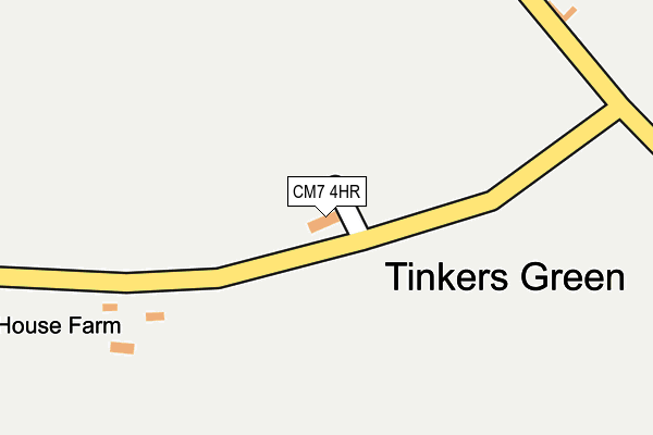
CM7 4HR lies on Rose Cottages in Cornish Hall End, Braintree. CM7 4HR is located in the Three Fields electoral ward, within the local authority district of Braintree and the English Parliamentary constituency of Braintree. The Sub Integrated Care Board (ICB) Location is NHS Mid and South Essex ICB - 06Q and the police force is Essex. This postcode has been in use since January 1980.


GetTheData
Source: OS OpenMap – Local (Ordnance Survey)
Source: OS VectorMap District (Ordnance Survey)
Licence: Open Government Licence (requires attribution)
| Easting | 566430 |
| Northing | 236103 |
| Latitude | 51.998428 |
| Longitude | 0.422914 |
GetTheData
Source: Open Postcode Geo
Licence: Open Government Licence
| Street | Rose Cottages |
| Locality | Cornish Hall End |
| Town/City | Braintree |
| Country | England |
| Postcode District | CM7 |
| ➜ CM7 open data dashboard ➜ See where CM7 is on a map ➜ Where is Tinkers Green? | |
GetTheData
Source: Land Registry Price Paid Data
Licence: Open Government Licence
Elevation or altitude of CM7 4HR as distance above sea level:
| Metres | Feet | |
|---|---|---|
| Elevation | 90m | 295ft |
Elevation is measured from the approximate centre of the postcode, to the nearest point on an OS contour line from OS Terrain 50, which has contour spacing of ten vertical metres.
➜ How high above sea level am I? Find the elevation of your current position using your device's GPS.
GetTheData
Source: Open Postcode Elevation
Licence: Open Government Licence
| Ward | Three Fields |
| Constituency | Braintree |
GetTheData
Source: ONS Postcode Database
Licence: Open Government Licence
| Millfield Cottage (B1053 Walden Road) | Little Sampford | 1,804m |
| Millfield Cottage (B1053 Walden Road) | Little Sampford | 1,809m |
GetTheData
Source: NaPTAN
Licence: Open Government Licence
➜ Broadband speed and availability dashboard for CM7 4HR
| Percentage of properties with Next Generation Access | 100.0% |
| Percentage of properties with Superfast Broadband | 100.0% |
| Percentage of properties with Ultrafast Broadband | 100.0% |
| Percentage of properties with Full Fibre Broadband | 100.0% |
Superfast Broadband is between 30Mbps and 300Mbps
Ultrafast Broadband is > 300Mbps
| Median download speed | 7.4Mbps |
| Average download speed | 7.0Mbps |
| Maximum download speed | 9.72Mbps |
| Median upload speed | 1.1Mbps |
| Average upload speed | 1.1Mbps |
| Maximum upload speed | 1.18Mbps |
| Percentage of properties unable to receive 2Mbps | 0.0% |
| Percentage of properties unable to receive 5Mbps | 0.0% |
| Percentage of properties unable to receive 10Mbps | 0.0% |
| Percentage of properties unable to receive 30Mbps | 0.0% |
➜ Broadband speed and availability dashboard for CM7 4HR
GetTheData
Source: Ofcom
Licence: Ofcom Terms of Use (requires attribution)
GetTheData
Source: ONS Postcode Database
Licence: Open Government Licence
| Last Collection | |||
|---|---|---|---|
| Location | Mon-Fri | Sat | Distance |
| Stanbourne Road | 16:30 | 09:45 | 1,765m |
| Moor End | 16:30 | 10:00 | 2,477m |
| Hawkins Hill | 16:30 | 09:30 | 2,508m |
GetTheData
Source: Dracos
Licence: Creative Commons Attribution-ShareAlike
| Facility | Distance |
|---|---|
| Sampfords Cricket Club Sparepenny Lane, Great Sampford, Saffron Walden Grass Pitches | 2.2km |
| Finchingfield Playing Fields Stephen Marshall Avenue, Finchingfield Grass Pitches, Outdoor Tennis Courts | 4km |
| Steeple Bumpstead Primary School Bower Hall Drive, Steeple Bumpstead, Haverhill Grass Pitches, Swimming Pool | 4.9km |
GetTheData
Source: Active Places
Licence: Open Government Licence
| School | Phase of Education | Distance |
|---|---|---|
| Great Sampford Community Primary School Finchingfield Road, Great Sampford, Saffron Walden, CB10 2RL | Primary | 2.1km |
| Finchingfield St John the Baptist CofE Primary Academy Vicarage Road, Finchingfield, Braintree, CM7 4LD | Primary | 4.1km |
| Steeple Bumpstead Primary School Bower Hall Drive, Steeple Bumpstead, Haverhill, CB9 7ED | Primary | 4.9km |
GetTheData
Source: Edubase
Licence: Open Government Licence
The below table lists the International Territorial Level (ITL) codes (formerly Nomenclature of Territorial Units for Statistics (NUTS) codes) and Local Administrative Units (LAU) codes for CM7 4HR:
| ITL 1 Code | Name |
|---|---|
| TLH | East |
| ITL 2 Code | Name |
| TLH3 | Essex |
| ITL 3 Code | Name |
| TLH34 | Essex Haven Gateway |
| LAU 1 Code | Name |
| E07000067 | Braintree |
GetTheData
Source: ONS Postcode Directory
Licence: Open Government Licence
The below table lists the Census Output Area (OA), Lower Layer Super Output Area (LSOA), and Middle Layer Super Output Area (MSOA) for CM7 4HR:
| Code | Name | |
|---|---|---|
| OA | E00108774 | |
| LSOA | E01021412 | Braintree 005C |
| MSOA | E02004450 | Braintree 005 |
GetTheData
Source: ONS Postcode Directory
Licence: Open Government Licence
| CM7 4HP | Sampford Road | 567m |
| CM7 4HT | Spains Hall Road | 623m |
| CM7 4HW | Briar Cottages | 1026m |
| CM7 4HU | Spains Hall Road | 1031m |
| CM7 4HN | Sampford Road | 1101m |
| CB10 2QP | Maynards Lane | 1203m |
| CB10 2QS | Stambourne Road | 1209m |
| CB10 2RR | Parsonage Farm Lane | 1260m |
| CM7 4HL | Sampford Road | 1686m |
| CB10 2QT | Finchingfield Road | 1786m |
GetTheData
Source: Open Postcode Geo; Land Registry Price Paid Data
Licence: Open Government Licence