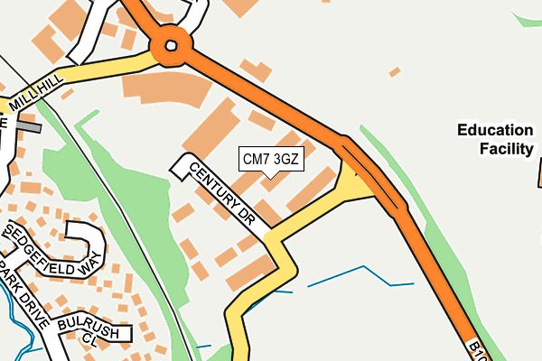
CM7 3GZ is located in the Braintree Central & Beckers Green electoral ward, within the local authority district of Braintree and the English Parliamentary constituency of Braintree. The Sub Integrated Care Board (ICB) Location is NHS Mid and South Essex ICB - 06Q and the police force is Essex. This postcode has been in use since June 2001.


GetTheData
Source: OS OpenMap – Local (Ordnance Survey)
Source: OS VectorMap District (Ordnance Survey)
Licence: Open Government Licence (requires attribution)
| Easting | 576943 |
| Northing | 222508 |
| Latitude | 51.873083 |
| Longitude | 0.568933 |
GetTheData
Source: Open Postcode Geo
Licence: Open Government Licence
| Country | England |
| Postcode District | CM7 |
| ➜ CM7 open data dashboard ➜ See where CM7 is on a map ➜ Where is Braintree? | |
GetTheData
Source: Land Registry Price Paid Data
Licence: Open Government Licence
Elevation or altitude of CM7 3GZ as distance above sea level:
| Metres | Feet | |
|---|---|---|
| Elevation | 60m | 197ft |
Elevation is measured from the approximate centre of the postcode, to the nearest point on an OS contour line from OS Terrain 50, which has contour spacing of ten vertical metres.
➜ How high above sea level am I? Find the elevation of your current position using your device's GPS.
GetTheData
Source: Open Postcode Elevation
Licence: Open Government Licence
| Ward | Braintree Central & Beckers Green |
| Constituency | Braintree |
GetTheData
Source: ONS Postcode Database
Licence: Open Government Licence
| August 2023 | Other theft | On or near Rye Grass Way | 398m |
| December 2022 | Violence and sexual offences | On or near Rye Grass Way | 398m |
| December 2022 | Violence and sexual offences | On or near The Lindens | 473m |
| ➜ Get more crime data in our Crime section | |||
GetTheData
Source: data.police.uk
Licence: Open Government Licence
| Charter Way | Braintree | 50m |
| Charter Way | Braintree | 59m |
| Freeport Railway Station (Charter Way) | Braintree | 433m |
| Chapel Hill | Braintree | 433m |
| Chapel Hill | Braintree | 439m |
| Braintree Freeport Station | 0.4km |
| Braintree Station | 0.9km |
| Cressing Station | 2.4km |
GetTheData
Source: NaPTAN
Licence: Open Government Licence
GetTheData
Source: ONS Postcode Database
Licence: Open Government Licence

➜ Get more ratings from the Food Standards Agency
GetTheData
Source: Food Standards Agency
Licence: FSA terms & conditions
| Last Collection | |||
|---|---|---|---|
| Location | Mon-Fri | Sat | Distance |
| Orchard Drive | 17:30 | 09:15 | 583m |
| Masefield Road P.o. | 17:30 | 12:00 | 1,038m |
| Notley Road | 17:30 | 09:15 | 1,129m |
GetTheData
Source: Dracos
Licence: Creative Commons Attribution-ShareAlike
| Facility | Distance |
|---|---|
| Braintree Lawn Tennis Club Clockhouse Way, Braintree Squash Courts, Outdoor Tennis Courts | 183m |
| Braintree Town Fc (Cressing Road) Clockhouse Way, Braintree Grass Pitches | 385m |
| Alec Hunter Academy Stubbs Lane, Braintree Grass Pitches, Sports Hall, Studio, Outdoor Tennis Courts | 389m |
GetTheData
Source: Active Places
Licence: Open Government Licence
| School | Phase of Education | Distance |
|---|---|---|
| Alec Hunter Academy Stubbs Lane, Braintree, CM7 3NR | Secondary | 478m |
| Beckers Green Primary School Beckers Green Road, Braintree, CM7 3PR | Primary | 844m |
| John Ray Junior School Notley Road, Braintree, CM7 1HL | Primary | 1.3km |
GetTheData
Source: Edubase
Licence: Open Government Licence
The below table lists the International Territorial Level (ITL) codes (formerly Nomenclature of Territorial Units for Statistics (NUTS) codes) and Local Administrative Units (LAU) codes for CM7 3GZ:
| ITL 1 Code | Name |
|---|---|
| TLH | East |
| ITL 2 Code | Name |
| TLH3 | Essex |
| ITL 3 Code | Name |
| TLH34 | Essex Haven Gateway |
| LAU 1 Code | Name |
| E07000067 | Braintree |
GetTheData
Source: ONS Postcode Directory
Licence: Open Government Licence
The below table lists the Census Output Area (OA), Lower Layer Super Output Area (LSOA), and Middle Layer Super Output Area (MSOA) for CM7 3GZ:
| Code | Name | |
|---|---|---|
| OA | E00108549 | |
| LSOA | E01021368 | Braintree 011A |
| MSOA | E02004456 | Braintree 011 |
GetTheData
Source: ONS Postcode Directory
Licence: Open Government Licence
| CM7 1WA | Bulrush Close | 239m |
| CM7 1XB | Sedgefield Way | 241m |
| CM7 3QP | Megs Way | 330m |
| CM7 3QZ | Chapel Hill | 347m |
| CM7 3QR | Mill Hill | 352m |
| CM7 3RQ | Angle Side | 360m |
| CM7 1TW | Rushmoor Drive | 376m |
| CM7 3RD | Clockhouse Way | 383m |
| CM7 3NZ | Haytor Close | 389m |
| CM7 3QX | Chapel Hill | 396m |
GetTheData
Source: Open Postcode Geo; Land Registry Price Paid Data
Licence: Open Government Licence