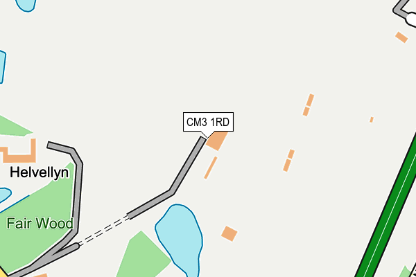
CM3 1RD is located in the Boreham and The Leighs electoral ward, within the local authority district of Chelmsford and the English Parliamentary constituency of Saffron Walden. The Sub Integrated Care Board (ICB) Location is NHS Mid and South Essex ICB - 06Q and the police force is Essex. This postcode has been in use since December 1999.


GetTheData
Source: OS OpenMap – Local (Ordnance Survey)
Source: OS VectorMap District (Ordnance Survey)
Licence: Open Government Licence (requires attribution)
| Easting | 573189 |
| Northing | 218921 |
| Latitude | 51.842031 |
| Longitude | 0.512634 |
GetTheData
Source: Open Postcode Geo
Licence: Open Government Licence
| Country | England |
| Postcode District | CM3 |
➜ See where CM3 is on a map | |
GetTheData
Source: Land Registry Price Paid Data
Licence: Open Government Licence
Elevation or altitude of CM3 1RD as distance above sea level:
| Metres | Feet | |
|---|---|---|
| Elevation | 70m | 230ft |
Elevation is measured from the approximate centre of the postcode, to the nearest point on an OS contour line from OS Terrain 50, which has contour spacing of ten vertical metres.
➜ How high above sea level am I? Find the elevation of your current position using your device's GPS.
GetTheData
Source: Open Postcode Elevation
Licence: Open Government Licence
| Ward | Boreham And The Leighs |
| Constituency | Saffron Walden |
GetTheData
Source: ONS Postcode Database
Licence: Open Government Licence
| Lyndeswood Farm (London Road) | Youngs End | 582m |
| Lyndeswood Farm (London Road) | Youngs End | 637m |
| Dog & Partridge (Main Road) | Great Leighs | 849m |
| Dog & Partridge (Main Road) | Great Leighs | 850m |
| Green Dragon (London Road) | Youngs End | 868m |
| Cressing Station | 4.6km |
| Braintree Station | 4.8km |
| Braintree Freeport Station | 4.9km |
GetTheData
Source: NaPTAN
Licence: Open Government Licence
GetTheData
Source: ONS Postcode Database
Licence: Open Government Licence


➜ Get more ratings from the Food Standards Agency
GetTheData
Source: Food Standards Agency
Licence: FSA terms & conditions
| Last Collection | |||
|---|---|---|---|
| Location | Mon-Fri | Sat | Distance |
| Youngs End | 16:00 | 07:30 | 990m |
| Ranks Green | 16:30 | 07:45 | 2,072m |
| Whitecourts | 16:00 | 09:15 | 2,365m |
GetTheData
Source: Dracos
Licence: Creative Commons Attribution-ShareAlike
The below table lists the International Territorial Level (ITL) codes (formerly Nomenclature of Territorial Units for Statistics (NUTS) codes) and Local Administrative Units (LAU) codes for CM3 1RD:
| ITL 1 Code | Name |
|---|---|
| TLH | East |
| ITL 2 Code | Name |
| TLH3 | Essex |
| ITL 3 Code | Name |
| TLH36 | Heart of Essex |
| LAU 1 Code | Name |
| E07000070 | Chelmsford |
GetTheData
Source: ONS Postcode Directory
Licence: Open Government Licence
The below table lists the Census Output Area (OA), Lower Layer Super Output Area (LSOA), and Middle Layer Super Output Area (MSOA) for CM3 1RD:
| Code | Name | |
|---|---|---|
| OA | E00109420 | |
| LSOA | E01021538 | Chelmsford 001A |
| MSOA | E02004485 | Chelmsford 001 |
GetTheData
Source: ONS Postcode Directory
Licence: Open Government Licence
| CM3 1PZ | Moulsham Hall Lane | 492m |
| CM77 8QN | London Road | 778m |
| CM3 1NT | Banters Lane | 822m |
| CM3 1NS | Main Road | 837m |
| CM3 1PX | Lynders Wood Lane | 864m |
| CM77 8QW | Blackley Lane | 870m |
| CM77 7QL | London Road | 874m |
| CM3 1QN | Dumney Lane | 924m |
| CM3 1NR | Main Road | 1008m |
| CM3 1SH | Shimbrooks | 1057m |
GetTheData
Source: Open Postcode Geo; Land Registry Price Paid Data
Licence: Open Government Licence