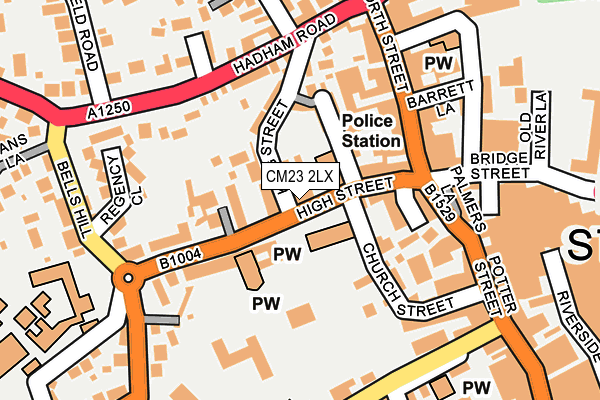
CM23 2LX is located in the Bishop's Stortford Central electoral ward, within the local authority district of East Hertfordshire and the English Parliamentary constituency of Hertford and Stortford. The Sub Integrated Care Board (ICB) Location is NHS Hertfordshire and West Essex ICB - 06K and the police force is Hertfordshire. This postcode has been in use since January 1980.


GetTheData
Source: OS OpenMap – Local (Ordnance Survey)
Source: OS VectorMap District (Ordnance Survey)
Licence: Open Government Licence (requires attribution)
| Easting | 548595 |
| Northing | 221368 |
| Latitude | 51.871105 |
| Longitude | 0.156997 |
GetTheData
Source: Open Postcode Geo
Licence: Open Government Licence
| Country | England |
| Postcode District | CM23 |
| ➜ CM23 open data dashboard ➜ See where CM23 is on a map ➜ Where is Bishop's Stortford? | |
GetTheData
Source: Land Registry Price Paid Data
Licence: Open Government Licence
Elevation or altitude of CM23 2LX as distance above sea level:
| Metres | Feet | |
|---|---|---|
| Elevation | 70m | 230ft |
Elevation is measured from the approximate centre of the postcode, to the nearest point on an OS contour line from OS Terrain 50, which has contour spacing of ten vertical metres.
➜ How high above sea level am I? Find the elevation of your current position using your device's GPS.
GetTheData
Source: Open Postcode Elevation
Licence: Open Government Licence
| Ward | Bishop's Stortford Central |
| Constituency | Hertford And Stortford |
GetTheData
Source: ONS Postcode Database
Licence: Open Government Licence
| January 2024 | Violence and sexual offences | On or near Chestnut Close | 429m |
| December 2023 | Burglary | On or near Chestnut Close | 429m |
| November 2023 | Anti-social behaviour | On or near Chestnut Close | 429m |
| ➜ Get more crime data in our Crime section | |||
GetTheData
Source: data.police.uk
Licence: Open Government Licence
| Church Street Surgery (Church Street) | Bishop's Stortford | 79m |
| North Street (Hadham Road) | Bishop's Stortford | 185m |
| Thornfield Road (Hadham Road) | Bishop's Stortford | 204m |
| North Street (Hadham Road) | Bishop's Stortford | 208m |
| Thornfield Road (Hadham Road) | Bishop's Stortford | 248m |
| Bishops Stortford Station | 0.7km |
| Stansted Mountfitchet Station | 4.5km |
GetTheData
Source: NaPTAN
Licence: Open Government Licence
| Percentage of properties with Next Generation Access | 100.0% |
| Percentage of properties with Superfast Broadband | 100.0% |
| Percentage of properties with Ultrafast Broadband | 33.3% |
| Percentage of properties with Full Fibre Broadband | 0.0% |
Superfast Broadband is between 30Mbps and 300Mbps
Ultrafast Broadband is > 300Mbps
| Percentage of properties unable to receive 2Mbps | 0.0% |
| Percentage of properties unable to receive 5Mbps | 0.0% |
| Percentage of properties unable to receive 10Mbps | 0.0% |
| Percentage of properties unable to receive 30Mbps | 0.0% |
GetTheData
Source: Ofcom
Licence: Ofcom Terms of Use (requires attribution)
GetTheData
Source: ONS Postcode Database
Licence: Open Government Licence


➜ Get more ratings from the Food Standards Agency
GetTheData
Source: Food Standards Agency
Licence: FSA terms & conditions
| Last Collection | |||
|---|---|---|---|
| Location | Mon-Fri | Sat | Distance |
| Windhill | 17:30 | 11:30 | 156m |
| Market Square | 17:20 | 12:00 | 177m |
| Market Square | 17:20 | 12:00 | 177m |
GetTheData
Source: Dracos
Licence: Creative Commons Attribution-ShareAlike
| Facility | Distance |
|---|---|
| Saint Mary's Catholic School Windhill, Bishop's Stortford Grass Pitches, Sports Hall, Studio | 240m |
| St Michaels C Of E (Va) Primary School Apton Road, Bishop's Stortford Grass Pitches | 345m |
| Snap Fitness (Bishop's Stortford) Adderley Road, Adderley Road, Bishop's Stortford Health and Fitness Gym | 384m |
GetTheData
Source: Active Places
Licence: Open Government Licence
| School | Phase of Education | Distance |
|---|---|---|
| Windhill21 Windhill, Bishop's Stortford, CM23 2NE | Primary | 233m |
| St Mary's Catholic School Windhill, Bishop's Stortford, CM23 2NQ | Secondary | 240m |
| White Trees Independent School 13a London Road, Bishops Stortford, Hertfordshire, CM23 5NA | Not applicable | 246m |
GetTheData
Source: Edubase
Licence: Open Government Licence
The below table lists the International Territorial Level (ITL) codes (formerly Nomenclature of Territorial Units for Statistics (NUTS) codes) and Local Administrative Units (LAU) codes for CM23 2LX:
| ITL 1 Code | Name |
|---|---|
| TLH | East |
| ITL 2 Code | Name |
| TLH2 | Bedfordshire and Hertfordshire |
| ITL 3 Code | Name |
| TLH23 | Hertfordshire CC |
| LAU 1 Code | Name |
| E07000242 | East Hertfordshire |
GetTheData
Source: ONS Postcode Directory
Licence: Open Government Licence
The below table lists the Census Output Area (OA), Lower Layer Super Output Area (LSOA), and Middle Layer Super Output Area (MSOA) for CM23 2LX:
| Code | Name | |
|---|---|---|
| OA | E00119124 | |
| LSOA | E01023449 | East Hertfordshire 004A |
| MSOA | E02004881 | East Hertfordshire 004 |
GetTheData
Source: ONS Postcode Directory
Licence: Open Government Licence
| CM23 2LS | High Street | 75m |
| CM23 2NG | Windhill | 87m |
| CM23 2TW | Basbow Lane | 88m |
| CM23 2NY | King Street Mews | 97m |
| CM23 2NA | Basbow Lane | 100m |
| CM23 2NB | King Street | 103m |
| CM23 2FS | The George Courtyard | 103m |
| CM23 2ND | Windhill | 105m |
| CM23 2FG | William Searing Close | 124m |
| CM23 3UU | Market Square | 134m |
GetTheData
Source: Open Postcode Geo; Land Registry Price Paid Data
Licence: Open Government Licence