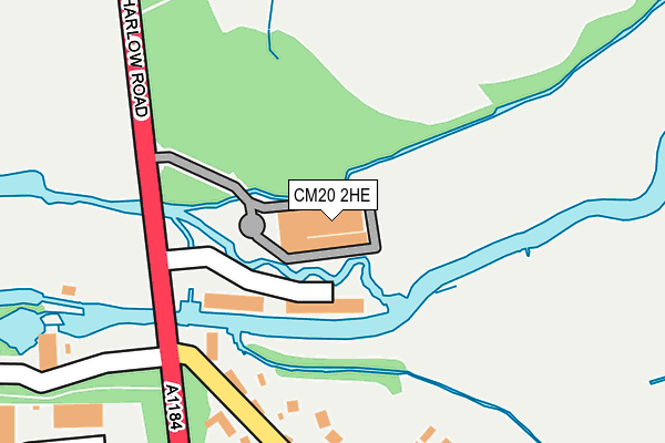
CM20 2HE is located in the Sawbridgeworth electoral ward, within the local authority district of East Hertfordshire and the English Parliamentary constituency of Hertford and Stortford. The Sub Integrated Care Board (ICB) Location is NHS Hertfordshire and West Essex ICB - 06K and the police force is Hertfordshire. This postcode has been in use since January 1980.


GetTheData
Source: OS OpenMap – Local (Ordnance Survey)
Source: OS VectorMap District (Ordnance Survey)
Licence: Open Government Licence (requires attribution)
| Easting | 547334 |
| Northing | 212934 |
| Latitude | 51.795661 |
| Longitude | 0.135107 |
GetTheData
Source: Open Postcode Geo
Licence: Open Government Licence
| Country | England |
| Postcode District | CM20 |
➜ See where CM20 is on a map ➜ Where is Harlow? | |
GetTheData
Source: Land Registry Price Paid Data
Licence: Open Government Licence
Elevation or altitude of CM20 2HE as distance above sea level:
| Metres | Feet | |
|---|---|---|
| Elevation | 50m | 164ft |
Elevation is measured from the approximate centre of the postcode, to the nearest point on an OS contour line from OS Terrain 50, which has contour spacing of ten vertical metres.
➜ How high above sea level am I? Find the elevation of your current position using your device's GPS.
GetTheData
Source: Open Postcode Elevation
Licence: Open Government Licence
| Ward | Sawbridgeworth |
| Constituency | Hertford And Stortford |
GetTheData
Source: ONS Postcode Database
Licence: Open Government Licence
| Beefeater (Cambridge Road) | Harlow Mill | 241m |
| Beefeater (Cambridge Road) | Harlow Mill | 377m |
| Redricks Lane (Harlow Road) | Sawbridgeworth | 463m |
| Redricks Lane (Harlow Road) | Sawbridgeworth | 481m |
| Harlow Mill Railway Station (Cambridge Road) | Harlow Mill | 636m |
| Harlow Mill Station | 0.6km |
| Sawbridgeworth Station | 2.7km |
| Harlow Town Station | 3.2km |
GetTheData
Source: NaPTAN
Licence: Open Government Licence
| Median download speed | 31.2Mbps |
| Average download speed | 32.3Mbps |
| Maximum download speed | 37.60Mbps |
| Median upload speed | 7.2Mbps |
| Average upload speed | 7.2Mbps |
| Maximum upload speed | 7.38Mbps |
GetTheData
Source: Ofcom
Licence: Ofcom Terms of Use (requires attribution)
GetTheData
Source: ONS Postcode Database
Licence: Open Government Licence


➜ Get more ratings from the Food Standards Agency
GetTheData
Source: Food Standards Agency
Licence: FSA terms & conditions
| Last Collection | |||
|---|---|---|---|
| Location | Mon-Fri | Sat | Distance |
| The Hoo | 17:15 | 12:15 | 511m |
| Tesco | 17:30 | 12:30 | 1,244m |
| Litle Penny | 17:00 | 11:45 | 1,284m |
GetTheData
Source: Dracos
Licence: Creative Commons Attribution-ShareAlike
| Risk of CM20 2HE flooding from rivers and sea | Low |
| ➜ CM20 2HE flood map | |
GetTheData
Source: Open Flood Risk by Postcode
Licence: Open Government Licence
The below table lists the International Territorial Level (ITL) codes (formerly Nomenclature of Territorial Units for Statistics (NUTS) codes) and Local Administrative Units (LAU) codes for CM20 2HE:
| ITL 1 Code | Name |
|---|---|
| TLH | East |
| ITL 2 Code | Name |
| TLH2 | Bedfordshire and Hertfordshire |
| ITL 3 Code | Name |
| TLH23 | Hertfordshire CC |
| LAU 1 Code | Name |
| E07000242 | East Hertfordshire |
GetTheData
Source: ONS Postcode Directory
Licence: Open Government Licence
The below table lists the Census Output Area (OA), Lower Layer Super Output Area (LSOA), and Middle Layer Super Output Area (MSOA) for CM20 2HE:
| Code | Name | |
|---|---|---|
| OA | E00119370 | |
| LSOA | E01023500 | East Hertfordshire 011B |
| MSOA | E02004888 | East Hertfordshire 011 |
GetTheData
Source: ONS Postcode Directory
Licence: Open Government Licence
| CM20 2AD | Cambridge Road | 95m |
| CM17 0HQ | Old Road | 245m |
| CM17 0JD | Wyldwood Close | 283m |
| CM17 0HN | The Crescent | 336m |
| CM17 0GX | Ranulf Close | 366m |
| CM17 0GZ | The Robins | 388m |
| CM17 0HL | Hart Road | 412m |
| CM21 0AJ | Harlow Road | 418m |
| CM17 0HG | Old Road | 419m |
| CM17 0HW | Wheatfields | 432m |
GetTheData
Source: Open Postcode Geo; Land Registry Price Paid Data
Licence: Open Government Licence