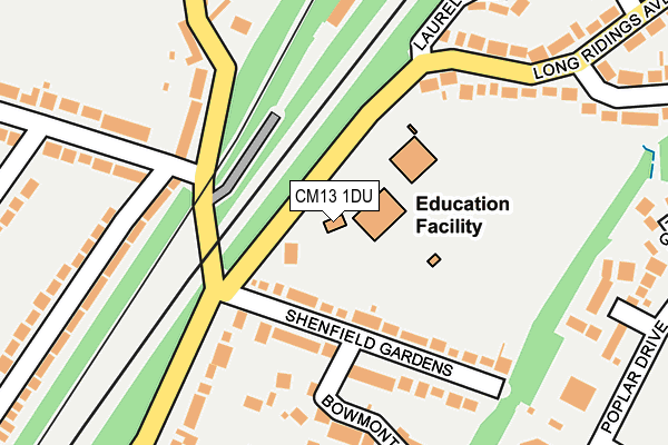
CM13 1DU is located in the Hutton North electoral ward, within the local authority district of Brentwood and the English Parliamentary constituency of Brentwood and Ongar. The Sub Integrated Care Board (ICB) Location is NHS Mid and South Essex ICB - 99E and the police force is Essex. This postcode has been in use since January 1980.


GetTheData
Source: OS OpenMap – Local (Ordnance Survey)
Source: OS VectorMap District (Ordnance Survey)
Licence: Open Government Licence (requires attribution)
| Easting | 561815 |
| Northing | 195526 |
| Latitude | 51.635270 |
| Longitude | 0.336811 |
GetTheData
Source: Open Postcode Geo
Licence: Open Government Licence
| Country | England |
| Postcode District | CM13 |
| ➜ CM13 open data dashboard ➜ See where CM13 is on a map ➜ Where is Brentwood? | |
GetTheData
Source: Land Registry Price Paid Data
Licence: Open Government Licence
Elevation or altitude of CM13 1DU as distance above sea level:
| Metres | Feet | |
|---|---|---|
| Elevation | 70m | 230ft |
Elevation is measured from the approximate centre of the postcode, to the nearest point on an OS contour line from OS Terrain 50, which has contour spacing of ten vertical metres.
➜ How high above sea level am I? Find the elevation of your current position using your device's GPS.
GetTheData
Source: Open Postcode Elevation
Licence: Open Government Licence
| Ward | Hutton North |
| Constituency | Brentwood And Ongar |
GetTheData
Source: ONS Postcode Database
Licence: Open Government Licence
| January 2024 | Violence and sexual offences | On or near Long Ridings Avenue | 252m |
| September 2023 | Vehicle crime | On or near Long Ridings Avenue | 252m |
| August 2023 | Violence and sexual offences | On or near Long Ridings Avenue | 252m |
| ➜ Get more crime data in our Crime section | |||
GetTheData
Source: data.police.uk
Licence: Open Government Licence
| Long Ridings School (Long Ridings Avenue) | Shenfield | 46m |
| Long Ridings School (Long Ridings Avenue) | Shenfield | 67m |
| Walton Gardens (Long Ridings Avenue) | Shenfield | 285m |
| Walton Gardens (Long Ridings Avenue) | Shenfield | 373m |
| Poplar Drive (Rayleigh Road) | Hutton | 424m |
| Shenfield Station | 0.7km |
| Brentwood Station | 3.5km |
| Ingatestone Station | 4.8km |
GetTheData
Source: NaPTAN
Licence: Open Government Licence
| Percentage of properties with Next Generation Access | 100.0% |
| Percentage of properties with Superfast Broadband | 100.0% |
| Percentage of properties with Ultrafast Broadband | 0.0% |
| Percentage of properties with Full Fibre Broadband | 0.0% |
Superfast Broadband is between 30Mbps and 300Mbps
Ultrafast Broadband is > 300Mbps
| Percentage of properties unable to receive 2Mbps | 0.0% |
| Percentage of properties unable to receive 5Mbps | 0.0% |
| Percentage of properties unable to receive 10Mbps | 0.0% |
| Percentage of properties unable to receive 30Mbps | 0.0% |
GetTheData
Source: Ofcom
Licence: Ofcom Terms of Use (requires attribution)
GetTheData
Source: ONS Postcode Database
Licence: Open Government Licence


➜ Get more ratings from the Food Standards Agency
GetTheData
Source: Food Standards Agency
Licence: FSA terms & conditions
| Last Collection | |||
|---|---|---|---|
| Location | Mon-Fri | Sat | Distance |
| Oliver Road | 17:00 | 08:15 | 166m |
| Long Ridings Avenue | 17:00 | 08:45 | 205m |
| Woodland Avenue P.o. | 17:10 | 11:30 | 673m |
GetTheData
Source: Dracos
Licence: Creative Commons Attribution-ShareAlike
| Facility | Distance |
|---|---|
| Long Ridings Primary School Long Ridings Avenue, Hutton, Brentwood Grass Pitches | 43m |
| Alexander Lane Alexander Lane, Shenfield , Brentwood Grass Pitches | 304m |
| Hutton Poplars 1 Poplar Drive, Hutton , Brentwood Grass Pitches | 370m |
GetTheData
Source: Active Places
Licence: Open Government Licence
| School | Phase of Education | Distance |
|---|---|---|
| Long Ridings Primary School Long Ridings Avenue, Hutton, Brentwood, CM13 1DU | Primary | 46m |
| St Joseph the Worker Catholic Primary School Highview Crescent, Hutton, CM13 1BJ | Primary | 549m |
| Shenfield High School Alexander Lane, Shenfield, Brentwood, CM15 8RY | Secondary | 571m |
GetTheData
Source: Edubase
Licence: Open Government Licence
The below table lists the International Territorial Level (ITL) codes (formerly Nomenclature of Territorial Units for Statistics (NUTS) codes) and Local Administrative Units (LAU) codes for CM13 1DU:
| ITL 1 Code | Name |
|---|---|
| TLH | East |
| ITL 2 Code | Name |
| TLH3 | Essex |
| ITL 3 Code | Name |
| TLH36 | Heart of Essex |
| LAU 1 Code | Name |
| E07000068 | Brentwood |
GetTheData
Source: ONS Postcode Directory
Licence: Open Government Licence
The below table lists the Census Output Area (OA), Lower Layer Super Output Area (LSOA), and Middle Layer Super Output Area (MSOA) for CM13 1DU:
| Code | Name | |
|---|---|---|
| OA | E00108993 | |
| LSOA | E01021453 | Brentwood 005B |
| MSOA | E02004468 | Brentwood 005 |
GetTheData
Source: ONS Postcode Directory
Licence: Open Government Licence
| CM13 1DT | Shenfield Gardens | 104m |
| CM15 8QE | Alexander Lane | 173m |
| CM13 1EB | Bowmont Close | 186m |
| CM15 8QD | Oliver Road | 222m |
| CM13 1DZ | Long Ridings Avenue | 226m |
| CM13 1YQ | Halstead Way | 247m |
| CM15 8PG | Hunter Avenue | 263m |
| CM13 1YY | Poplar Drive | 283m |
| CM13 1YG | Birdbrook Close | 288m |
| CM13 1AZ | Great Oaks | 299m |
GetTheData
Source: Open Postcode Geo; Land Registry Price Paid Data
Licence: Open Government Licence