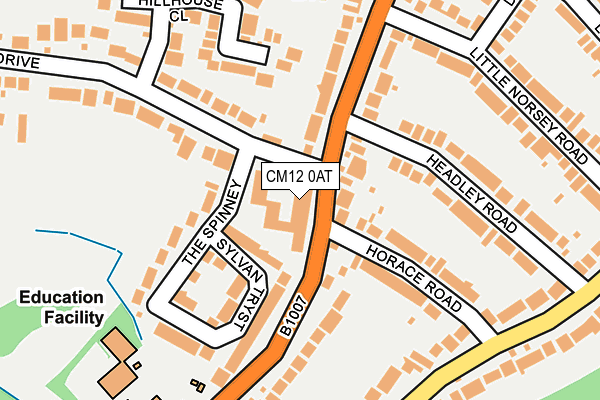
CM12 0AT is located in the Billericay West electoral ward, within the local authority district of Basildon and the English Parliamentary constituency of Basildon and Billericay. The Sub Integrated Care Board (ICB) Location is NHS Mid and South Essex ICB - 99E and the police force is Essex. This postcode has been in use since January 1980.


GetTheData
Source: OS OpenMap – Local (Ordnance Survey)
Source: OS VectorMap District (Ordnance Survey)
Licence: Open Government Licence (requires attribution)
| Easting | 567935 |
| Northing | 195677 |
| Latitude | 51.634834 |
| Longitude | 0.425233 |
GetTheData
Source: Open Postcode Geo
Licence: Open Government Licence
| Country | England |
| Postcode District | CM12 |
| ➜ CM12 open data dashboard ➜ See where CM12 is on a map ➜ Where is Billericay? | |
GetTheData
Source: Land Registry Price Paid Data
Licence: Open Government Licence
Elevation or altitude of CM12 0AT as distance above sea level:
| Metres | Feet | |
|---|---|---|
| Elevation | 90m | 295ft |
Elevation is measured from the approximate centre of the postcode, to the nearest point on an OS contour line from OS Terrain 50, which has contour spacing of ten vertical metres.
➜ How high above sea level am I? Find the elevation of your current position using your device's GPS.
GetTheData
Source: Open Postcode Elevation
Licence: Open Government Licence
| Ward | Billericay West |
| Constituency | Basildon And Billericay |
GetTheData
Source: ONS Postcode Database
Licence: Open Government Licence
| December 2023 | Burglary | On or near Supermarket | 432m |
| November 2023 | Shoplifting | On or near Supermarket | 432m |
| August 2023 | Shoplifting | On or near Supermarket | 432m |
| ➜ Get more crime data in our Crime section | |||
GetTheData
Source: data.police.uk
Licence: Open Government Licence
| Headley Road (Stock Road) | Billericay | 152m |
| Headley Road (Stock Road) | Billericay | 168m |
| St. John's School (Stock Road) | Billericay | 286m |
| St. John's School (Stock Road) | Billericay | 389m |
| Bush Hall Stores (Stock Road) | Billericay | 403m |
| Billericay Station | 0.8km |
| Ingatestone Station | 4.6km |
GetTheData
Source: NaPTAN
Licence: Open Government Licence
| Median download speed | 12.1Mbps |
| Average download speed | 26.0Mbps |
| Maximum download speed | 80.00Mbps |
| Median upload speed | 1.2Mbps |
| Average upload speed | 5.4Mbps |
| Maximum upload speed | 20.00Mbps |
GetTheData
Source: Ofcom
Licence: Ofcom Terms of Use (requires attribution)
Estimated total energy consumption in CM12 0AT by fuel type, 2015.
| Consumption (kWh) | 77,834 |
|---|---|
| Meter count | 60 |
| Mean (kWh/meter) | 1,297 |
| Median (kWh/meter) | 1,240 |
GetTheData
Source: Postcode level gas estimates: 2015 (experimental)
Source: Postcode level electricity estimates: 2015 (experimental)
Licence: Open Government Licence
GetTheData
Source: ONS Postcode Database
Licence: Open Government Licence


➜ Get more ratings from the Food Standards Agency
GetTheData
Source: Food Standards Agency
Licence: FSA terms & conditions
| Last Collection | |||
|---|---|---|---|
| Location | Mon-Fri | Sat | Distance |
| St Johns School | 17:30 | 12:00 | 265m |
| Lilford Road | 17:30 | 12:15 | 427m |
| Norsey View Drive | 17:30 | 12:15 | 533m |
GetTheData
Source: Dracos
Licence: Creative Commons Attribution-ShareAlike
| Facility | Distance |
|---|---|
| St Johns School Stock Road, Billericay Sports Hall, Grass Pitches | 252m |
| Buttsbury Junior School Academy Norsey View Drive, Billericay Sports Hall | 595m |
| Mayflower High School Stock Road, Billericay Grass Pitches, Sports Hall, Swimming Pool, Outdoor Tennis Courts | 616m |
GetTheData
Source: Active Places
Licence: Open Government Licence
| School | Phase of Education | Distance |
|---|---|---|
| St John's School 47-49 Stock Road, Billericay, Essex, CM12 0AR | Not applicable | 252m |
| Buttsbury Infant School Perry Street, Billericay, CM12 0NX | Primary | 420m |
| Buttsbury Junior School Norsey View Drive, Billericay, CM12 0QR | Primary | 596m |
GetTheData
Source: Edubase
Licence: Open Government Licence
The below table lists the International Territorial Level (ITL) codes (formerly Nomenclature of Territorial Units for Statistics (NUTS) codes) and Local Administrative Units (LAU) codes for CM12 0AT:
| ITL 1 Code | Name |
|---|---|
| TLH | East |
| ITL 2 Code | Name |
| TLH3 | Essex |
| ITL 3 Code | Name |
| TLH37 | Essex Thames Gateway |
| LAU 1 Code | Name |
| E07000066 | Basildon |
GetTheData
Source: ONS Postcode Directory
Licence: Open Government Licence
The below table lists the Census Output Area (OA), Lower Layer Super Output Area (LSOA), and Middle Layer Super Output Area (MSOA) for CM12 0AT:
| Code | Name | |
|---|---|---|
| OA | E00107916 | |
| LSOA | E01021247 | Basildon 003E |
| MSOA | E02004426 | Basildon 003 |
GetTheData
Source: ONS Postcode Directory
Licence: Open Government Licence
| CM12 0BD | Stock Road | 49m |
| CM12 0AX | Sylvan Tryst | 127m |
| CM12 0AZ | Hillhouse Drive | 129m |
| CM11 1AA | Horace Road | 131m |
| CM12 0AU | The Spinney | 132m |
| CM12 0RX | Stock Road | 150m |
| CM12 0RN | Stock Road | 154m |
| CM11 1BJ | Headley Road | 168m |
| CM12 0BE | Stock Road | 183m |
| CM12 0QF | Fern Close | 205m |
GetTheData
Source: Open Postcode Geo; Land Registry Price Paid Data
Licence: Open Government Licence