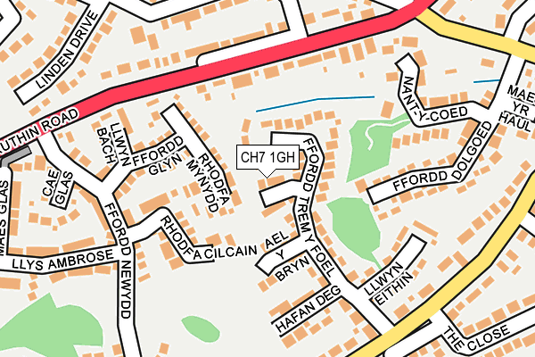
CH7 1GH lies on Y Dolydd in Mold. CH7 1GH is located in the Mold South electoral ward, within the unitary authority of Flintshire and the Welsh Parliamentary constituency of Delyn. The Local Health Board is Betsi Cadwaladr University and the police force is North Wales. This postcode has been in use since May 1994.


GetTheData
Source: OS OpenMap – Local (Ordnance Survey)
Source: OS VectorMap District (Ordnance Survey)
Licence: Open Government Licence (requires attribution)
| Easting | 323120 |
| Northing | 363285 |
| Latitude | 53.161116 |
| Longitude | -3.151304 |
GetTheData
Source: Open Postcode Geo
Licence: Open Government Licence
| Street | Y Dolydd |
| Town/City | Mold |
| Country | Wales |
| Postcode District | CH7 |
➜ See where CH7 is on a map ➜ Where is Mold? | |
GetTheData
Source: Land Registry Price Paid Data
Licence: Open Government Licence
Elevation or altitude of CH7 1GH as distance above sea level:
| Metres | Feet | |
|---|---|---|
| Elevation | 130m | 427ft |
Elevation is measured from the approximate centre of the postcode, to the nearest point on an OS contour line from OS Terrain 50, which has contour spacing of ten vertical metres.
➜ How high above sea level am I? Find the elevation of your current position using your device's GPS.
GetTheData
Source: Open Postcode Elevation
Licence: Open Government Licence
| Ward | Mold South |
| Constituency | Delyn |
GetTheData
Source: ONS Postcode Database
Licence: Open Government Licence
2016 8 JUN £209,000 |
2015 15 DEC £200,000 |
2013 28 FEB £177,500 |
3, Y DOLYDD, MOLD, CH7 1GH 2011 22 DEC £180,000 |
2005 11 MAR £182,000 |
2003 23 MAY £165,000 |
4, Y DOLYDD, MOLD, CH7 1GH 1997 31 JAN £79,000 |
GetTheData
Source: HM Land Registry Price Paid Data
Licence: Contains HM Land Registry data © Crown copyright and database right 2025. This data is licensed under the Open Government Licence v3.0.
| Woodland Rise (Ruthin Road) | Mold | 154m |
| Woodland Rise (Ruthin Road) | Mold | 161m |
| Hendy Road (Ruthin Road) | Mold | 213m |
| Hafod Park East (Hafod Park) | Mold | 215m |
| Hendy Road (Ruthin Road) | Mold | 217m |
GetTheData
Source: NaPTAN
Licence: Open Government Licence
| Percentage of properties with Next Generation Access | 100.0% |
| Percentage of properties with Superfast Broadband | 100.0% |
| Percentage of properties with Ultrafast Broadband | 0.0% |
| Percentage of properties with Full Fibre Broadband | 0.0% |
Superfast Broadband is between 30Mbps and 300Mbps
Ultrafast Broadband is > 300Mbps
| Median download speed | 39.0Mbps |
| Average download speed | 37.6Mbps |
| Maximum download speed | 40.00Mbps |
| Median upload speed | 6.1Mbps |
| Average upload speed | 6.3Mbps |
| Maximum upload speed | 7.19Mbps |
| Percentage of properties unable to receive 2Mbps | 0.0% |
| Percentage of properties unable to receive 5Mbps | 0.0% |
| Percentage of properties unable to receive 10Mbps | 0.0% |
| Percentage of properties unable to receive 30Mbps | 0.0% |
GetTheData
Source: Ofcom
Licence: Ofcom Terms of Use (requires attribution)


➜ Get more ratings from the Food Standards Agency
GetTheData
Source: Food Standards Agency
Licence: FSA terms & conditions
| Last Collection | |||
|---|---|---|---|
| Location | Mon-Fri | Sat | Distance |
| Penyffordd | 17:18 | 11:30 | 280m |
| Hafod Park | 17:15 | 11:30 | 486m |
| St Mary's Park | 15:30 | 12:00 | 545m |
GetTheData
Source: Dracos
Licence: Creative Commons Attribution-ShareAlike
The below table lists the International Territorial Level (ITL) codes (formerly Nomenclature of Territorial Units for Statistics (NUTS) codes) and Local Administrative Units (LAU) codes for CH7 1GH:
| ITL 1 Code | Name |
|---|---|
| TLL | Wales |
| ITL 2 Code | Name |
| TLL2 | East Wales |
| ITL 3 Code | Name |
| TLL23 | Flintshire and Wrexham |
| LAU 1 Code | Name |
| W06000005 | Flintshire |
GetTheData
Source: ONS Postcode Directory
Licence: Open Government Licence
The below table lists the Census Output Area (OA), Lower Layer Super Output Area (LSOA), and Middle Layer Super Output Area (MSOA) for CH7 1GH:
| Code | Name | |
|---|---|---|
| OA | W00001699 | |
| LSOA | W01000317 | Flintshire 016E |
| MSOA | W02000073 | Flintshire 016 |
GetTheData
Source: ONS Postcode Directory
Licence: Open Government Licence
| CH7 1NG | Ffordd Trem Y Foel | 65m |
| CH7 1GQ | Rhodfa Mynydd | 70m |
| CH7 1GB | Ael Y Bryn | 103m |
| CH7 1GR | Rhodfa Cilcain | 105m |
| CH7 1YX | Hafan Deg | 144m |
| CH7 1GZ | Ffordd Glyn | 146m |
| CH7 1QH | Ruthin Road | 160m |
| CH7 1EH | Llwyn Eithin | 161m |
| CH7 1GW | Llwyn Bach | 183m |
| CH7 1NX | Nant Y Coed | 192m |
GetTheData
Source: Open Postcode Geo; Land Registry Price Paid Data
Licence: Open Government Licence