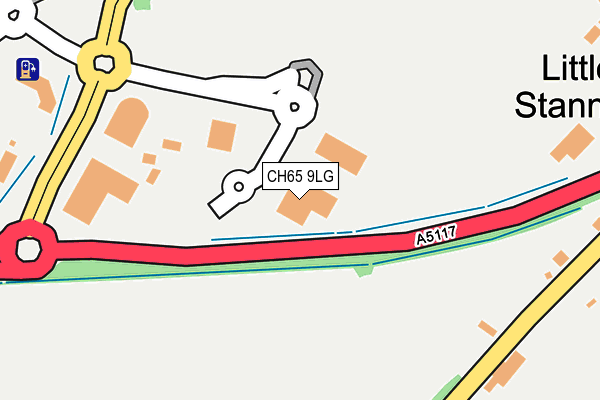
CH65 9LG is located in the Whitby Groves electoral ward, within the unitary authority of Cheshire West and Chester and the English Parliamentary constituency of Ellesmere Port and Neston. The Sub Integrated Care Board (ICB) Location is NHS Cheshire and Merseyside ICB - 27D and the police force is Cheshire. This postcode has been in use since February 2013.


GetTheData
Source: OS OpenMap – Local (Ordnance Survey)
Source: OS VectorMap District (Ordnance Survey)
Licence: Open Government Licence (requires attribution)
| Easting | 340912 |
| Northing | 374036 |
| Latitude | 53.260035 |
| Longitude | -2.887234 |
GetTheData
Source: Open Postcode Geo
Licence: Open Government Licence
| Country | England |
| Postcode District | CH65 |
| ➜ CH65 open data dashboard ➜ See where CH65 is on a map | |
GetTheData
Source: Land Registry Price Paid Data
Licence: Open Government Licence
Elevation or altitude of CH65 9LG as distance above sea level:
| Metres | Feet | |
|---|---|---|
| Elevation | 30m | 98ft |
Elevation is measured from the approximate centre of the postcode, to the nearest point on an OS contour line from OS Terrain 50, which has contour spacing of ten vertical metres.
➜ How high above sea level am I? Find the elevation of your current position using your device's GPS.
GetTheData
Source: Open Postcode Elevation
Licence: Open Government Licence
| Ward | Whitby Groves |
| Constituency | Ellesmere Port And Neston |
GetTheData
Source: ONS Postcode Database
Licence: Open Government Licence
| June 2022 | Anti-social behaviour | On or near Lloyd Drive | 401m |
| June 2022 | Shoplifting | On or near Shopping Area | 438m |
| June 2022 | Vehicle crime | On or near Shopping Area | 438m |
| ➜ Get more crime data in our Crime section | |||
GetTheData
Source: data.police.uk
Licence: Open Government Licence
| Blue Planet Aquarium (Grounds) | Cheshire Oaks | 157m |
| Blue Planet Aquarium (Kinsey Road) | Cheshire Oaks | 299m |
| Longlooms Road (Stanney Woods Avenue) | Whitbyheath | 304m |
| Longlooms Road | Whitbyheath | 306m |
| Longlooms Road (Stanney Woods Avenue) | Whitbyheath | 319m |
| Ellesmere Port Station | 2.5km |
| Overpool Station | 3.6km |
| Stanlow & Thornton Station | 3.6km |
GetTheData
Source: NaPTAN
Licence: Open Government Licence
GetTheData
Source: ONS Postcode Database
Licence: Open Government Licence


➜ Get more ratings from the Food Standards Agency
GetTheData
Source: Food Standards Agency
Licence: FSA terms & conditions
| Last Collection | |||
|---|---|---|---|
| Location | Mon-Fri | Sat | Distance |
| Stanney Oak Estate | 17:07 | 12:00 | 295m |
| Little Stanney. | 16:30 | 09:00 | 355m |
| Coliseum Way | 16:55 | 12:00 | 425m |
GetTheData
Source: Dracos
Licence: Creative Commons Attribution-ShareAlike
| Facility | Distance |
|---|---|
| David Lloyd (Cheshire Oaks) Stanney Lane, Ellesmere Port Sports Hall, Swimming Pool, Health and Fitness Gym, Indoor Tennis Centre, Studio, Squash Courts, Outdoor Tennis Courts | 496m |
| Ellesmere Port Sports Village Stanney Lane, Ellesmere Port Swimming Pool, Studio, Sports Hall, Health and Fitness Gym, Artificial Grass Pitch, Athletics | 743m |
| Core Fitness Centre (Closed) Stanney Mill Lane, Little Stanney, Chester Health and Fitness Gym | 939m |
GetTheData
Source: Active Places
Licence: Open Government Licence
| School | Phase of Education | Distance |
|---|---|---|
| The Oaks Community Primary School Rochester Drive, Ellesmere Port, CH65 9EX | Primary | 816m |
| St Bernard's Roman Catholic Primary School Sherbourne Road, Ellesmere Port, CH65 5EW | Primary | 1.3km |
| Ellesmere Port Christ Church CofE Primary School Deeside, Whitby, Ellesmere Port, CH65 6TQ | Primary | 1.3km |
GetTheData
Source: Edubase
Licence: Open Government Licence
The below table lists the International Territorial Level (ITL) codes (formerly Nomenclature of Territorial Units for Statistics (NUTS) codes) and Local Administrative Units (LAU) codes for CH65 9LG:
| ITL 1 Code | Name |
|---|---|
| TLD | North West (England) |
| ITL 2 Code | Name |
| TLD6 | Cheshire |
| ITL 3 Code | Name |
| TLD63 | Cheshire West and Chester |
| LAU 1 Code | Name |
| E06000050 | Cheshire West and Chester |
GetTheData
Source: ONS Postcode Directory
Licence: Open Government Licence
The below table lists the Census Output Area (OA), Lower Layer Super Output Area (LSOA), and Middle Layer Super Output Area (MSOA) for CH65 9LG:
| Code | Name | |
|---|---|---|
| OA | E00093688 | |
| LSOA | E01018566 | Cheshire West and Chester 014B |
| MSOA | E02003851 | Cheshire West and Chester 014 |
GetTheData
Source: ONS Postcode Directory
Licence: Open Government Licence
| CH2 4HS | Rake Lane | 276m |
| CH2 4HT | Stanney Lane | 354m |
| CH2 4PZ | Wood Farm Close | 361m |
| CH2 4HN | Meadow View | 376m |
| CH2 4HZ | Ring Road | 419m |
| CH65 9JN | Stanney Lane | 496m |
| CH65 9HX | Orkney Close | 514m |
| CH65 9HD | Coliseum Way | 525m |
| CH65 9HT | Shetland Drive | 526m |
| CH65 9HU | Alderney Close | 539m |
GetTheData
Source: Open Postcode Geo; Land Registry Price Paid Data
Licence: Open Government Licence