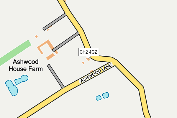
CH2 4GZ is located in the Gowy Rural electoral ward, within the unitary authority of Cheshire West and Chester and the English Parliamentary constituency of Ellesmere Port and Neston. The Sub Integrated Care Board (ICB) Location is NHS Cheshire and Merseyside ICB - 27D and the police force is Cheshire. This postcode has been in use since July 2006.


GetTheData
Source: OS OpenMap – Local (Ordnance Survey)
Source: OS VectorMap District (Ordnance Survey)
Licence: Open Government Licence (requires attribution)
| Easting | 342875 |
| Northing | 372525 |
| Latitude | 53.246654 |
| Longitude | -2.857539 |
GetTheData
Source: Open Postcode Geo
Licence: Open Government Licence
| Country | England |
| Postcode District | CH2 |
| ➜ CH2 open data dashboard ➜ See where CH2 is on a map | |
GetTheData
Source: Land Registry Price Paid Data
Licence: Open Government Licence
Elevation or altitude of CH2 4GZ as distance above sea level:
| Metres | Feet | |
|---|---|---|
| Elevation | 10m | 33ft |
Elevation is measured from the approximate centre of the postcode, to the nearest point on an OS contour line from OS Terrain 50, which has contour spacing of ten vertical metres.
➜ How high above sea level am I? Find the elevation of your current position using your device's GPS.
GetTheData
Source: Open Postcode Elevation
Licence: Open Government Licence
| Ward | Gowy Rural |
| Constituency | Ellesmere Port And Neston |
GetTheData
Source: ONS Postcode Database
Licence: Open Government Licence
| June 2022 | Other theft | On or near Picton Lane | 53m |
| February 2022 | Public order | On or near Picton Lane | 53m |
| ➜ Get more crime data in our Crime section | |||
GetTheData
Source: data.police.uk
Licence: Open Government Licence
| Motorway Bridge (Wervin Road) | Croughton | 770m |
| Motorway Bridge (Wervin Road) | Croughton | 782m |
| Bunbury Close (Little Stanney Lane) | Stoak | 830m |
| Bunbury Close (Little Stanney Lane) | Stoak | 842m |
| Crossroads (Wervin Road) | Wervin | 953m |
| Stanlow & Thornton Station | 3.7km |
| Ince & Elton Station | 4.3km |
| Ellesmere Port Station | 4.7km |
GetTheData
Source: NaPTAN
Licence: Open Government Licence
| Percentage of properties with Next Generation Access | 100.0% |
| Percentage of properties with Superfast Broadband | 100.0% |
| Percentage of properties with Ultrafast Broadband | 0.0% |
| Percentage of properties with Full Fibre Broadband | 0.0% |
Superfast Broadband is between 30Mbps and 300Mbps
Ultrafast Broadband is > 300Mbps
| Percentage of properties unable to receive 2Mbps | 0.0% |
| Percentage of properties unable to receive 5Mbps | 0.0% |
| Percentage of properties unable to receive 10Mbps | 0.0% |
| Percentage of properties unable to receive 30Mbps | 0.0% |
GetTheData
Source: Ofcom
Licence: Ofcom Terms of Use (requires attribution)
GetTheData
Source: ONS Postcode Database
Licence: Open Government Licence


➜ Get more ratings from the Food Standards Agency
GetTheData
Source: Food Standards Agency
Licence: FSA terms & conditions
| Last Collection | |||
|---|---|---|---|
| Location | Mon-Fri | Sat | Distance |
| Stoak. | 16:15 | 09:00 | 1,036m |
| Little Stanney. | 16:30 | 09:00 | 2,286m |
| Caughall Road, | 17:04 | 12:37 | 2,379m |
GetTheData
Source: Dracos
Licence: Creative Commons Attribution-ShareAlike
| Facility | Distance |
|---|---|
| Core Fitness Centre (Closed) Stanney Mill Lane, Little Stanney, Chester Health and Fitness Gym | 2.2km |
| Sandfield Golf Course & Driving Range Ince Lane, Bridge Trafford, Chester Golf | 2.3km |
| Acresfield Academy Acres Lane, Upton, Chester Grass Pitches | 2.7km |
GetTheData
Source: Active Places
Licence: Open Government Licence
| School | Phase of Education | Distance |
|---|---|---|
| Acresfield Academy Acres Lane, Upton By Chester, Chester, CH2 1LJ | Primary | 2.7km |
| Mickle Trafford Village School School Lane, Mickle Trafford, Chester, CH2 4EF | Primary | 3.1km |
| The Oaks Community Primary School Rochester Drive, Ellesmere Port, CH65 9EX | Primary | 3.2km |
GetTheData
Source: Edubase
Licence: Open Government Licence
The below table lists the International Territorial Level (ITL) codes (formerly Nomenclature of Territorial Units for Statistics (NUTS) codes) and Local Administrative Units (LAU) codes for CH2 4GZ:
| ITL 1 Code | Name |
|---|---|
| TLD | North West (England) |
| ITL 2 Code | Name |
| TLD6 | Cheshire |
| ITL 3 Code | Name |
| TLD63 | Cheshire West and Chester |
| LAU 1 Code | Name |
| E06000050 | Cheshire West and Chester |
GetTheData
Source: ONS Postcode Directory
Licence: Open Government Licence
The below table lists the Census Output Area (OA), Lower Layer Super Output Area (LSOA), and Middle Layer Super Output Area (MSOA) for CH2 4GZ:
| Code | Name | |
|---|---|---|
| OA | E00092495 | |
| LSOA | E01018337 | Cheshire West and Chester 022C |
| MSOA | E02003794 | Cheshire West and Chester 022 |
GetTheData
Source: ONS Postcode Directory
Licence: Open Government Licence
| CH2 4HF | Picton Lane | 131m |
| CH2 4HL | Bunbury Close | 836m |
| CH2 4BX | Ashwood Lane | 862m |
| CH2 4HQ | Croughton Road | 867m |
| CH2 4BZ | Wervin Road | 899m |
| CH2 4HJ | Croughton Road | 922m |
| CH2 4BY | Wervin Road | 976m |
| CH2 4HP | Church Lane | 998m |
| CH2 4BS | Wervin Mobile Home Park | 1035m |
| CH2 4HW | Little Stanney Lane | 1037m |
GetTheData
Source: Open Postcode Geo; Land Registry Price Paid Data
Licence: Open Government Licence