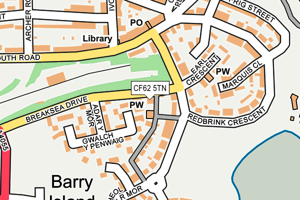
CF62 5TN is located in the Baruc electoral ward, within the unitary authority of Vale of Glamorgan and the Welsh Parliamentary constituency of Vale of Glamorgan. The Local Health Board is Cardiff and Vale University and the police force is South Wales. This postcode has been in use since January 1993.


GetTheData
Source: OS OpenMap – Local (Ordnance Survey)
Source: OS VectorMap District (Ordnance Survey)
Licence: Open Government Licence (requires attribution)
| Easting | 311865 |
| Northing | 166759 |
| Latitude | 51.392999 |
| Longitude | -3.268133 |
GetTheData
Source: Open Postcode Geo
Licence: Open Government Licence
| Country | Wales |
| Postcode District | CF62 |
| ➜ CF62 open data dashboard ➜ See where CF62 is on a map ➜ Where is Barry? | |
GetTheData
Source: Land Registry Price Paid Data
Licence: Open Government Licence
Elevation or altitude of CF62 5TN as distance above sea level:
| Metres | Feet | |
|---|---|---|
| Elevation | 30m | 98ft |
Elevation is measured from the approximate centre of the postcode, to the nearest point on an OS contour line from OS Terrain 50, which has contour spacing of ten vertical metres.
➜ How high above sea level am I? Find the elevation of your current position using your device's GPS.
GetTheData
Source: Open Postcode Elevation
Licence: Open Government Licence
| Ward | Baruc |
| Constituency | Vale Of Glamorgan |
GetTheData
Source: ONS Postcode Database
Licence: Open Government Licence
| August 2023 | Violence and sexual offences | On or near Gwalch Y Penwaig | 121m |
| January 2023 | Violence and sexual offences | On or near Gwalch Y Penwaig | 121m |
| September 2022 | Violence and sexual offences | On or near Gwalch Y Penwaig | 121m |
| ➜ Get more crime data in our Crime section | |||
GetTheData
Source: data.police.uk
Licence: Open Government Licence
| Community Centre (Friars Road) | Barry Island | 80m |
| Adar Y Mor (Breaksea Drive) | Barry Island | 86m |
| Clive Place | Barry Island | 215m |
| Plymouth Road | Barry Island | 278m |
| Clive Road | Barry Island | 291m |
| Barry Island Station | 0.4km |
| Barry Docks Station | 1.2km |
| Barry Station | 1.2km |
GetTheData
Source: NaPTAN
Licence: Open Government Licence
GetTheData
Source: ONS Postcode Database
Licence: Open Government Licence


➜ Get more ratings from the Food Standards Agency
GetTheData
Source: Food Standards Agency
Licence: FSA terms & conditions
| Last Collection | |||
|---|---|---|---|
| Location | Mon-Fri | Sat | Distance |
| Ffordd Y Mileniwm | 17:30 | 12:15 | 927m |
| Parade | 17:00 | 11:45 | 1,262m |
| Vale Street | 18:30 | 12:00 | 1,335m |
GetTheData
Source: Dracos
Licence: Creative Commons Attribution-ShareAlike
| School | Phase of Education | Distance |
|---|---|---|
| Barry Island Primary Clive Road, Barry Island, Barry, Vale of Glamorgan, CF62 5UZ | Not applicable | 403m |
| Ysgol Sant Baruc Ffordd Y Mileniwm, Barry, CF62 5AT | Not applicable | 831m |
| High Street Primary School St Paul's Avenue, Barry, Vale of Glamorgan, CF62 8HT | Not applicable | 1.3km |
GetTheData
Source: Edubase
Licence: Open Government Licence
The below table lists the International Territorial Level (ITL) codes (formerly Nomenclature of Territorial Units for Statistics (NUTS) codes) and Local Administrative Units (LAU) codes for CF62 5TN:
| ITL 1 Code | Name |
|---|---|
| TLL | Wales |
| ITL 2 Code | Name |
| TLL2 | East Wales |
| ITL 3 Code | Name |
| TLL22 | Cardiff and Vale of Glamorgan |
| LAU 1 Code | Name |
| W06000014 | Vale of Glamorgan |
GetTheData
Source: ONS Postcode Directory
Licence: Open Government Licence
The below table lists the Census Output Area (OA), Lower Layer Super Output Area (LSOA), and Middle Layer Super Output Area (MSOA) for CF62 5TN:
| Code | Name | |
|---|---|---|
| OA | W00005606 | |
| LSOA | W01001061 | The Vale of Glamorgan 015C |
| MSOA | W02000251 | The Vale of Glamorgan 015 |
GetTheData
Source: ONS Postcode Directory
Licence: Open Government Licence
| CF62 5TR | Friars Road | 46m |
| CF62 5TA | St Johns Court | 50m |
| CF62 5AJ | Heol Gylfinir | 51m |
| CF62 5TD | Friars Road | 52m |
| CF62 5UF | Plymouth Road | 99m |
| CF62 5AL | Heol Pal | 103m |
| CF62 5AF | Adar Y Mor | 129m |
| CF62 5AG | Gwalch Y Penwaig | 129m |
| CF62 5TY | Plymouth Road | 142m |
| CF62 5TS | Earl Crescent | 149m |
GetTheData
Source: Open Postcode Geo; Land Registry Price Paid Data
Licence: Open Government Licence