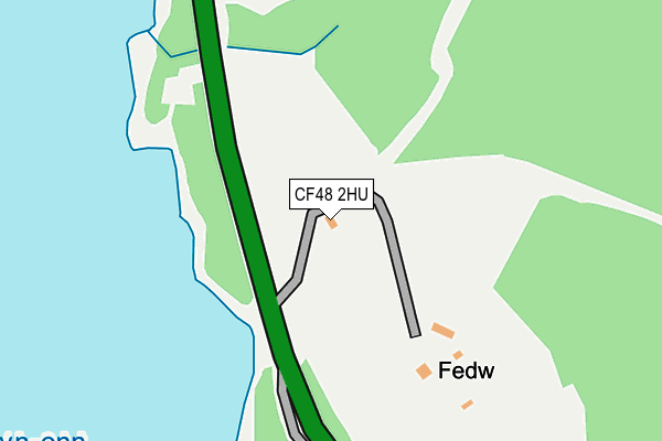
CF48 2HU is located in the Hirwaun, Penderyn and Rhigos electoral ward, within the unitary authority of Rhondda Cynon Taf and the Welsh Parliamentary constituency of Cynon Valley. The Local Health Board is Cwm Taf Morgannwg University and the police force is South Wales. This postcode has been in use since January 1980.


GetTheData
Source: OS OpenMap – Local (Ordnance Survey)
Source: OS VectorMap District (Ordnance Survey)
Licence: Open Government Licence (requires attribution)
| Easting | 301116 |
| Northing | 211237 |
| Latitude | 51.791022 |
| Longitude | -3.435136 |
GetTheData
Source: Open Postcode Geo
Licence: Open Government Licence
| Country | Wales |
| Postcode District | CF48 |
| ➜ CF48 open data dashboard ➜ See where CF48 is on a map | |
GetTheData
Source: Land Registry Price Paid Data
Licence: Open Government Licence
Elevation or altitude of CF48 2HU as distance above sea level:
| Metres | Feet | |
|---|---|---|
| Elevation | 280m | 919ft |
Elevation is measured from the approximate centre of the postcode, to the nearest point on an OS contour line from OS Terrain 50, which has contour spacing of ten vertical metres.
➜ How high above sea level am I? Find the elevation of your current position using your device's GPS.
GetTheData
Source: Open Postcode Elevation
Licence: Open Government Licence
| Ward | Hirwaun, Penderyn And Rhigos |
| Constituency | Cynon Valley |
GetTheData
Source: ONS Postcode Database
Licence: Open Government Licence
| Llwyn-on Village (A470) | Llwyn-on | 267m |
| Llwyn-on Village (A470) | Llwyn-on | 273m |
GetTheData
Source: NaPTAN
Licence: Open Government Licence
GetTheData
Source: ONS Postcode Database
Licence: Open Government Licence


➜ Get more ratings from the Food Standards Agency
GetTheData
Source: Food Standards Agency
Licence: FSA terms & conditions
| Last Collection | |||
|---|---|---|---|
| Location | Mon-Fri | Sat | Distance |
| Llwynon Cwmtaff | 12:30 | 10:45 | 286m |
| Maple Crescent | 16:45 | 11:30 | 3,552m |
| Pontsarn Station | 14:45 | 08:15 | 3,602m |
GetTheData
Source: Dracos
Licence: Creative Commons Attribution-ShareAlike
| School | Phase of Education | Distance |
|---|---|---|
| Ysgol-Y-Graig Primary School Cefn Coed, Merthyr Tydfil, CF48 2LR | Not applicable | 3.9km |
| Pen-Y-Dre High School Gurnos Estate, Merthyr Tydfil, CF47 9BY | Not applicable | 4.6km |
| Ysgol Gynradd Coed y Dderwen Gellideg Estate, Merthyr Tydfil, CF48 1LG | Not applicable | 4.7km |
GetTheData
Source: Edubase
Licence: Open Government Licence
The below table lists the International Territorial Level (ITL) codes (formerly Nomenclature of Territorial Units for Statistics (NUTS) codes) and Local Administrative Units (LAU) codes for CF48 2HU:
| ITL 1 Code | Name |
|---|---|
| TLL | Wales |
| ITL 2 Code | Name |
| TLL1 | West Wales and The Valleys |
| ITL 3 Code | Name |
| TLL15 | Central Valleys |
| LAU 1 Code | Name |
| W06000016 | Rhondda Cynon Taf |
GetTheData
Source: ONS Postcode Directory
Licence: Open Government Licence
The below table lists the Census Output Area (OA), Lower Layer Super Output Area (LSOA), and Middle Layer Super Output Area (MSOA) for CF48 2HU:
| Code | Name | |
|---|---|---|
| OA | W00006479 | |
| LSOA | W01001233 | Rhondda Cynon Taf 001F |
| MSOA | W02000252 | Rhondda Cynon Taf 001 |
GetTheData
Source: ONS Postcode Directory
Licence: Open Government Licence
| CF48 2HT | Llwyn Onn Houses | 323m |
| CF48 2HS | 429m | |
| CF48 2LF | Sweet Water Park | 3195m |
| CF48 2ES | Hawthorn Hill | 3282m |
| CF48 2ER | Poplar Place | 3310m |
| CF48 2EY | Crabtree Walk | 3331m |
| CF48 2ET | Sycamore Crescent | 3349m |
| CF48 2HA | The Birchway | 3373m |
| CF48 2EN | The Copse | 3378m |
| CF48 2EP | Beechwood Avenue | 3393m |
GetTheData
Source: Open Postcode Geo; Land Registry Price Paid Data
Licence: Open Government Licence