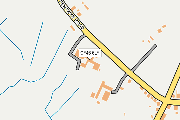
CF46 6LY is located in the Nelson electoral ward, within the unitary authority of Caerphilly and the Welsh Parliamentary constituency of Caerphilly. The Local Health Board is Aneurin Bevan University and the police force is Gwent. This postcode has been in use since December 1995.


GetTheData
Source: OS OpenMap – Local (Ordnance Survey)
Source: OS VectorMap District (Ordnance Survey)
Licence: Open Government Licence (requires attribution)
| Easting | 310320 |
| Northing | 195642 |
| Latitude | 51.652390 |
| Longitude | -3.297695 |
GetTheData
Source: Open Postcode Geo
Licence: Open Government Licence
| Country | Wales |
| Postcode District | CF46 |
| ➜ CF46 open data dashboard ➜ See where CF46 is on a map | |
GetTheData
Source: Land Registry Price Paid Data
Licence: Open Government Licence
Elevation or altitude of CF46 6LY as distance above sea level:
| Metres | Feet | |
|---|---|---|
| Elevation | 160m | 525ft |
Elevation is measured from the approximate centre of the postcode, to the nearest point on an OS contour line from OS Terrain 50, which has contour spacing of ten vertical metres.
➜ How high above sea level am I? Find the elevation of your current position using your device's GPS.
GetTheData
Source: Open Postcode Elevation
Licence: Open Government Licence
| Ward | Nelson |
| Constituency | Caerphilly |
GetTheData
Source: ONS Postcode Database
Licence: Open Government Licence
| June 2022 | Violence and sexual offences | On or near Llwyncelyn Terrace | 403m |
| June 2022 | Violence and sexual offences | On or near Ynys Las | 428m |
| May 2022 | Violence and sexual offences | On or near Llwyncelyn Terrace | 403m |
| ➜ Get more crime data in our Crime section | |||
GetTheData
Source: data.police.uk
Licence: Open Government Licence
| Welsh Water Offices (Pentwyn Road) | Nelson | 65m |
| Welsh Water Offices (Pentwyn Road) | Nelson | 71m |
| Hollybush (High Street) | Nelson | 305m |
| Maes-yr-onen Path (Bwl Road) | Nelson | 332m |
| Hollybush (High Street) | Nelson | 341m |
| Quakers Yard Station | 2km |
| Abercynon Station | 2.2km |
| Ystrad Mynach Station | 4.1km |
GetTheData
Source: NaPTAN
Licence: Open Government Licence
GetTheData
Source: ONS Postcode Database
Licence: Open Government Licence


➜ Get more ratings from the Food Standards Agency
GetTheData
Source: Food Standards Agency
Licence: FSA terms & conditions
| Last Collection | |||
|---|---|---|---|
| Location | Mon-Fri | Sat | Distance |
| Cardiff Road Edwardsville | 17:30 | 12:00 | 2,172m |
| St Winifreds Church | 16:45 | 11:45 | 4,926m |
| Glanynant Post Office | 16:15 | 11:00 | 5,179m |
GetTheData
Source: Dracos
Licence: Creative Commons Attribution-ShareAlike
| School | Phase of Education | Distance |
|---|---|---|
| Llanfabon Infants School Bryncelyn Avenue, Nelson, Treharris, Caerphilly, CF46 6HL | Not applicable | 780m |
| Llancaeach Junior School Commercial Street, Nelson, Treharris, CF46 6NF | Not applicable | 1.2km |
| Trelewis Primary School Trelewis, Treharris, Merthyr Tydfil, CF46 6AH | Not applicable | 1.8km |
GetTheData
Source: Edubase
Licence: Open Government Licence
The below table lists the International Territorial Level (ITL) codes (formerly Nomenclature of Territorial Units for Statistics (NUTS) codes) and Local Administrative Units (LAU) codes for CF46 6LY:
| ITL 1 Code | Name |
|---|---|
| TLL | Wales |
| ITL 2 Code | Name |
| TLL1 | West Wales and The Valleys |
| ITL 3 Code | Name |
| TLL16 | Gwent Valleys |
| LAU 1 Code | Name |
| W06000018 | Caerphilly |
GetTheData
Source: ONS Postcode Directory
Licence: Open Government Licence
The below table lists the Census Output Area (OA), Lower Layer Super Output Area (LSOA), and Middle Layer Super Output Area (MSOA) for CF46 6LY:
| Code | Name | |
|---|---|---|
| OA | W00007219 | |
| LSOA | W01001379 | Caerphilly 013C |
| MSOA | W02000302 | Caerphilly 013 |
GetTheData
Source: ONS Postcode Directory
Licence: Open Government Licence
| CF46 6HE | Pentwyn Road | 214m |
| CF46 6LU | Pentwyn Road | 251m |
| CF46 6HD | Bwl Road | 342m |
| CF46 6HF | Llwyncelyn Terrace | 391m |
| CF46 6LE | Ynys Las | 402m |
| CF46 6LA | Clos Cae Pwll | 409m |
| CF46 5BU | Ty Llwyd Terrace | 422m |
| CF46 6HB | High Street | 448m |
| CF46 5PN | The Hollies | 452m |
| CF46 6LB | Clos Waun Ceffyl | 454m |
GetTheData
Source: Open Postcode Geo; Land Registry Price Paid Data
Licence: Open Government Licence