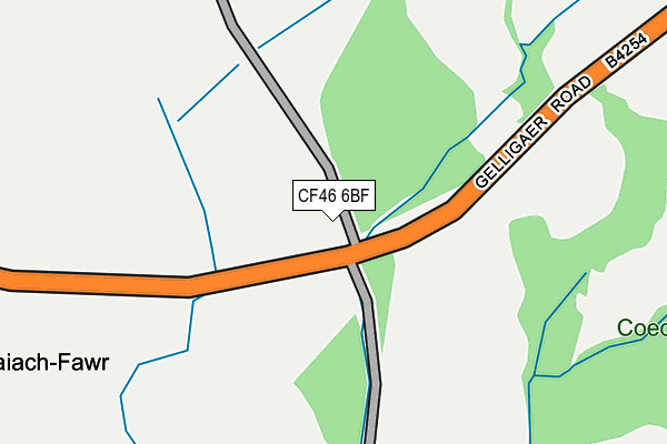
CF46 6BF is located in the St Cattwg electoral ward, within the unitary authority of Caerphilly and the Welsh Parliamentary constituency of Caerphilly. The Local Health Board is Aneurin Bevan University and the police force is Gwent. This postcode has been in use since December 2014.


GetTheData
Source: OS OpenMap – Local (Ordnance Survey)
Source: OS VectorMap District (Ordnance Survey)
Licence: Open Government Licence (requires attribution)
| Easting | 311717 |
| Northing | 196764 |
| Latitude | 51.662697 |
| Longitude | -3.277791 |
GetTheData
Source: Open Postcode Geo
Licence: Open Government Licence
| Country | Wales |
| Postcode District | CF46 |
| ➜ CF46 open data dashboard ➜ See where CF46 is on a map | |
GetTheData
Source: Land Registry Price Paid Data
Licence: Open Government Licence
Elevation or altitude of CF46 6BF as distance above sea level:
| Metres | Feet | |
|---|---|---|
| Elevation | 180m | 591ft |
Elevation is measured from the approximate centre of the postcode, to the nearest point on an OS contour line from OS Terrain 50, which has contour spacing of ten vertical metres.
➜ How high above sea level am I? Find the elevation of your current position using your device's GPS.
GetTheData
Source: Open Postcode Elevation
Licence: Open Government Licence
| Ward | St Cattwg |
| Constituency | Caerphilly |
GetTheData
Source: ONS Postcode Database
Licence: Open Government Licence
| Llancaiach Fawr (Gelligaer Road) | Nelson | 323m |
| Llancaiach Fawr (Gelligaer Road) | Nelson | 331m |
| Top Hill Farm (Gelligaer Road) | Gelligaer | 574m |
| Top Hill Farm (Gelligaer Road) | Gelligaer | 606m |
| Tydvil Close (Gelligaer Road) | Trelewis | 666m |
| Quakers Yard Station | 3.1km |
| Pengam Station | 3.4km |
| Ystrad Mynach Station | 3.5km |
GetTheData
Source: NaPTAN
Licence: Open Government Licence
GetTheData
Source: ONS Postcode Database
Licence: Open Government Licence


➜ Get more ratings from the Food Standards Agency
GetTheData
Source: Food Standards Agency
Licence: FSA terms & conditions
| Last Collection | |||
|---|---|---|---|
| Location | Mon-Fri | Sat | Distance |
| Cardiff Road Edwardsville | 17:30 | 12:00 | 3,236m |
| Glanynant Post Office | 16:15 | 11:00 | 3,505m |
| Fleur De Lys Village | 16:00 | 11:00 | 3,701m |
GetTheData
Source: Dracos
Licence: Creative Commons Attribution-ShareAlike
| School | Phase of Education | Distance |
|---|---|---|
| Greenhill Primary School Penywrlod, Gelligaer, Hengoed, CF82 8EU | Not applicable | 1.3km |
| Trelewis Primary School Trelewis, Treharris, Merthyr Tydfil, CF46 6AH | Not applicable | 1.3km |
| Llancaeach Junior School Commercial Street, Nelson, Treharris, CF46 6NF | Not applicable | 1.3km |
GetTheData
Source: Edubase
Licence: Open Government Licence
The below table lists the International Territorial Level (ITL) codes (formerly Nomenclature of Territorial Units for Statistics (NUTS) codes) and Local Administrative Units (LAU) codes for CF46 6BF:
| ITL 1 Code | Name |
|---|---|
| TLL | Wales |
| ITL 2 Code | Name |
| TLL1 | West Wales and The Valleys |
| ITL 3 Code | Name |
| TLL16 | Gwent Valleys |
| LAU 1 Code | Name |
| W06000018 | Caerphilly |
GetTheData
Source: ONS Postcode Directory
Licence: Open Government Licence
The below table lists the Census Output Area (OA), Lower Layer Super Output Area (LSOA), and Middle Layer Super Output Area (MSOA) for CF46 6BF:
| Code | Name | |
|---|---|---|
| OA | W00007403 | |
| LSOA | W01001418 | Caerphilly 008E |
| MSOA | W02000297 | Caerphilly 008 |
GetTheData
Source: ONS Postcode Directory
Licence: Open Government Licence
| CF46 6EJ | Orchard Row | 516m |
| CF46 6EE | Manor View | 547m |
| CF46 6EQ | Highfield Rise | 552m |
| CF46 6ET | Ivy Close | 607m |
| CF46 6EZ | Primrose Walk | 613m |
| CF46 6EF | River Avenue | 615m |
| CF46 6EG | Tudor Court | 638m |
| CF46 6DW | Tydfil Close | 651m |
| CF46 6DD | Pandy View | 724m |
| CF46 6TD | 739m |
GetTheData
Source: Open Postcode Geo; Land Registry Price Paid Data
Licence: Open Government Licence