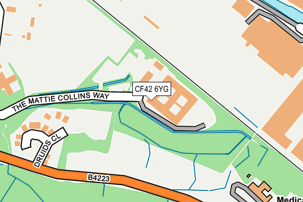
CF42 6YG is located in the Treorchy electoral ward, within the unitary authority of Rhondda Cynon Taf and the Welsh Parliamentary constituency of Rhondda. The Local Health Board is Cwm Taf Morgannwg University and the police force is South Wales. This postcode has been in use since January 1992.


GetTheData
Source: OS OpenMap – Local (Ordnance Survey)
Source: OS VectorMap District (Ordnance Survey)
Licence: Open Government Licence (requires attribution)
| Easting | 296093 |
| Northing | 196230 |
| Latitude | 51.655222 |
| Longitude | -3.503445 |
GetTheData
Source: Open Postcode Geo
Licence: Open Government Licence
| Country | Wales |
| Postcode District | CF42 |
| ➜ CF42 open data dashboard ➜ See where CF42 is on a map ➜ Where is Treorchy? | |
GetTheData
Source: Land Registry Price Paid Data
Licence: Open Government Licence
Elevation or altitude of CF42 6YG as distance above sea level:
| Metres | Feet | |
|---|---|---|
| Elevation | 170m | 558ft |
Elevation is measured from the approximate centre of the postcode, to the nearest point on an OS contour line from OS Terrain 50, which has contour spacing of ten vertical metres.
➜ How high above sea level am I? Find the elevation of your current position using your device's GPS.
GetTheData
Source: Open Postcode Elevation
Licence: Open Government Licence
| Ward | Treorchy |
| Constituency | Rhondda |
GetTheData
Source: ONS Postcode Database
Licence: Open Government Licence
| January 2024 | Theft from the person | On or near Parking Area | 409m |
| January 2024 | Shoplifting | On or near Parking Area | 409m |
| January 2024 | Burglary | On or near Parking Area | 409m |
| ➜ Get more crime data in our Crime section | |||
GetTheData
Source: data.police.uk
Licence: Open Government Licence
| Ysbyty George Thomas (The Mattie Collins Way) | Treorchy | 18m |
| Pentwyn Hospital (Pen-twyn Road) | Pentre | 235m |
| Pentwyn Hospital (Pen-twyn Road) | Pentre | 244m |
| Pencelli Hotel (Station Road) | Treorchy | 370m |
| Lo Cost (Station Road) | Treorchy | 392m |
| Treorchy Station | 0.3km |
| Ton Pentre Station | 1.5km |
| Ynyswen Station | 1.7km |
GetTheData
Source: NaPTAN
Licence: Open Government Licence
GetTheData
Source: ONS Postcode Database
Licence: Open Government Licence


➜ Get more ratings from the Food Standards Agency
GetTheData
Source: Food Standards Agency
Licence: FSA terms & conditions
| Last Collection | |||
|---|---|---|---|
| Location | Mon-Fri | Sat | Distance |
| Treorchy Post Office | 18:00 | 12:30 | 505m |
| Carne Street | 16:45 | 11:45 | 619m |
| Aubery Road | 17:15 | 11:00 | 633m |
GetTheData
Source: Dracos
Licence: Creative Commons Attribution-ShareAlike
| School | Phase of Education | Distance |
|---|---|---|
| Treorchy Comprehensive School Pengelli, Treorchy, Rhondda, CF42 6UL | Not applicable | 674m |
| Treorchy Primary School Glyncoli Road, Treorchy, Rhondda, CF42 6SA | Not applicable | 694m |
| Parc Primary School Tallis Street, Cwmparc, Treorchy, CF42 6LY | Not applicable | 918m |
GetTheData
Source: Edubase
Licence: Open Government Licence
The below table lists the International Territorial Level (ITL) codes (formerly Nomenclature of Territorial Units for Statistics (NUTS) codes) and Local Administrative Units (LAU) codes for CF42 6YG:
| ITL 1 Code | Name |
|---|---|
| TLL | Wales |
| ITL 2 Code | Name |
| TLL1 | West Wales and The Valleys |
| ITL 3 Code | Name |
| TLL15 | Central Valleys |
| LAU 1 Code | Name |
| W06000016 | Rhondda Cynon Taf |
GetTheData
Source: ONS Postcode Directory
Licence: Open Government Licence
The below table lists the Census Output Area (OA), Lower Layer Super Output Area (LSOA), and Middle Layer Super Output Area (MSOA) for CF42 6YG:
| Code | Name | |
|---|---|---|
| OA | W00006680 | |
| LSOA | W01001270 | Rhondda Cynon Taf 010B |
| MSOA | W02000261 | Rhondda Cynon Taf 010 |
GetTheData
Source: ONS Postcode Directory
Licence: Open Government Licence
| CF42 6LJ | Druids Close | 220m |
| CF42 6PN | Regent Street | 337m |
| CF42 6PP | Regent Street | 353m |
| CF42 6PL | Rees Street | 377m |
| CF42 6HL | Pencai Terrace | 381m |
| CF42 6PW | Hermon Street | 392m |
| CF42 6PR | Regent Street | 404m |
| CF42 6HA | Tan Y Fron | 407m |
| CF42 6PA | High Street | 412m |
| CF42 6NU | High Street | 424m |
GetTheData
Source: Open Postcode Geo; Land Registry Price Paid Data
Licence: Open Government Licence