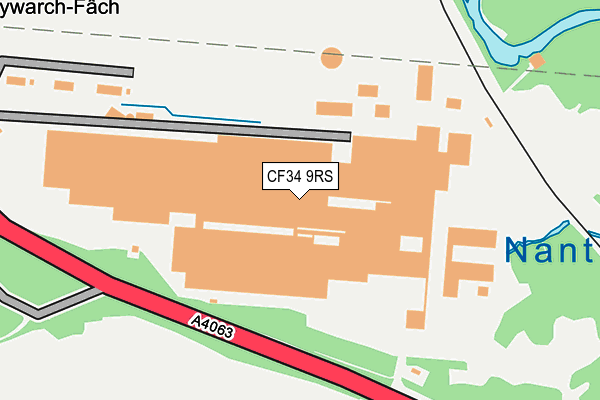
CF34 9RS is located in the Llangynwyd electoral ward, within the unitary authority of Bridgend and the Welsh Parliamentary constituency of Ogmore. The Local Health Board is Cwm Taf Morgannwg University and the police force is South Wales. This postcode has been in use since January 1980.


GetTheData
Source: OS OpenMap – Local (Ordnance Survey)
Source: OS VectorMap District (Ordnance Survey)
Licence: Open Government Licence (requires attribution)
| Easting | 287816 |
| Northing | 187146 |
| Latitude | 51.571986 |
| Longitude | -3.620135 |
GetTheData
Source: Open Postcode Geo
Licence: Open Government Licence
| Country | Wales |
| Postcode District | CF34 |
| ➜ CF34 open data dashboard ➜ See where CF34 is on a map | |
GetTheData
Source: Land Registry Price Paid Data
Licence: Open Government Licence
Elevation or altitude of CF34 9RS as distance above sea level:
| Metres | Feet | |
|---|---|---|
| Elevation | 80m | 262ft |
Elevation is measured from the approximate centre of the postcode, to the nearest point on an OS contour line from OS Terrain 50, which has contour spacing of ten vertical metres.
➜ How high above sea level am I? Find the elevation of your current position using your device's GPS.
GetTheData
Source: Open Postcode Elevation
Licence: Open Government Licence
| Ward | Llangynwyd |
| Constituency | Ogmore |
GetTheData
Source: ONS Postcode Database
Licence: Open Government Licence
| Gelli-las Fawr (Bridgend Road) | Llangynwyd | 362m |
| Gelli-las Fawr (Bridgend Road) | Llangynwyd | 418m |
| Paper Mills (Bridgend Road) | Llangynwyd | 420m |
| Paper Mills (Bridgend Road) | Llangynwyd | 454m |
| Green Meadow (Bridgend Road) | Llangynwyd | 1,033m |
| Garth (Bridgend) Station | 3.1km |
| Tondu Station | 3.2km |
| Maesteg (Ewenny Road) Station | 4.2km |
GetTheData
Source: NaPTAN
Licence: Open Government Licence
GetTheData
Source: ONS Postcode Database
Licence: Open Government Licence


➜ Get more ratings from the Food Standards Agency
GetTheData
Source: Food Standards Agency
Licence: FSA terms & conditions
| Last Collection | |||
|---|---|---|---|
| Location | Mon-Fri | Sat | Distance |
| Penybryn | 11:00 | 10:00 | 4,030m |
| Bedford Road | 17:15 | 11:00 | 4,641m |
| Cefn Cross | 17:15 | 11:00 | 4,695m |
GetTheData
Source: Dracos
Licence: Creative Commons Attribution-ShareAlike
| School | Phase of Education | Distance |
|---|---|---|
| Llangynwyd Primary School Heol Cadrawd, Llangynwyd, Maesteg, Bridgend, CF34 9TE | Not applicable | 2km |
| Ysgol Gynradd Gymraeg Calon Y Cymoedd Betws Road, Betws, Bridgend, CF32 8TD | Not applicable | 2.2km |
| Betws Primary School Heol Bradford, Bettws, Bridgend, CF32 8TB | Not applicable | 2.2km |
GetTheData
Source: Edubase
Licence: Open Government Licence
The below table lists the International Territorial Level (ITL) codes (formerly Nomenclature of Territorial Units for Statistics (NUTS) codes) and Local Administrative Units (LAU) codes for CF34 9RS:
| ITL 1 Code | Name |
|---|---|
| TLL | Wales |
| ITL 2 Code | Name |
| TLL1 | West Wales and The Valleys |
| ITL 3 Code | Name |
| TLL17 | Bridgend and Neath Port Talbot |
| LAU 1 Code | Name |
| W06000013 | Bridgend |
GetTheData
Source: ONS Postcode Directory
Licence: Open Government Licence
The below table lists the Census Output Area (OA), Lower Layer Super Output Area (LSOA), and Middle Layer Super Output Area (MSOA) for CF34 9RS:
| Code | Name | |
|---|---|---|
| OA | W00005361 | |
| LSOA | W01001012 | Bridgend 005A |
| MSOA | W02000222 | Bridgend 005 |
GetTheData
Source: ONS Postcode Directory
Licence: Open Government Licence
| CF32 0EG | 527m | |
| CF34 9RU | 1106m | |
| CF34 9RT | Greenmeadow | 1130m |
| CF32 8UD | Greenfield Terrace | 1232m |
| CF32 8UB | Glannant Row | 1255m |
| CF32 8TY | Greenmeadow | 1338m |
| CF32 0EE | 1423m | |
| CF34 0EA | Bryn Terrace | 1554m |
| CF34 0DY | 1572m | |
| CF32 8TU | Godra Bryn | 1785m |
GetTheData
Source: Open Postcode Geo; Land Registry Price Paid Data
Licence: Open Government Licence