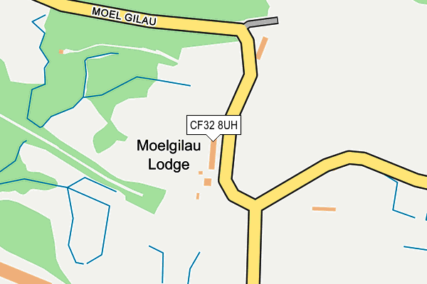
CF32 8UH is located in the Garw Valley electoral ward, within the unitary authority of Bridgend and the Welsh Parliamentary constituency of Ogmore. The Local Health Board is Cwm Taf Morgannwg University and the police force is South Wales. This postcode has been in use since January 1980.


GetTheData
Source: OS OpenMap – Local (Ordnance Survey)
Source: OS VectorMap District (Ordnance Survey)
Licence: Open Government Licence (requires attribution)
| Easting | 290541 |
| Northing | 187952 |
| Latitude | 51.579766 |
| Longitude | -3.581083 |
GetTheData
Source: Open Postcode Geo
Licence: Open Government Licence
| Country | Wales |
| Postcode District | CF32 |
| ➜ CF32 open data dashboard ➜ See where CF32 is on a map | |
GetTheData
Source: Land Registry Price Paid Data
Licence: Open Government Licence
Elevation or altitude of CF32 8UH as distance above sea level:
| Metres | Feet | |
|---|---|---|
| Elevation | 140m | 459ft |
Elevation is measured from the approximate centre of the postcode, to the nearest point on an OS contour line from OS Terrain 50, which has contour spacing of ten vertical metres.
➜ How high above sea level am I? Find the elevation of your current position using your device's GPS.
GetTheData
Source: Open Postcode Elevation
Licence: Open Government Licence
| Ward | Garw Valley |
| Constituency | Ogmore |
GetTheData
Source: ONS Postcode Database
Licence: Open Government Licence
| Llangeinor House (Unclassified) | Llangeinor | 504m |
| Heol Glannant | Bettws | 701m |
| Heol Glannant | Bettws | 754m |
| Pavillion (Heol Richard Price) | Betws | 781m |
| Heol Glannant (Heol Glanant) | Betws | 809m |
| Tondu Station | 3.7km |
| Garth (Bridgend) Station | 4.6km |
| Sarn Station | 4.6km |
GetTheData
Source: NaPTAN
Licence: Open Government Licence
| Percentage of properties with Next Generation Access | 100.0% |
| Percentage of properties with Superfast Broadband | 0.0% |
| Percentage of properties with Ultrafast Broadband | 0.0% |
| Percentage of properties with Full Fibre Broadband | 0.0% |
Superfast Broadband is between 30Mbps and 300Mbps
Ultrafast Broadband is > 300Mbps
| Percentage of properties unable to receive 2Mbps | 0.0% |
| Percentage of properties unable to receive 5Mbps | 0.0% |
| Percentage of properties unable to receive 10Mbps | 0.0% |
| Percentage of properties unable to receive 30Mbps | 100.0% |
GetTheData
Source: Ofcom
Licence: Ofcom Terms of Use (requires attribution)
GetTheData
Source: ONS Postcode Database
Licence: Open Government Licence


➜ Get more ratings from the Food Standards Agency
GetTheData
Source: Food Standards Agency
Licence: FSA terms & conditions
| School | Phase of Education | Distance |
|---|---|---|
| Tynyrheol Primary School Heol Llangeinor, Llangeinor, Bridgend, CF32 8PN | Not applicable | 1km |
| Betws Primary School Heol Bradford, Bettws, Bridgend, CF32 8TB | Not applicable | 1.3km |
| Ysgol Gynradd Gymraeg Calon Y Cymoedd Betws Road, Betws, Bridgend, CF32 8TD | Not applicable | 1.4km |
GetTheData
Source: Edubase
Licence: Open Government Licence
The below table lists the International Territorial Level (ITL) codes (formerly Nomenclature of Territorial Units for Statistics (NUTS) codes) and Local Administrative Units (LAU) codes for CF32 8UH:
| ITL 1 Code | Name |
|---|---|
| TLL | Wales |
| ITL 2 Code | Name |
| TLL1 | West Wales and The Valleys |
| ITL 3 Code | Name |
| TLL17 | Bridgend and Neath Port Talbot |
| LAU 1 Code | Name |
| W06000013 | Bridgend |
GetTheData
Source: ONS Postcode Directory
Licence: Open Government Licence
The below table lists the Census Output Area (OA), Lower Layer Super Output Area (LSOA), and Middle Layer Super Output Area (MSOA) for CF32 8UH:
| Code | Name | |
|---|---|---|
| OA | W00005349 | |
| LSOA | W01001009 | Bridgend 004C |
| MSOA | W02000221 | Bridgend 004 |
GetTheData
Source: ONS Postcode Directory
Licence: Open Government Licence
| CF32 8PH | Bettws Road | 665m |
| CF32 8SA | Bryn Awel | 697m |
| CF32 8SF | Heol Glannant | 732m |
| CF32 8SD | Brynmawr | 734m |
| CF32 8SB | Pen Y Mynydd | 755m |
| CF32 8SE | Pen Y Mynydd | 787m |
| CF32 8PY | 787m | |
| CF32 8SR | Heol Glannant | 807m |
| CF32 8RP | Waun Fach | 852m |
| CF32 8SS | Pen Parcau | 866m |
GetTheData
Source: Open Postcode Geo; Land Registry Price Paid Data
Licence: Open Government Licence