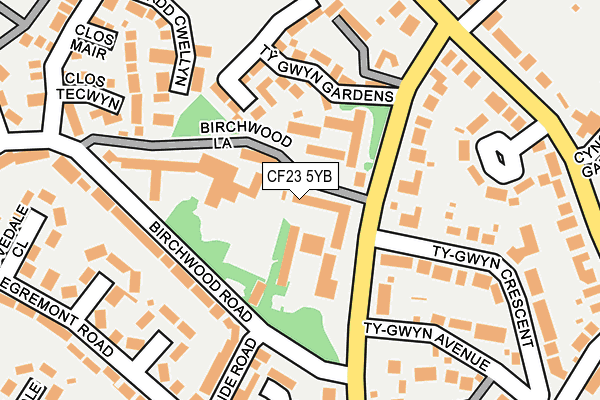
CF23 5YB is located in the Penylan electoral ward, within the unitary authority of Cardiff and the Welsh Parliamentary constituency of Cardiff Central. The Local Health Board is Cardiff and Vale University and the police force is South Wales. This postcode has been in use since June 1999.


GetTheData
Source: OS OpenMap – Local (Ordnance Survey)
Source: OS VectorMap District (Ordnance Survey)
Licence: Open Government Licence (requires attribution)
| Easting | 319172 |
| Northing | 179100 |
| Latitude | 51.505030 |
| Longitude | -3.165959 |
GetTheData
Source: Open Postcode Geo
Licence: Open Government Licence
| Country | Wales |
| Postcode District | CF23 |
| ➜ CF23 open data dashboard ➜ See where CF23 is on a map ➜ Where is Cardiff? | |
GetTheData
Source: Land Registry Price Paid Data
Licence: Open Government Licence
Elevation or altitude of CF23 5YB as distance above sea level:
| Metres | Feet | |
|---|---|---|
| Elevation | 60m | 197ft |
Elevation is measured from the approximate centre of the postcode, to the nearest point on an OS contour line from OS Terrain 50, which has contour spacing of ten vertical metres.
➜ How high above sea level am I? Find the elevation of your current position using your device's GPS.
GetTheData
Source: Open Postcode Elevation
Licence: Open Government Licence
| Ward | Penylan |
| Constituency | Cardiff Central |
GetTheData
Source: ONS Postcode Database
Licence: Open Government Licence
| December 2023 | Vehicle crime | On or near Brandreth Road | 363m |
| November 2023 | Vehicle crime | On or near Further/Higher Educational Building | 432m |
| October 2023 | Violence and sexual offences | On or near Cefn-Coed Gardens | 434m |
| ➜ Get more crime data in our Crime section | |||
GetTheData
Source: data.police.uk
Licence: Open Government Licence
| University Hall (Ty-gwyn Road) | Cardiff | 90m |
| University Hall (Ty-gwyn Road) | Cardiff | 115m |
| Birchwood Road | Cardiff | 116m |
| Ty Gwyn Sch (Ty-gwyn Road) | Cardiff | 118m |
| Birchwood Road | Cardiff | 127m |
| Heath Low Level Station | 1.6km |
| Heath High Level Station | 1.7km |
| Cathays Station | 2km |
GetTheData
Source: NaPTAN
Licence: Open Government Licence
| Percentage of properties with Next Generation Access | 100.0% |
| Percentage of properties with Superfast Broadband | 100.0% |
| Percentage of properties with Ultrafast Broadband | 0.0% |
| Percentage of properties with Full Fibre Broadband | 0.0% |
Superfast Broadband is between 30Mbps and 300Mbps
Ultrafast Broadband is > 300Mbps
| Percentage of properties unable to receive 2Mbps | 0.0% |
| Percentage of properties unable to receive 5Mbps | 0.0% |
| Percentage of properties unable to receive 10Mbps | 0.0% |
| Percentage of properties unable to receive 30Mbps | 0.0% |
GetTheData
Source: Ofcom
Licence: Ofcom Terms of Use (requires attribution)
GetTheData
Source: ONS Postcode Database
Licence: Open Government Licence


➜ Get more ratings from the Food Standards Agency
GetTheData
Source: Food Standards Agency
Licence: FSA terms & conditions
| Last Collection | |||
|---|---|---|---|
| Location | Mon-Fri | Sat | Distance |
| Ael Y Bryn | 17:30 | 11:45 | 441m |
| Lake Road West | 572m | ||
| Keswick Avenue | 17:30 | 12:15 | 741m |
GetTheData
Source: Dracos
Licence: Creative Commons Attribution-ShareAlike
| School | Phase of Education | Distance |
|---|---|---|
| All Saints C.I.W. Primary School Ael-Y-Bryn, Llanedeyrn, Cardiff, CF23 9LF | Not applicable | 826m |
| Lakeside Primary School Ontario Way, Lakeside, Cardiff, CF23 6HB | Not applicable | 842m |
| Roath Park Primary School Penywain Road, Roath Park, Cardiff, CF24 4BB | Not applicable | 869m |
GetTheData
Source: Edubase
Licence: Open Government Licence
The below table lists the International Territorial Level (ITL) codes (formerly Nomenclature of Territorial Units for Statistics (NUTS) codes) and Local Administrative Units (LAU) codes for CF23 5YB:
| ITL 1 Code | Name |
|---|---|
| TLL | Wales |
| ITL 2 Code | Name |
| TLL2 | East Wales |
| ITL 3 Code | Name |
| TLL22 | Cardiff and Vale of Glamorgan |
| LAU 1 Code | Name |
| W06000015 | Cardiff |
GetTheData
Source: ONS Postcode Directory
Licence: Open Government Licence
The below table lists the Census Output Area (OA), Lower Layer Super Output Area (LSOA), and Middle Layer Super Output Area (MSOA) for CF23 5YB:
| Code | Name | |
|---|---|---|
| OA | W00010128 | |
| LSOA | W01001821 | Cardiff 024A |
| MSOA | W02000390 | Cardiff 024 |
GetTheData
Source: ONS Postcode Directory
Licence: Open Government Licence
| CF23 5JG | Ty Gwyn Road | 133m |
| CF23 5BF | Ty Gwyn Gardens | 147m |
| CF23 5LJ | Birchwood Road | 161m |
| CF23 6AU | Pen Y Lan Oval | 173m |
| CF23 5LQ | Borrowdale Close | 174m |
| CF23 5NJ | Brandreth Gardens | 180m |
| CF23 5JH | Penylan Court | 185m |
| CF23 5LL | Arnside Road | 189m |
| CF23 5LR | Deepdale Close | 207m |
| CF23 5JL | Ty Gwyn Crescent | 216m |
GetTheData
Source: Open Postcode Geo; Land Registry Price Paid Data
Licence: Open Government Licence