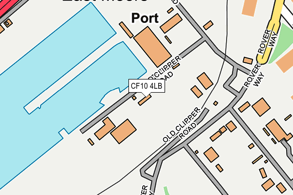
CF10 4LB is located in the Butetown electoral ward, within the unitary authority of Cardiff and the Welsh Parliamentary constituency of Cardiff South and Penarth. The Local Health Board is Cardiff and Vale University and the police force is South Wales. This postcode has been in use since March 2012.


GetTheData
Source: OS OpenMap – Local (Ordnance Survey)
Source: OS VectorMap District (Ordnance Survey)
Licence: Open Government Licence (requires attribution)
| Easting | 319841 |
| Northing | 174167 |
| Latitude | 51.460780 |
| Longitude | -3.155210 |
GetTheData
Source: Open Postcode Geo
Licence: Open Government Licence
| Country | Wales |
| Postcode District | CF10 |
| ➜ CF10 open data dashboard ➜ See where CF10 is on a map ➜ Where is Cardiff? | |
GetTheData
Source: Land Registry Price Paid Data
Licence: Open Government Licence
Elevation or altitude of CF10 4LB as distance above sea level:
| Metres | Feet | |
|---|---|---|
| Elevation | 10m | 33ft |
Elevation is measured from the approximate centre of the postcode, to the nearest point on an OS contour line from OS Terrain 50, which has contour spacing of ten vertical metres.
➜ How high above sea level am I? Find the elevation of your current position using your device's GPS.
GetTheData
Source: Open Postcode Elevation
Licence: Open Government Licence
| Ward | Butetown |
| Constituency | Cardiff South And Penarth |
GetTheData
Source: ONS Postcode Database
Licence: Open Government Licence
| June 2022 | Vehicle crime | On or near Cold Stores Road | 392m |
| June 2022 | Possession of weapons | On or near Britannia Quay | 453m |
| June 2022 | Criminal damage and arson | On or near Tyneside Road | 474m |
| ➜ Get more crime data in our Crime section | |||
GetTheData
Source: data.police.uk
Licence: Open Government Licence
| Roath Lock (Compass Road) | Cardiff Docks | 199m |
| Roath Lock (Compass Road) | Cardiff Docks | 213m |
| Doctor Who Experience (Bute Dry Dock) | Cardiff Docks | 305m |
| Doctor Who Experience (Bute Dry Dock) | Cardiff Docks | 319m |
| Harbour Drive (Britannia Quay) | Cardiff Bay | 450m |
| Cardiff Bay Station | 1km |
| Cardiff Central Station | 2.4km |
| Grangetown (Cardiff) Station | 2.5km |
GetTheData
Source: NaPTAN
Licence: Open Government Licence
GetTheData
Source: ONS Postcode Database
Licence: Open Government Licence


➜ Get more ratings from the Food Standards Agency
GetTheData
Source: Food Standards Agency
Licence: FSA terms & conditions
| Last Collection | |||
|---|---|---|---|
| Location | Mon-Fri | Sat | Distance |
| Britannia Quay | 18:30 | 11:30 | 481m |
| Bute Street Post Office | 18:30 | 12:00 | 899m |
| James Street | 18:30 | 11:30 | 969m |
GetTheData
Source: Dracos
Licence: Creative Commons Attribution-ShareAlike
| School | Phase of Education | Distance |
|---|---|---|
| Mount Stuart Primary Adelaide Street, Butetown, Cardiff, CF10 5BS | Not applicable | 957m |
| Ysgol Gynradd Gymraeg Hamadryad Hamadryad Road, Caerdydd, CF10 5UY | Not applicable | 1.4km |
| St Cuthbert's R.C. Primary School Letton Way, Cardiff Bay, Cardiff, CF10 4AB | Not applicable | 1.5km |
GetTheData
Source: Edubase
Licence: Open Government Licence
The below table lists the International Territorial Level (ITL) codes (formerly Nomenclature of Territorial Units for Statistics (NUTS) codes) and Local Administrative Units (LAU) codes for CF10 4LB:
| ITL 1 Code | Name |
|---|---|
| TLL | Wales |
| ITL 2 Code | Name |
| TLL2 | East Wales |
| ITL 3 Code | Name |
| TLL22 | Cardiff and Vale of Glamorgan |
| LAU 1 Code | Name |
| W06000015 | Cardiff |
GetTheData
Source: ONS Postcode Directory
Licence: Open Government Licence
The below table lists the Census Output Area (OA), Lower Layer Super Output Area (LSOA), and Middle Layer Super Output Area (MSOA) for CF10 4LB:
| Code | Name | |
|---|---|---|
| OA | W00010210 | |
| LSOA | W01001940 | Cardiff 048A |
| MSOA | W02000422 | Cardiff 048 |
GetTheData
Source: ONS Postcode Directory
Licence: Open Government Licence
| CF10 4NQ | Adventurers Quay | 457m |
| CF10 4NR | Adventurers Quay | 464m |
| CF10 4RG | Falcon Drive | 471m |
| CF10 4RF | Falcon Drive | 498m |
| CF10 4NP | Adventurers Quay | 511m |
| CF10 4RH | Falcon Drive | 515m |
| CF10 4RE | Falcon Drive | 538m |
| CF10 4RD | Falcon Drive | 580m |
| CF10 4NS | Adventurers Quay | 611m |
| CF10 4RB | Falcon Drive | 623m |
GetTheData
Source: Open Postcode Geo; Land Registry Price Paid Data
Licence: Open Government Licence