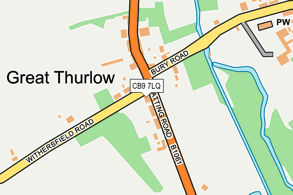
CB9 7LQ is located in the Withersfield electoral ward, within the local authority district of West Suffolk and the English Parliamentary constituency of West Suffolk. The Sub Integrated Care Board (ICB) Location is NHS Suffolk and North East Essex ICB - 07K and the police force is Suffolk. This postcode has been in use since January 1980.


GetTheData
Source: OS OpenMap – Local (Ordnance Survey)
Source: OS VectorMap District (Ordnance Survey)
Licence: Open Government Licence (requires attribution)
| Easting | 567839 |
| Northing | 250186 |
| Latitude | 52.124503 |
| Longitude | 0.450334 |
GetTheData
Source: Open Postcode Geo
Licence: Open Government Licence
| Country | England |
| Postcode District | CB9 |
| ➜ CB9 open data dashboard ➜ See where CB9 is on a map ➜ Where is Great Thurlow? | |
GetTheData
Source: Land Registry Price Paid Data
Licence: Open Government Licence
Elevation or altitude of CB9 7LQ as distance above sea level:
| Metres | Feet | |
|---|---|---|
| Elevation | 70m | 230ft |
Elevation is measured from the approximate centre of the postcode, to the nearest point on an OS contour line from OS Terrain 50, which has contour spacing of ten vertical metres.
➜ How high above sea level am I? Find the elevation of your current position using your device's GPS.
GetTheData
Source: Open Postcode Elevation
Licence: Open Government Licence
| Ward | Withersfield |
| Constituency | West Suffolk |
GetTheData
Source: ONS Postcode Database
Licence: Open Government Licence
| February 2022 | Violence and sexual offences | On or near Park/Open Space | 201m |
| February 2022 | Violence and sexual offences | On or near Park/Open Space | 201m |
| August 2021 | Possession of weapons | On or near The Street | 224m |
| ➜ Get more crime data in our Crime section | |||
GetTheData
Source: data.police.uk
Licence: Open Government Licence
| The Old Rose & Crown (Wratting Road) | Great Thurlow | 11m |
| The Old Rose & Crown (Wratting Road) | Great Thurlow | 34m |
| Garage (The Street) | Great Thurlow | 134m |
| Garage (The Street) | Great Thurlow | 146m |
| Pound Green (Church Road) | Little Thurlow | 1,052m |
GetTheData
Source: NaPTAN
Licence: Open Government Licence
GetTheData
Source: ONS Postcode Database
Licence: Open Government Licence


➜ Get more ratings from the Food Standards Agency
GetTheData
Source: Food Standards Agency
Licence: FSA terms & conditions
| Last Collection | |||
|---|---|---|---|
| Location | Mon-Fri | Sat | Distance |
| Thurlow Post Office | 16:45 | 11:00 | 74m |
| High Street | 16:45 | 08:30 | 679m |
| Thurlow Green | 16:00 | 10:15 | 1,430m |
GetTheData
Source: Dracos
Licence: Creative Commons Attribution-ShareAlike
| Facility | Distance |
|---|---|
| Great Thurlow Recreation Ground Wratting Road, Thurlow, Haverhill Grass Pitches, Outdoor Tennis Courts | 200m |
| Withersfield Parish Sports Ground Wratting Road, Withersfield Grass Pitches | 2.7km |
| Great Bradley Recreation Ground Clarendale Estate, Great Bradley, Newmarket Grass Pitches | 2.9km |
GetTheData
Source: Active Places
Licence: Open Government Licence
| School | Phase of Education | Distance |
|---|---|---|
| Thurlow Voluntary Controlled Primary School The Street, Little Thurlow, Haverhill, CB9 7HY | Primary | 855m |
| Broadlands Hall Little Wratting, Haverhill, CB9 7UA | Not applicable | 3.3km |
| Barnardiston Hall Preparatory School Barnardiston, Haverhill, CB9 7TG | Not applicable | 3.5km |
GetTheData
Source: Edubase
Licence: Open Government Licence
The below table lists the International Territorial Level (ITL) codes (formerly Nomenclature of Territorial Units for Statistics (NUTS) codes) and Local Administrative Units (LAU) codes for CB9 7LQ:
| ITL 1 Code | Name |
|---|---|
| TLH | East |
| ITL 2 Code | Name |
| TLH1 | East Anglia |
| ITL 3 Code | Name |
| TLH14 | Suffolk CC |
| LAU 1 Code | Name |
| E07000245 | West Suffolk |
GetTheData
Source: ONS Postcode Directory
Licence: Open Government Licence
The below table lists the Census Output Area (OA), Lower Layer Super Output Area (LSOA), and Middle Layer Super Output Area (MSOA) for CB9 7LQ:
| Code | Name | |
|---|---|---|
| OA | E00153718 | |
| LSOA | E01030151 | St Edmundsbury 011C |
| MSOA | E02006283 | St Edmundsbury 011 |
GetTheData
Source: ONS Postcode Directory
Licence: Open Government Licence
| CB9 7LA | The Street | 352m |
| CB9 7LF | Bury Road | 442m |
| CB9 7HX | The Street | 702m |
| CB9 7HY | Pound Green | 982m |
| CB9 7JQ | Church Road | 1042m |
| CB9 7HZ | Bradley Road | 1249m |
| CB9 7JH | The Green | 1342m |
| CB9 7JJ | Broad Road | 1534m |
| CB9 7JL | The Green | 1610m |
| CB9 7JE | Poplar View | 1786m |
GetTheData
Source: Open Postcode Geo; Land Registry Price Paid Data
Licence: Open Government Licence