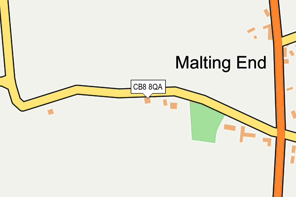
CB8 8QA lies on Malting End in Wickhambrook, Newmarket. CB8 8QA is located in the Whepstead & Wickhambrook electoral ward, within the local authority district of West Suffolk and the English Parliamentary constituency of West Suffolk. The Sub Integrated Care Board (ICB) Location is NHS Suffolk and North East Essex ICB - 07K and the police force is Suffolk. This postcode has been in use since January 1980.


GetTheData
Source: OS OpenMap – Local (Ordnance Survey)
Source: OS VectorMap District (Ordnance Survey)
Licence: Open Government Licence (requires attribution)
| Easting | 574570 |
| Northing | 254278 |
| Latitude | 52.159173 |
| Longitude | 0.550656 |
GetTheData
Source: Open Postcode Geo
Licence: Open Government Licence
| Street | Malting End |
| Locality | Wickhambrook |
| Town/City | Newmarket |
| Country | England |
| Postcode District | CB8 |
| ➜ CB8 open data dashboard ➜ See where CB8 is on a map | |
GetTheData
Source: Land Registry Price Paid Data
Licence: Open Government Licence
Elevation or altitude of CB8 8QA as distance above sea level:
| Metres | Feet | |
|---|---|---|
| Elevation | 100m | 328ft |
Elevation is measured from the approximate centre of the postcode, to the nearest point on an OS contour line from OS Terrain 50, which has contour spacing of ten vertical metres.
➜ How high above sea level am I? Find the elevation of your current position using your device's GPS.
GetTheData
Source: Open Postcode Elevation
Licence: Open Government Licence
| Ward | Whepstead & Wickhambrook |
| Constituency | West Suffolk |
GetTheData
Source: ONS Postcode Database
Licence: Open Government Licence
| Pound House (Duddery) | Wickhambrook | 635m |
| Pound House (Duddery) | Wickhambrook | 639m |
| Pond (The Green) | Attleton Green | 716m |
| Pond (The Green) | Attleton Green | 718m |
| Thorns Corner (B1063) | Wickhambrook | 939m |
GetTheData
Source: NaPTAN
Licence: Open Government Licence
➜ Broadband speed and availability dashboard for CB8 8QA
| Percentage of properties with Next Generation Access | 100.0% |
| Percentage of properties with Superfast Broadband | 100.0% |
| Percentage of properties with Ultrafast Broadband | 0.0% |
| Percentage of properties with Full Fibre Broadband | 0.0% |
Superfast Broadband is between 30Mbps and 300Mbps
Ultrafast Broadband is > 300Mbps
| Median download speed | 6.7Mbps |
| Average download speed | 25.1Mbps |
| Maximum download speed | 76.83Mbps |
| Median upload speed | 1.4Mbps |
| Average upload speed | 3.4Mbps |
| Maximum upload speed | 9.06Mbps |
| Percentage of properties unable to receive 2Mbps | 0.0% |
| Percentage of properties unable to receive 5Mbps | 0.0% |
| Percentage of properties unable to receive 10Mbps | 0.0% |
| Percentage of properties unable to receive 30Mbps | 0.0% |
➜ Broadband speed and availability dashboard for CB8 8QA
GetTheData
Source: Ofcom
Licence: Ofcom Terms of Use (requires attribution)
GetTheData
Source: ONS Postcode Database
Licence: Open Government Licence


➜ Get more ratings from the Food Standards Agency
GetTheData
Source: Food Standards Agency
Licence: FSA terms & conditions
| Last Collection | |||
|---|---|---|---|
| Location | Mon-Fri | Sat | Distance |
| Malting End | 16:15 | 09:00 | 321m |
| Attleton Green | 16:00 | 09:15 | 697m |
| Wickhambrook Post Office | 16:00 | 10:00 | 904m |
GetTheData
Source: Dracos
Licence: Creative Commons Attribution-ShareAlike
| Facility | Distance |
|---|---|
| Wickhambrook Recreation Ground Cemetery Road, Wickhambrook, Newmarket Grass Pitches, Outdoor Tennis Courts | 1km |
| Hmp Highpoint South Highpoint, Stradishall, Newmarket Artificial Grass Pitch | 3.5km |
| Stansfield Village Hall And Playing Field Stansfield Hall Road, Stansfield Grass Pitches, Sports Hall | 4.6km |
GetTheData
Source: Active Places
Licence: Open Government Licence
| School | Phase of Education | Distance |
|---|---|---|
| Wickhambrook Primary Academy Wickhambrook, Newmarket, CB8 8XN | Primary | 841m |
| Barnardiston Hall Preparatory School Barnardiston, Haverhill, CB9 7TG | Not applicable | 5.1km |
GetTheData
Source: Edubase
Licence: Open Government Licence
The below table lists the International Territorial Level (ITL) codes (formerly Nomenclature of Territorial Units for Statistics (NUTS) codes) and Local Administrative Units (LAU) codes for CB8 8QA:
| ITL 1 Code | Name |
|---|---|
| TLH | East |
| ITL 2 Code | Name |
| TLH1 | East Anglia |
| ITL 3 Code | Name |
| TLH14 | Suffolk CC |
| LAU 1 Code | Name |
| E07000245 | West Suffolk |
GetTheData
Source: ONS Postcode Directory
Licence: Open Government Licence
The below table lists the Census Output Area (OA), Lower Layer Super Output Area (LSOA), and Middle Layer Super Output Area (MSOA) for CB8 8QA:
| Code | Name | |
|---|---|---|
| OA | E00153713 | |
| LSOA | E01030150 | St Edmundsbury 010C |
| MSOA | E02006282 | St Edmundsbury 010 |
GetTheData
Source: ONS Postcode Directory
Licence: Open Government Licence
| CB8 8YH | Malting End | 299m |
| CB8 8XQ | Wash Lane | 397m |
| CB8 8UH | Post Office Hill | 435m |
| CB8 8UJ | Cloak Lane | 549m |
| CB8 8XL | Shop Hill | 587m |
| CB8 8UL | 699m | |
| CB8 8YA | Attleton Green | 702m |
| CB8 8XH | Church Road | 768m |
| CB8 8XN | Cutbush | 832m |
| CB8 8YB | Attleton Green | 878m |
GetTheData
Source: Open Postcode Geo; Land Registry Price Paid Data
Licence: Open Government Licence