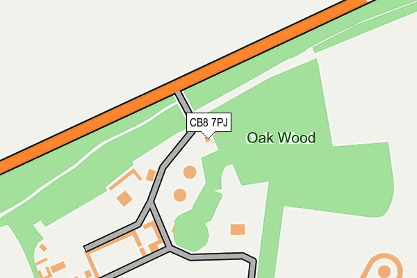
CB8 7PJ is located in the Kentford & Moulton electoral ward, within the local authority district of West Suffolk and the English Parliamentary constituency of West Suffolk. The Sub Integrated Care Board (ICB) Location is NHS Suffolk and North East Essex ICB - 07K and the police force is Suffolk. This postcode has been in use since January 1980.


GetTheData
Source: OS OpenMap – Local (Ordnance Survey)
Source: OS VectorMap District (Ordnance Survey)
Licence: Open Government Licence (requires attribution)
| Easting | 567479 |
| Northing | 265582 |
| Latitude | 52.262917 |
| Longitude | 0.452712 |
GetTheData
Source: Open Postcode Geo
Licence: Open Government Licence
| Country | England |
| Postcode District | CB8 |
| ➜ CB8 open data dashboard ➜ See where CB8 is on a map | |
GetTheData
Source: Land Registry Price Paid Data
Licence: Open Government Licence
Elevation or altitude of CB8 7PJ as distance above sea level:
| Metres | Feet | |
|---|---|---|
| Elevation | 60m | 197ft |
Elevation is measured from the approximate centre of the postcode, to the nearest point on an OS contour line from OS Terrain 50, which has contour spacing of ten vertical metres.
➜ How high above sea level am I? Find the elevation of your current position using your device's GPS.
GetTheData
Source: Open Postcode Elevation
Licence: Open Government Licence
| Ward | Kentford & Moulton |
| Constituency | West Suffolk |
GetTheData
Source: ONS Postcode Database
Licence: Open Government Licence
| Kennett Station | 3km |
| Newmarket Station | 4.2km |
GetTheData
Source: NaPTAN
Licence: Open Government Licence
GetTheData
Source: ONS Postcode Database
Licence: Open Government Licence

➜ Get more ratings from the Food Standards Agency
GetTheData
Source: Food Standards Agency
Licence: FSA terms & conditions
| Last Collection | |||
|---|---|---|---|
| Location | Mon-Fri | Sat | Distance |
| Moulton Road | 16:45 | 09:00 | 1,824m |
| La Hogue Farm | 16:15 | 09:30 | 2,203m |
| Moulton Post Office | 16:45 | 09:00 | 2,387m |
GetTheData
Source: Dracos
Licence: Creative Commons Attribution-ShareAlike
| Facility | Distance |
|---|---|
| Moulton Playing Fields Bridge Street, Moulton, Newmarket Grass Pitches | 2.4km |
| Snailwell Road Snailwell Road, Newmarket Grass Pitches | 2.6km |
| The Health & Fitness Club At Bedford Lodge Hotel Bury Road, Newmarket Swimming Pool, Health and Fitness Gym, Studio | 2.9km |
GetTheData
Source: Active Places
Licence: Open Government Licence
| School | Phase of Education | Distance |
|---|---|---|
| Moulton Church of England Voluntary Controlled Primary School School Road, Moulton, Newmarket, CB8 8PR | Primary | 2.2km |
| Kennett Primary School 98 Station Road, Kennett, Newmarket, CB8 7QQ | Primary | 3.4km |
| Fairstead House Fordham Road, Newmarket, Suffolk, CB8 7AA | Not applicable | 3.4km |
GetTheData
Source: Edubase
Licence: Open Government Licence
The below table lists the International Territorial Level (ITL) codes (formerly Nomenclature of Territorial Units for Statistics (NUTS) codes) and Local Administrative Units (LAU) codes for CB8 7PJ:
| ITL 1 Code | Name |
|---|---|
| TLH | East |
| ITL 2 Code | Name |
| TLH1 | East Anglia |
| ITL 3 Code | Name |
| TLH14 | Suffolk CC |
| LAU 1 Code | Name |
| E07000245 | West Suffolk |
GetTheData
Source: ONS Postcode Directory
Licence: Open Government Licence
The below table lists the Census Output Area (OA), Lower Layer Super Output Area (LSOA), and Middle Layer Super Output Area (MSOA) for CB8 7PJ:
| Code | Name | |
|---|---|---|
| OA | E00152679 | |
| LSOA | E01029957 | Forest Heath 005C |
| MSOA | E02006242 | Forest Heath 005 |
GetTheData
Source: ONS Postcode Directory
Licence: Open Government Licence
| CB8 8QN | Moulton Road | 1758m |
| CB8 7RQ | Norwich Road | 1883m |
| CB8 8QG | Moulton Road | 1959m |
| CB8 8QP | Newmarket Road | 2149m |
| CB8 8QW | Milburn Drove | 2177m |
| CB8 8QR | Kennett Road | 2187m |
| CB8 8SN | Chippenham Road | 2255m |
| CB8 8RT | Lark Hill | 2274m |
| CB8 8SS | Newmarket Road | 2285m |
| CB8 7BY | Bury Road | 2332m |
GetTheData
Source: Open Postcode Geo; Land Registry Price Paid Data
Licence: Open Government Licence