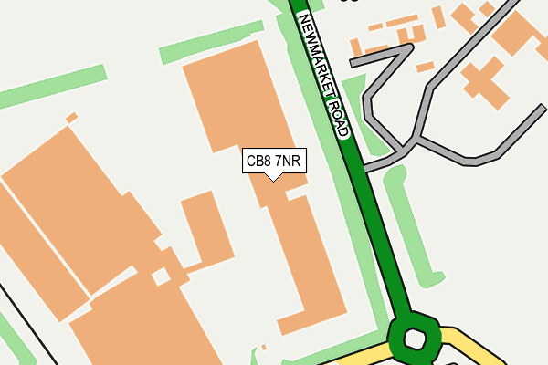
CB8 7NR is located in the Fordham & Isleham electoral ward, within the local authority district of East Cambridgeshire and the English Parliamentary constituency of South East Cambridgeshire. The Sub Integrated Care Board (ICB) Location is NHS Cambridgeshire and Peterborough ICB - 06H and the police force is Cambridgeshire. This postcode has been in use since August 1993.


GetTheData
Source: OS OpenMap – Local (Ordnance Survey)
Source: OS VectorMap District (Ordnance Survey)
Licence: Open Government Licence (requires attribution)
| Easting | 563033 |
| Northing | 268737 |
| Latitude | 52.292576 |
| Longitude | 0.389122 |
GetTheData
Source: Open Postcode Geo
Licence: Open Government Licence
| Country | England |
| Postcode District | CB8 |
| ➜ CB8 open data dashboard ➜ See where CB8 is on a map | |
GetTheData
Source: Land Registry Price Paid Data
Licence: Open Government Licence
Elevation or altitude of CB8 7NR as distance above sea level:
| Metres | Feet | |
|---|---|---|
| Elevation | 20m | 66ft |
Elevation is measured from the approximate centre of the postcode, to the nearest point on an OS contour line from OS Terrain 50, which has contour spacing of ten vertical metres.
➜ How high above sea level am I? Find the elevation of your current position using your device's GPS.
GetTheData
Source: Open Postcode Elevation
Licence: Open Government Licence
| Ward | Fordham & Isleham |
| Constituency | South East Cambridgeshire |
GetTheData
Source: ONS Postcode Database
Licence: Open Government Licence
| January 2022 | Other theft | On or near Landwade Road | 236m |
| October 2021 | Vehicle crime | On or near Landwade Road | 236m |
| October 2021 | Other theft | On or near Landwade Road | 236m |
| ➜ Get more crime data in our Crime section | |||
GetTheData
Source: data.police.uk
Licence: Open Government Licence
| Lynx Business Park (Snailwell Road) | Snailwell | 854m |
| Lynx Business Park (Snailwell Road) | Snailwell | 856m |
| Cockpen Road (Station Road) | Fordham | 1,710m |
| Church Lane (The Street) | Snailwell | 1,731m |
| Cockpen Road (Station Road) | Fordham | 1,806m |
GetTheData
Source: NaPTAN
Licence: Open Government Licence
GetTheData
Source: ONS Postcode Database
Licence: Open Government Licence


➜ Get more ratings from the Food Standards Agency
GetTheData
Source: Food Standards Agency
Licence: FSA terms & conditions
| Last Collection | |||
|---|---|---|---|
| Location | Mon-Fri | Sat | Distance |
| Fordham Bridge | 16:45 | 08:00 | 1,186m |
| Landwade Village | 16:00 | 08:45 | 1,394m |
| Mill Lane | 16:30 | 10:30 | 1,635m |
GetTheData
Source: Dracos
Licence: Creative Commons Attribution-ShareAlike
| Facility | Distance |
|---|---|
| Lynx Fitness (Newmarket) Fordham Road, Fordham Road, Snailwell Health and Fitness Gym | 855m |
| Fordham Primary School Isleham Road, Fordham, Ely Grass Pitches, Sports Hall | 2.2km |
| Fordham Recreation Ground Carter Street, Fordham, Ely Grass Pitches, Outdoor Tennis Courts | 2.3km |
GetTheData
Source: Active Places
Licence: Open Government Licence
| School | Phase of Education | Distance |
|---|---|---|
| Cambian Dunbroch School Fordham Road, Fordham, Newmarket, Suffolk, CB8 7LG | Not applicable | 1.4km |
| Fordham CofE Primary School Isleham Road, Fordham, Ely, CB7 5NL | Primary | 2.2km |
| Exning Primary School Oxford Street, Exning, Newmarket, CB8 7EW | Primary | 3.3km |
GetTheData
Source: Edubase
Licence: Open Government Licence
The below table lists the International Territorial Level (ITL) codes (formerly Nomenclature of Territorial Units for Statistics (NUTS) codes) and Local Administrative Units (LAU) codes for CB8 7NR:
| ITL 1 Code | Name |
|---|---|
| TLH | East |
| ITL 2 Code | Name |
| TLH1 | East Anglia |
| ITL 3 Code | Name |
| TLH12 | Cambridgeshire CC |
| LAU 1 Code | Name |
| E07000009 | East Cambridgeshire |
GetTheData
Source: ONS Postcode Directory
Licence: Open Government Licence
The below table lists the Census Output Area (OA), Lower Layer Super Output Area (LSOA), and Middle Layer Super Output Area (MSOA) for CB8 7NR:
| Code | Name | |
|---|---|---|
| OA | E00090974 | |
| LSOA | E01018035 | East Cambridgeshire 007B |
| MSOA | E02003738 | East Cambridgeshire 007 |
GetTheData
Source: ONS Postcode Directory
Licence: Open Government Licence
| CB8 7NB | Fordham Road | 750m |
| CB7 5LL | Newmarket Road | 929m |
| CB8 7LG | Fordham Road | 955m |
| CB7 5JZ | Scabious Gardens | 1543m |
| CB7 5PF | River Lane | 1568m |
| CB7 5PH | Feast Close | 1570m |
| CB7 5LW | Station Road | 1577m |
| CB7 5PE | Collins Hill | 1625m |
| CB7 5LJ | Ironbridge Path | 1652m |
| CB7 5WS | Abbey Place | 1685m |
GetTheData
Source: Open Postcode Geo; Land Registry Price Paid Data
Licence: Open Government Licence