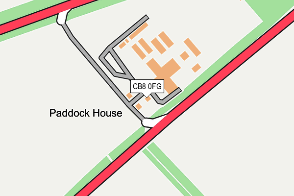
CB8 0FG is located in the Woodditton electoral ward, within the local authority district of East Cambridgeshire and the English Parliamentary constituency of South East Cambridgeshire. The Sub Integrated Care Board (ICB) Location is NHS Cambridgeshire and Peterborough ICB - 06H and the police force is Cambridgeshire. This postcode has been in use since August 2008.


GetTheData
Source: OS OpenMap – Local (Ordnance Survey)
Source: OS VectorMap District (Ordnance Survey)
Licence: Open Government Licence (requires attribution)
| Easting | 561281 |
| Northing | 260977 |
| Latitude | 52.223387 |
| Longitude | 0.359752 |
GetTheData
Source: Open Postcode Geo
Licence: Open Government Licence
| Country | England |
| Postcode District | CB8 |
| ➜ CB8 open data dashboard ➜ See where CB8 is on a map | |
GetTheData
Source: Land Registry Price Paid Data
Licence: Open Government Licence
Elevation or altitude of CB8 0FG as distance above sea level:
| Metres | Feet | |
|---|---|---|
| Elevation | 50m | 164ft |
Elevation is measured from the approximate centre of the postcode, to the nearest point on an OS contour line from OS Terrain 50, which has contour spacing of ten vertical metres.
➜ How high above sea level am I? Find the elevation of your current position using your device's GPS.
GetTheData
Source: Open Postcode Elevation
Licence: Open Government Licence
| Ward | Woodditton |
| Constituency | South East Cambridgeshire |
GetTheData
Source: ONS Postcode Database
Licence: Open Government Licence
| July Lodge (London Road (A1304)) | Stetchworth | 677m |
| July Lodge (London Road (A1304)) | Stetchworth | 722m |
| Dullingham Station | 2.5km |
| Newmarket Station | 3.6km |
GetTheData
Source: NaPTAN
Licence: Open Government Licence
GetTheData
Source: ONS Postcode Database
Licence: Open Government Licence


➜ Get more ratings from the Food Standards Agency
GetTheData
Source: Food Standards Agency
Licence: FSA terms & conditions
| Last Collection | |||
|---|---|---|---|
| Location | Mon-Fri | Sat | Distance |
| Stetchworth Toll | 16:00 | 07:30 | 663m |
| Golf Links | 16:00 | 07:30 | 1,765m |
| Crockfords | 16:45 | 10:00 | 2,233m |
GetTheData
Source: Dracos
Licence: Creative Commons Attribution-ShareAlike
| Facility | Distance |
|---|---|
| Links Golf Club (Newmarket Limited) The Links, Cambridge Road, Newmarket Golf | 1.7km |
| Dullingham Polo Fields Station Road, Station Road, Dullingham Grass Pitches | 2.2km |
| Newmarket Lawn Tennis Club Hamilton Road, Newmarket Indoor Tennis Centre, Outdoor Tennis Courts | 3km |
GetTheData
Source: Active Places
Licence: Open Government Licence
| School | Phase of Education | Distance |
|---|---|---|
| Houldsworth Valley Primary Academy Rowley Drive, Newmarket, CB8 0PU | Primary | 3.4km |
| Paddocks Primary School Rochfort Avenue, Newmarket, CB8 0DL | Primary | 3.6km |
| Ditton Lodge Primary School St Johns Avenue, Newmarket, CB8 8BL | Primary | 3.7km |
GetTheData
Source: Edubase
Licence: Open Government Licence
The below table lists the International Territorial Level (ITL) codes (formerly Nomenclature of Territorial Units for Statistics (NUTS) codes) and Local Administrative Units (LAU) codes for CB8 0FG:
| ITL 1 Code | Name |
|---|---|
| TLH | East |
| ITL 2 Code | Name |
| TLH1 | East Anglia |
| ITL 3 Code | Name |
| TLH12 | Cambridgeshire CC |
| LAU 1 Code | Name |
| E07000009 | East Cambridgeshire |
GetTheData
Source: ONS Postcode Directory
Licence: Open Government Licence
The below table lists the Census Output Area (OA), Lower Layer Super Output Area (LSOA), and Middle Layer Super Output Area (MSOA) for CB8 0FG:
| Code | Name | |
|---|---|---|
| OA | E00090913 | |
| LSOA | E01018023 | East Cambridgeshire 011C |
| MSOA | E02006825 | East Cambridgeshire 011 |
GetTheData
Source: ONS Postcode Directory
Licence: Open Government Licence
| CB8 0TW | London Road | 594m |
| CB8 0TR | London Road | 1868m |
| CB8 9UT | Station Road | 2385m |
| CB8 9JT | Dullingham Road | 2419m |
| CB8 0TS | Lower Hare Park | 2586m |
| CB8 9XA | Vicarage Close | 2803m |
| CB8 9UZ | Eagle Lane | 2848m |
| CB8 0WY | Hamilton Road | 2874m |
| CB8 0NG | Hamilton Court | 2934m |
| CB8 9UY | The Crescent | 2955m |
GetTheData
Source: Open Postcode Geo; Land Registry Price Paid Data
Licence: Open Government Licence