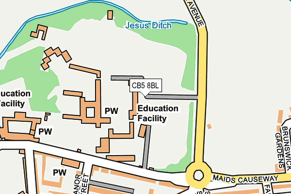
CB5 8BL is located in the Market electoral ward, within the local authority district of Cambridge and the English Parliamentary constituency of Cambridge. The Sub Integrated Care Board (ICB) Location is NHS Cambridgeshire and Peterborough ICB - 06H and the police force is Cambridgeshire. This postcode has been in use since January 1980.


GetTheData
Source: OS OpenMap – Local (Ordnance Survey)
Source: OS VectorMap District (Ordnance Survey)
Licence: Open Government Licence (requires attribution)
| Easting | 545134 |
| Northing | 259020 |
| Latitude | 52.210306 |
| Longitude | 0.122734 |
GetTheData
Source: Open Postcode Geo
Licence: Open Government Licence
| Country | England |
| Postcode District | CB5 |
| ➜ CB5 open data dashboard ➜ See where CB5 is on a map ➜ Where is Cambridge? | |
GetTheData
Source: Land Registry Price Paid Data
Licence: Open Government Licence
Elevation or altitude of CB5 8BL as distance above sea level:
| Metres | Feet | |
|---|---|---|
| Elevation | 10m | 33ft |
Elevation is measured from the approximate centre of the postcode, to the nearest point on an OS contour line from OS Terrain 50, which has contour spacing of ten vertical metres.
➜ How high above sea level am I? Find the elevation of your current position using your device's GPS.
GetTheData
Source: Open Postcode Elevation
Licence: Open Government Licence
| Ward | Market |
| Constituency | Cambridge |
GetTheData
Source: ONS Postcode Database
Licence: Open Government Licence
| January 2024 | Bicycle theft | On or near Belmont Place | 362m |
| January 2024 | Drugs | On or near Belmont Place | 362m |
| December 2023 | Other theft | On or near Belmont Place | 362m |
| ➜ Get more crime data in our Crime section | |||
GetTheData
Source: data.police.uk
Licence: Open Government Licence
| The Busway Park Street (Round Church Street) | Cambridge | 273m |
| Belmont Place (Jesus Lane) | Cambridge | 317m |
| Belmont Place (Jesus Lane) | Cambridge | 328m |
| Bridge Street (Jesus Lane) | Cambridge | 331m |
| The Busway Cloister Court (Jesus Lane) | Cambridge | 336m |
| Cambridge Station | 2.1km |
GetTheData
Source: NaPTAN
Licence: Open Government Licence
GetTheData
Source: ONS Postcode Database
Licence: Open Government Licence


➜ Get more ratings from the Food Standards Agency
GetTheData
Source: Food Standards Agency
Licence: FSA terms & conditions
| Last Collection | |||
|---|---|---|---|
| Location | Mon-Fri | Sat | Distance |
| Jesus Lane | 18:30 | 12:30 | 224m |
| Carlyle Road | 17:30 | 12:15 | 363m |
| Sidney Sussex College | 18:45 | 13:00 | 366m |
GetTheData
Source: Dracos
Licence: Creative Commons Attribution-ShareAlike
| Facility | Distance |
|---|---|
| Jesus College Cambridge Grass Pitches, Squash Courts, Outdoor Tennis Courts, Health and Fitness Gym | 0m |
| Jesus Green Victoria Avenue, Cambridge Grass Pitches, Outdoor Tennis Courts, Swimming Pool | 180m |
| Jesus Green Lido Victoria Avenue, Cambridge Swimming Pool | 309m |
GetTheData
Source: Active Places
Licence: Open Government Licence
| School | Phase of Education | Distance |
|---|---|---|
| Park Street CofE Primary School Lower Park Street, Cambridge, CB5 8AR | Primary | 199m |
| University of Cambridge Vice Chancellor's Office, University Offices, The Old Schools, Cambridge, CB2 1TN | Not applicable | 694m |
| Parkside Community College Parkside, Cambridge, CB1 1EH | Secondary | 763m |
GetTheData
Source: Edubase
Licence: Open Government Licence
The below table lists the International Territorial Level (ITL) codes (formerly Nomenclature of Territorial Units for Statistics (NUTS) codes) and Local Administrative Units (LAU) codes for CB5 8BL:
| ITL 1 Code | Name |
|---|---|
| TLH | East |
| ITL 2 Code | Name |
| TLH1 | East Anglia |
| ITL 3 Code | Name |
| TLH12 | Cambridgeshire CC |
| LAU 1 Code | Name |
| E07000008 | Cambridge |
GetTheData
Source: ONS Postcode Directory
Licence: Open Government Licence
The below table lists the Census Output Area (OA), Lower Layer Super Output Area (LSOA), and Middle Layer Super Output Area (MSOA) for CB5 8BL:
| Code | Name | |
|---|---|---|
| OA | E00090711 | |
| LSOA | E01032797 | Cambridge 007G |
| MSOA | E02003725 | Cambridge 007 |
GetTheData
Source: ONS Postcode Directory
Licence: Open Government Licence
| CB5 8BJ | Jesus Lane | 152m |
| CB5 8AL | Park Parade | 223m |
| CB5 8AW | Portugal Street | 237m |
| CB5 8AT | New Park Street | 259m |
| CB5 8AN | St Johns Road | 289m |
| CB5 8AF | Portugal Place | 298m |
| CB5 8BA | Jesus Lane | 302m |
| CB1 1LS | Malcolm Place | 302m |
| CB5 8AJ | Richmond Terrace | 305m |
| CB1 1LJ | Manor Place | 310m |
GetTheData
Source: Open Postcode Geo; Land Registry Price Paid Data
Licence: Open Government Licence