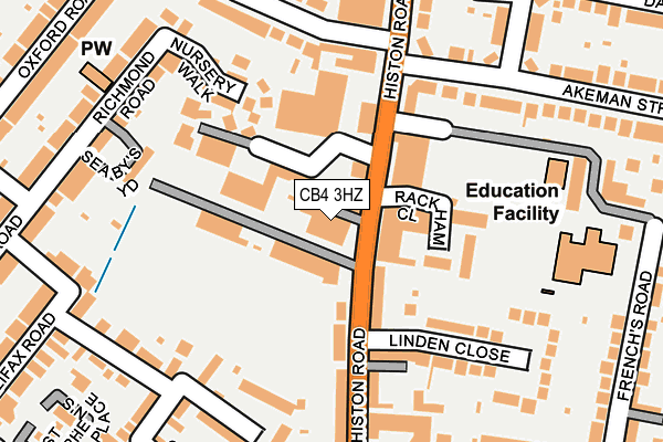
CB4 3HZ is located in the Arbury electoral ward, within the local authority district of Cambridge and the English Parliamentary constituency of Cambridge. The Sub Integrated Care Board (ICB) Location is NHS Cambridgeshire and Peterborough ICB - 06H and the police force is Cambridgeshire. This postcode has been in use since May 2004.


GetTheData
Source: OS OpenMap – Local (Ordnance Survey)
Source: OS VectorMap District (Ordnance Survey)
Licence: Open Government Licence (requires attribution)
| Easting | 544293 |
| Northing | 259919 |
| Latitude | 52.218590 |
| Longitude | 0.110789 |
GetTheData
Source: Open Postcode Geo
Licence: Open Government Licence
| Country | England |
| Postcode District | CB4 |
| ➜ CB4 open data dashboard ➜ See where CB4 is on a map ➜ Where is Cambridge? | |
GetTheData
Source: Land Registry Price Paid Data
Licence: Open Government Licence
Elevation or altitude of CB4 3HZ as distance above sea level:
| Metres | Feet | |
|---|---|---|
| Elevation | 20m | 66ft |
Elevation is measured from the approximate centre of the postcode, to the nearest point on an OS contour line from OS Terrain 50, which has contour spacing of ten vertical metres.
➜ How high above sea level am I? Find the elevation of your current position using your device's GPS.
GetTheData
Source: Open Postcode Elevation
Licence: Open Government Licence
| Ward | Arbury |
| Constituency | Cambridge |
GetTheData
Source: ONS Postcode Database
Licence: Open Government Licence
| January 2024 | Violence and sexual offences | On or near Francis Darwin Court | 292m |
| January 2024 | Criminal damage and arson | On or near Darwin Drive | 347m |
| December 2023 | Criminal damage and arson | On or near Francis Darwin Court | 292m |
| ➜ Get more crime data in our Crime section | |||
GetTheData
Source: data.police.uk
Licence: Open Government Licence
| Linden Close (Histon Road) | Chesterton | 109m |
| Linden Close (Histon Road) | Chesterton | 120m |
| Akeman Street (Histon Road) | Chesterton | 127m |
| Akeman Street (Histon Road) | Chesterton | 133m |
| Gilbert Road (Histon Road) | Chesterton | 308m |
| Cambridge Station | 3.3km |
GetTheData
Source: NaPTAN
Licence: Open Government Licence
GetTheData
Source: ONS Postcode Database
Licence: Open Government Licence


➜ Get more ratings from the Food Standards Agency
GetTheData
Source: Food Standards Agency
Licence: FSA terms & conditions
| Last Collection | |||
|---|---|---|---|
| Location | Mon-Fri | Sat | Distance |
| Histon Road Post Office | 17:30 | 12:00 | 186m |
| Histon Road | 18:30 | 12:00 | 236m |
| Halifax Road | 18:15 | 12:45 | 282m |
GetTheData
Source: Dracos
Licence: Creative Commons Attribution-ShareAlike
| Facility | Distance |
|---|---|
| Fitzwilliam College Sports Ground Oxford Road, Cambridge Grass Pitches, Outdoor Tennis Courts | 350m |
| Mayfield Primary School Warwick Road, Cambridge Grass Pitches | 420m |
| Trinity Hall Sports Ground Storeys Way, Cambridge Grass Pitches | 607m |
GetTheData
Source: Active Places
Licence: Open Government Licence
| School | Phase of Education | Distance |
|---|---|---|
| St Luke's CofE Primary School Frenchs Road, Cambridge, CB4 3JZ | Primary | 234m |
| Mayfield Primary School Warwick Road, Cambridge, CB4 3HN | Primary | 406m |
| Chesterton Community College Gilbert Road, Cambridge, CB4 3NY | Secondary | 670m |
GetTheData
Source: Edubase
Licence: Open Government Licence
The below table lists the International Territorial Level (ITL) codes (formerly Nomenclature of Territorial Units for Statistics (NUTS) codes) and Local Administrative Units (LAU) codes for CB4 3HZ:
| ITL 1 Code | Name |
|---|---|
| TLH | East |
| ITL 2 Code | Name |
| TLH1 | East Anglia |
| ITL 3 Code | Name |
| TLH12 | Cambridgeshire CC |
| LAU 1 Code | Name |
| E07000008 | Cambridge |
GetTheData
Source: ONS Postcode Directory
Licence: Open Government Licence
The below table lists the Census Output Area (OA), Lower Layer Super Output Area (LSOA), and Middle Layer Super Output Area (MSOA) for CB4 3HZ:
| Code | Name | |
|---|---|---|
| OA | E00090562 | |
| LSOA | E01017949 | Cambridge 002A |
| MSOA | E02003720 | Cambridge 002 |
GetTheData
Source: ONS Postcode Directory
Licence: Open Government Licence
| CB4 3JH | Longview Terrace | 52m |
| CB4 3JP | Histon Road | 61m |
| CB4 3JD | Histon Road | 76m |
| CB4 3HX | Rackham Close | 129m |
| CB4 3PR | Nursery Walk | 152m |
| CB4 3QQ | Canterbury Close | 169m |
| CB4 3JU | Linden Close | 185m |
| CB4 3LH | Histon Road | 188m |
| CB4 3LQ | Histon Road | 192m |
| CB4 3QE | Canterbury Street | 203m |
GetTheData
Source: Open Postcode Geo; Land Registry Price Paid Data
Licence: Open Government Licence