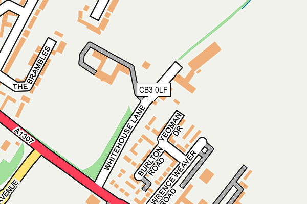
CB3 0LF is located in the Girton electoral ward, within the local authority district of South Cambridgeshire and the English Parliamentary constituency of South Cambridgeshire. The Sub Integrated Care Board (ICB) Location is NHS Cambridgeshire and Peterborough ICB - 06H and the police force is Cambridgeshire. This postcode has been in use since May 2022.


GetTheData
Source: OS OpenMap – Local (Ordnance Survey)
Source: OS VectorMap District (Ordnance Survey)
Licence: Open Government Licence (requires attribution)
| Easting | 543456 |
| Northing | 260755 |
| Latitude | 52.226332 |
| Longitude | 0.098928 |
GetTheData
Source: Open Postcode Geo
Licence: Open Government Licence
| Country | England |
| Postcode District | CB3 |
| ➜ CB3 open data dashboard ➜ See where CB3 is on a map | |
GetTheData
Source: Land Registry Price Paid Data
Licence: Open Government Licence
Elevation or altitude of CB3 0LF as distance above sea level:
| Metres | Feet | |
|---|---|---|
| Elevation | 20m | 66ft |
Elevation is measured from the approximate centre of the postcode, to the nearest point on an OS contour line from OS Terrain 50, which has contour spacing of ten vertical metres.
➜ How high above sea level am I? Find the elevation of your current position using your device's GPS.
GetTheData
Source: Open Postcode Elevation
Licence: Open Government Licence
| Ward | Girton |
| Constituency | South Cambridgeshire |
GetTheData
Source: ONS Postcode Database
Licence: Open Government Licence
| June 2022 | Vehicle crime | On or near Sports/Recreation Area | 168m |
| June 2022 | Violence and sexual offences | On or near Whitehouse Lane | 405m |
| June 2022 | Violence and sexual offences | On or near Whitehouse Lane | 405m |
| ➜ Get more crime data in our Crime section | |||
GetTheData
Source: data.police.uk
Licence: Open Government Licence
| Howes Place (Huntingdon Road) | Cambridge | 571m |
| Howes Place (Huntingdon Road) | Cambridge | 597m |
| Thornton Road (Huntingdon Road) | Cambridge | 602m |
| Thornton Road (Huntingdon Road) | Cambridge | 603m |
| Girton Road (Huntingdon Road) | Girton | 777m |
| Cambridge Station | 4.5km |
GetTheData
Source: NaPTAN
Licence: Open Government Licence
GetTheData
Source: ONS Postcode Database
Licence: Open Government Licence


➜ Get more ratings from the Food Standards Agency
GetTheData
Source: Food Standards Agency
Licence: FSA terms & conditions
| Last Collection | |||
|---|---|---|---|
| Location | Mon-Fri | Sat | Distance |
| Thornton Way | 18:45 | 12:30 | 388m |
| Howes Place | 19:00 | 12:45 | 580m |
| Carrisbrooke Road | 17:30 | 12:15 | 759m |
GetTheData
Source: Dracos
Licence: Creative Commons Attribution-ShareAlike
| Facility | Distance |
|---|---|
| Cambridge Squash Club (Closed) Histon Road, Cambridge Squash Courts | 766m |
| Eddington Playing Field Eddington Avenue, Eddington Avenue, Cambridge Grass Pitches | 785m |
| Mayfield Primary School Warwick Road, Cambridge Grass Pitches | 831m |
GetTheData
Source: Active Places
Licence: Open Government Licence
| School | Phase of Education | Distance |
|---|---|---|
| Mayfield Primary School Warwick Road, Cambridge, CB4 3HN | Primary | 835m |
| University of Cambridge Primary School Eddington Avenue, Cambridge, CB3 0QZ | Primary | 1.2km |
| St Luke's CofE Primary School Frenchs Road, Cambridge, CB4 3JZ | Primary | 1.4km |
GetTheData
Source: Edubase
Licence: Open Government Licence
The below table lists the International Territorial Level (ITL) codes (formerly Nomenclature of Territorial Units for Statistics (NUTS) codes) and Local Administrative Units (LAU) codes for CB3 0LF:
| ITL 1 Code | Name |
|---|---|
| TLH | East |
| ITL 2 Code | Name |
| TLH1 | East Anglia |
| ITL 3 Code | Name |
| TLH12 | Cambridgeshire CC |
| LAU 1 Code | Name |
| E07000012 | South Cambridgeshire |
GetTheData
Source: ONS Postcode Directory
Licence: Open Government Licence
The below table lists the Census Output Area (OA), Lower Layer Super Output Area (LSOA), and Middle Layer Super Output Area (MSOA) for CB3 0LF:
| Code | Name | |
|---|---|---|
| OA | E00170828 | |
| LSOA | E01018248 | South Cambridgeshire 009C |
| MSOA | E02003783 | South Cambridgeshire 009 |
GetTheData
Source: ONS Postcode Directory
Licence: Open Government Licence
| CB3 0NG | Thornton Close | 238m |
| CB3 0NF | Thornton Close | 270m |
| CB3 0NJ | Thornton Way | 340m |
| CB3 0GX | Lawrence Weaver Road | 349m |
| CB3 0NQ | Thornton Close | 365m |
| CB3 0NL | Thornton Way | 369m |
| CB3 0GZ | Yeoman Drive | 369m |
| CB3 0NH | Thornton Road | 393m |
| CB3 0GY | Yeoman Drive | 393m |
| CB3 0GS | Burlton Road | 447m |
GetTheData
Source: Open Postcode Geo; Land Registry Price Paid Data
Licence: Open Government Licence