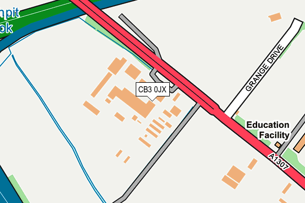
CB3 0JX is located in the Girton electoral ward, within the local authority district of South Cambridgeshire and the English Parliamentary constituency of South Cambridgeshire. The Sub Integrated Care Board (ICB) Location is NHS Cambridgeshire and Peterborough ICB - 06H and the police force is Cambridgeshire. This postcode has been in use since September 1991.


GetTheData
Source: OS OpenMap – Local (Ordnance Survey)
Source: OS VectorMap District (Ordnance Survey)
Licence: Open Government Licence (requires attribution)
| Easting | 541995 |
| Northing | 261123 |
| Latitude | 52.230017 |
| Longitude | 0.077707 |
GetTheData
Source: Open Postcode Geo
Licence: Open Government Licence
| Country | England |
| Postcode District | CB3 |
| ➜ CB3 open data dashboard ➜ See where CB3 is on a map ➜ Where is Girton? | |
GetTheData
Source: Land Registry Price Paid Data
Licence: Open Government Licence
Elevation or altitude of CB3 0JX as distance above sea level:
| Metres | Feet | |
|---|---|---|
| Elevation | 20m | 66ft |
Elevation is measured from the approximate centre of the postcode, to the nearest point on an OS contour line from OS Terrain 50, which has contour spacing of ten vertical metres.
➜ How high above sea level am I? Find the elevation of your current position using your device's GPS.
GetTheData
Source: Open Postcode Elevation
Licence: Open Government Licence
| Ward | Girton |
| Constituency | South Cambridgeshire |
GetTheData
Source: ONS Postcode Database
Licence: Open Government Licence
| June 2022 | Criminal damage and arson | On or near Further/Higher Educational Building | 448m |
| April 2022 | Vehicle crime | On or near M11 | 439m |
| April 2022 | Other crime | On or near M11 | 439m |
| ➜ Get more crime data in our Crime section | |||
GetTheData
Source: data.police.uk
Licence: Open Government Licence
| Wellbrook Way (Girton Road) | Girton | 583m |
| Wellbrook Way (Girton Road) | Girton | 603m |
| Pepys Way (Girton Road) | Girton | 700m |
| Girton Road (Huntingdon Road) | Girton | 729m |
| Pepys Way (Girton Road) | Girton | 778m |
| Cambridge Station | 5.7km |
GetTheData
Source: NaPTAN
Licence: Open Government Licence
GetTheData
Source: ONS Postcode Database
Licence: Open Government Licence


➜ Get more ratings from the Food Standards Agency
GetTheData
Source: Food Standards Agency
Licence: FSA terms & conditions
| Last Collection | |||
|---|---|---|---|
| Location | Mon-Fri | Sat | Distance |
| St Vincents Close | 18:45 | 12:00 | 502m |
| Girton Road | 18:45 | 12:30 | 606m |
| Pepys Way | 19:00 | 12:30 | 751m |
GetTheData
Source: Dracos
Licence: Creative Commons Attribution-ShareAlike
| Facility | Distance |
|---|---|
| Girton College Cambridge Swimming Pool, Grass Pitches, Squash Courts | 448m |
| Girton Glebe Primary School Cambridge Road, Girton, Cambridge Swimming Pool | 1.2km |
| Girton Recreation Ground Cambridge Road, Girton Grass Pitches, Outdoor Tennis Courts, Artificial Grass Pitch | 1.3km |
GetTheData
Source: Active Places
Licence: Open Government Licence
| School | Phase of Education | Distance |
|---|---|---|
| Girton Glebe Primary School Cambridge Road, Girton, Cambridge, CB3 0PN | Primary | 1km |
| Gretton School Manor Farm Road, Girton, Cambridge, CB3 0RX | Not applicable | 1.8km |
| University of Cambridge Primary School Eddington Avenue, Cambridge, CB3 0QZ | Primary | 1.9km |
GetTheData
Source: Edubase
Licence: Open Government Licence
The below table lists the International Territorial Level (ITL) codes (formerly Nomenclature of Territorial Units for Statistics (NUTS) codes) and Local Administrative Units (LAU) codes for CB3 0JX:
| ITL 1 Code | Name |
|---|---|
| TLH | East |
| ITL 2 Code | Name |
| TLH1 | East Anglia |
| ITL 3 Code | Name |
| TLH12 | Cambridgeshire CC |
| LAU 1 Code | Name |
| E07000012 | South Cambridgeshire |
GetTheData
Source: ONS Postcode Directory
Licence: Open Government Licence
The below table lists the Census Output Area (OA), Lower Layer Super Output Area (LSOA), and Middle Layer Super Output Area (MSOA) for CB3 0JX:
| Code | Name | |
|---|---|---|
| OA | E00092049 | |
| LSOA | E01018249 | South Cambridgeshire 009D |
| MSOA | E02003783 | South Cambridgeshire 009 |
GetTheData
Source: ONS Postcode Directory
Licence: Open Government Licence
| CB3 0PB | St Vincents Close | 490m |
| CB3 0XB | Weavers Field | 535m |
| CB3 0PD | St Vincents Close | 573m |
| CB3 0LH | Huntingdon Road | 574m |
| CB3 0PG | Woody Green | 587m |
| CB3 0LN | Girton Road | 607m |
| CB3 0PE | St Vincents Close | 636m |
| CB3 0LS | Girton Road | 654m |
| CB3 0LL | Girton Road | 671m |
| CB3 0PA | Pepys Way | 672m |
GetTheData
Source: Open Postcode Geo; Land Registry Price Paid Data
Licence: Open Government Licence