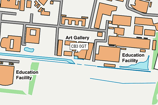
CB3 0GT is located in the Newnham electoral ward, within the local authority district of Cambridge and the English Parliamentary constituency of Cambridge. The Sub Integrated Care Board (ICB) Location is NHS Cambridgeshire and Peterborough ICB - 06H and the police force is Cambridgeshire. This postcode has been in use since February 2010.


GetTheData
Source: OS OpenMap – Local (Ordnance Survey)
Source: OS VectorMap District (Ordnance Survey)
Licence: Open Government Licence (requires attribution)
| Easting | 542895 |
| Northing | 258788 |
| Latitude | 52.208793 |
| Longitude | 0.089862 |
GetTheData
Source: Open Postcode Geo
Licence: Open Government Licence
| Country | England |
| Postcode District | CB3 |
| ➜ CB3 open data dashboard ➜ See where CB3 is on a map ➜ Where is Cambridge? | |
GetTheData
Source: Land Registry Price Paid Data
Licence: Open Government Licence
Elevation or altitude of CB3 0GT as distance above sea level:
| Metres | Feet | |
|---|---|---|
| Elevation | 20m | 66ft |
Elevation is measured from the approximate centre of the postcode, to the nearest point on an OS contour line from OS Terrain 50, which has contour spacing of ten vertical metres.
➜ How high above sea level am I? Find the elevation of your current position using your device's GPS.
GetTheData
Source: Open Postcode Elevation
Licence: Open Government Licence
| Ward | Newnham |
| Constituency | Cambridge |
GetTheData
Source: ONS Postcode Database
Licence: Open Government Licence
| June 2022 | Bicycle theft | On or near The Lawns | 391m |
| April 2022 | Violence and sexual offences | On or near Charles Babbage Road | 99m |
| April 2022 | Drugs | On or near Charles Babbage Road | 99m |
| ➜ Get more crime data in our Crime section | |||
GetTheData
Source: data.police.uk
Licence: Open Government Licence
| Cavendish Laboratory (Jj Thompson Avenue) | Cambridge | 141m |
| Cavendish Laboratory (Jj Thompson Avenue) | Cambridge | 141m |
| Veterinary School (Charles Babbage Road) | Cambridge | 256m |
| Veterinary School (Charles Babbage Road) | Cambridge | 257m |
| William Gates Building (Jj Thompson Avenue) | Cambridge | 291m |
| Cambridge Station | 3.6km |
GetTheData
Source: NaPTAN
Licence: Open Government Licence
GetTheData
Source: ONS Postcode Database
Licence: Open Government Licence


➜ Get more ratings from the Food Standards Agency
GetTheData
Source: Food Standards Agency
Licence: FSA terms & conditions
| Last Collection | |||
|---|---|---|---|
| Location | Mon-Fri | Sat | Distance |
| Observatories | 17:30 | 12:30 | 553m |
| Landsdowne Road | 17:30 | 12:30 | 572m |
| Wilberforce Road | 17:45 | 12:30 | 662m |
GetTheData
Source: Dracos
Licence: Creative Commons Attribution-ShareAlike
| Facility | Distance |
|---|---|
| University Of Cambridge Sports Centre (West Site) Philippa Fawcett Drive, Cambridge Health and Fitness Gym, Sports Hall, Squash Courts, Studio | 296m |
| Cambridge University Sports Ground Wilberforce Road, Cambridge Athletics, Artificial Grass Pitch | 562m |
| Emmanuel College Sports Ground Wilberforce Road, Cambridge Grass Pitches | 635m |
GetTheData
Source: Active Places
Licence: Open Government Licence
| School | Phase of Education | Distance |
|---|---|---|
| University of Cambridge Primary School Eddington Avenue, Cambridge, CB3 0QZ | Primary | 864m |
| St John's College School 73 Grange Road, Cambridge, CB3 9AB | Not applicable | 1.1km |
| King's College School West Road, Cambridge, CB3 9DN | Not applicable | 1.3km |
GetTheData
Source: Edubase
Licence: Open Government Licence
The below table lists the International Territorial Level (ITL) codes (formerly Nomenclature of Territorial Units for Statistics (NUTS) codes) and Local Administrative Units (LAU) codes for CB3 0GT:
| ITL 1 Code | Name |
|---|---|
| TLH | East |
| ITL 2 Code | Name |
| TLH1 | East Anglia |
| ITL 3 Code | Name |
| TLH12 | Cambridgeshire CC |
| LAU 1 Code | Name |
| E07000008 | Cambridge |
GetTheData
Source: ONS Postcode Directory
Licence: Open Government Licence
The below table lists the Census Output Area (OA), Lower Layer Super Output Area (LSOA), and Middle Layer Super Output Area (MSOA) for CB3 0GT:
| Code | Name | |
|---|---|---|
| OA | E00167063 | |
| LSOA | E01017984 | Cambridge 007D |
| MSOA | E02003725 | Cambridge 007 |
GetTheData
Source: ONS Postcode Directory
Licence: Open Government Licence
| CB3 0RS | Perry Court | 335m |
| CB3 0RU | The Lawns | 402m |
| CB3 0EX | Madingley Road | 556m |
| CB3 0EL | Madingley Road | 564m |
| CB3 0EW | Hedgerley Close | 574m |
| CB3 0EY | Conduit Head Road | 608m |
| CB3 0DW | Bradrushe Fields | 629m |
| CB3 0EU | Lansdowne Road | 638m |
| CB3 0EN | Bulstrode Gardens | 659m |
| CB3 0EQ | Wilberforce Road | 700m |
GetTheData
Source: Open Postcode Geo; Land Registry Price Paid Data
Licence: Open Government Licence