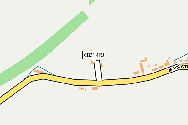
CB21 4RJ lies on Bangs Close in Shudy Camps, Cambridge. CB21 4RJ is located in the Linton electoral ward, within the local authority district of South Cambridgeshire and the English Parliamentary constituency of South East Cambridgeshire. The Sub Integrated Care Board (ICB) Location is NHS Cambridgeshire and Peterborough ICB - 06H and the police force is Cambridgeshire. This postcode has been in use since September 2006.


GetTheData
Source: OS OpenMap – Local (Ordnance Survey)
Source: OS VectorMap District (Ordnance Survey)
Licence: Open Government Licence (requires attribution)
| Easting | 561163 |
| Northing | 245032 |
| Latitude | 52.080190 |
| Longitude | 0.350468 |
GetTheData
Source: Open Postcode Geo
Licence: Open Government Licence
| Street | Bangs Close |
| Locality | Shudy Camps |
| Town/City | Cambridge |
| Country | England |
| Postcode District | CB21 |
| ➜ CB21 open data dashboard ➜ See where CB21 is on a map ➜ Where is Shudy Camps? | |
GetTheData
Source: Land Registry Price Paid Data
Licence: Open Government Licence
Elevation or altitude of CB21 4RJ as distance above sea level:
| Metres | Feet | |
|---|---|---|
| Elevation | 80m | 262ft |
Elevation is measured from the approximate centre of the postcode, to the nearest point on an OS contour line from OS Terrain 50, which has contour spacing of ten vertical metres.
➜ How high above sea level am I? Find the elevation of your current position using your device's GPS.
GetTheData
Source: Open Postcode Elevation
Licence: Open Government Licence
| Ward | Linton |
| Constituency | South East Cambridgeshire |
GetTheData
Source: ONS Postcode Database
Licence: Open Government Licence
| January 2022 | Criminal damage and arson | On or near Main Street | 68m |
| January 2022 | Criminal damage and arson | On or near Main Street | 68m |
| ➜ Get more crime data in our Crime section | |||
GetTheData
Source: data.police.uk
Licence: Open Government Licence
| Carter's Farm (Main Street) | Shudy Camps | 581m |
| Carter's Farm (Main Street) | Shudy Camps | 582m |
| St Mary's Church (Church Road) | Shudy Camps | 1,055m |
| St Mary's Church (Main Street) | Shudy Camps | 1,058m |
GetTheData
Source: NaPTAN
Licence: Open Government Licence
| Percentage of properties with Next Generation Access | 100.0% |
| Percentage of properties with Superfast Broadband | 100.0% |
| Percentage of properties with Ultrafast Broadband | 0.0% |
| Percentage of properties with Full Fibre Broadband | 0.0% |
Superfast Broadband is between 30Mbps and 300Mbps
Ultrafast Broadband is > 300Mbps
| Percentage of properties unable to receive 2Mbps | 0.0% |
| Percentage of properties unable to receive 5Mbps | 0.0% |
| Percentage of properties unable to receive 10Mbps | 0.0% |
| Percentage of properties unable to receive 30Mbps | 0.0% |
GetTheData
Source: Ofcom
Licence: Ofcom Terms of Use (requires attribution)
GetTheData
Source: ONS Postcode Database
Licence: Open Government Licence

➜ Get more ratings from the Food Standards Agency
GetTheData
Source: Food Standards Agency
Licence: FSA terms & conditions
| Last Collection | |||
|---|---|---|---|
| Location | Mon-Fri | Sat | Distance |
| Carters Farm | 16:45 | 11:00 | 497m |
| Cardinals Green | 16:45 | 10:30 | 1,548m |
| Horseheath Post Office | 17:00 | 10:30 | 2,216m |
GetTheData
Source: Dracos
Licence: Creative Commons Attribution-ShareAlike
| Facility | Distance |
|---|---|
| Mill Green Cricket Club Mill Green, Horseheath, Cambridge Grass Pitches | 1.4km |
| Horseheath Cricket Club Howards Lane, Horseheath Grass Pitches | 2km |
| Castle Camps Recreation Ground Park Lane, Castle Camps, Cambridge Grass Pitches, Outdoor Tennis Courts | 2.8km |
GetTheData
Source: Active Places
Licence: Open Government Licence
| School | Phase of Education | Distance |
|---|---|---|
| Glebe House Church Road, Shudy Camps, Cambridge, CB21 4QH | Not applicable | 1.2km |
| Castle Camps Church of England (Controlled) Primary School Church Lane, Castle Camps, Cambridge, CB21 4TH | Primary | 2.7km |
| Ashdon Primary School Bartlow Road, Ashdon, Saffron Walden, CB10 2HB | Primary | 3.7km |
GetTheData
Source: Edubase
Licence: Open Government Licence
The below table lists the International Territorial Level (ITL) codes (formerly Nomenclature of Territorial Units for Statistics (NUTS) codes) and Local Administrative Units (LAU) codes for CB21 4RJ:
| ITL 1 Code | Name |
|---|---|
| TLH | East |
| ITL 2 Code | Name |
| TLH1 | East Anglia |
| ITL 3 Code | Name |
| TLH12 | Cambridgeshire CC |
| LAU 1 Code | Name |
| E07000012 | South Cambridgeshire |
GetTheData
Source: ONS Postcode Directory
Licence: Open Government Licence
The below table lists the Census Output Area (OA), Lower Layer Super Output Area (LSOA), and Middle Layer Super Output Area (MSOA) for CB21 4RJ:
| Code | Name | |
|---|---|---|
| OA | E00091905 | |
| LSOA | E01018220 | South Cambridgeshire 016C |
| MSOA | E02003790 | South Cambridgeshire 016 |
GetTheData
Source: ONS Postcode Directory
Licence: Open Government Licence
| CB21 4RA | Main Street | 456m |
| CB21 4RB | Hockley Close | 958m |
| CB21 4RQ | Parkway | 999m |
| CB21 4RH | Blacksmiths Lane | 1234m |
| CB21 4RD | Shudy Camps Park | 1240m |
| CB21 4QZ | Mill Green | 1292m |
| CB21 4QX | Cardinals Green | 1479m |
| CB21 4QY | Cardinals Green | 1581m |
| CB21 4TP | Camps Hall Cottages | 1855m |
| CB21 4RF | Alington Terrace | 1966m |
GetTheData
Source: Open Postcode Geo; Land Registry Price Paid Data
Licence: Open Government Licence