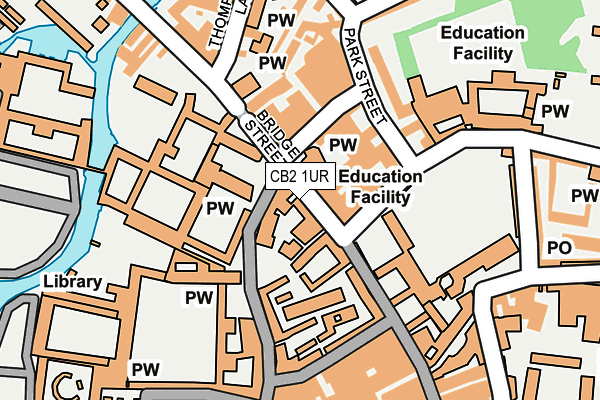
CB2 1UR is located in the Market electoral ward, within the local authority district of Cambridge and the English Parliamentary constituency of Cambridge. The Sub Integrated Care Board (ICB) Location is NHS Cambridgeshire and Peterborough ICB - 06H and the police force is Cambridgeshire. This postcode has been in use since January 1980.


GetTheData
Source: OS OpenMap – Local (Ordnance Survey)
Source: OS VectorMap District (Ordnance Survey)
Licence: Open Government Licence (requires attribution)
| Easting | 544871 |
| Northing | 258766 |
| Latitude | 52.208080 |
| Longitude | 0.118750 |
GetTheData
Source: Open Postcode Geo
Licence: Open Government Licence
| Country | England |
| Postcode District | CB2 |
| ➜ CB2 open data dashboard ➜ See where CB2 is on a map ➜ Where is Cambridge? | |
GetTheData
Source: Land Registry Price Paid Data
Licence: Open Government Licence
Elevation or altitude of CB2 1UR as distance above sea level:
| Metres | Feet | |
|---|---|---|
| Elevation | 10m | 33ft |
Elevation is measured from the approximate centre of the postcode, to the nearest point on an OS contour line from OS Terrain 50, which has contour spacing of ten vertical metres.
➜ How high above sea level am I? Find the elevation of your current position using your device's GPS.
GetTheData
Source: Open Postcode Elevation
Licence: Open Government Licence
| Ward | Market |
| Constituency | Cambridge |
GetTheData
Source: ONS Postcode Database
Licence: Open Government Licence
| January 2024 | Bicycle theft | On or near Belmont Place | 481m |
| January 2024 | Drugs | On or near Belmont Place | 481m |
| December 2023 | Other theft | On or near Belmont Place | 481m |
| ➜ Get more crime data in our Crime section | |||
GetTheData
Source: data.police.uk
Licence: Open Government Licence
| Bridge Street | Cambridge | 63m |
| The Busway Cloister Court (Jesus Lane) | Cambridge | 67m |
| Bridge Street (Jesus Lane) | Cambridge | 69m |
| All Saints Passage (Trinity Street) | Cambridge | 79m |
| Bridge Street | Cambridge | 83m |
| Cambridge Station | 2km |
GetTheData
Source: NaPTAN
Licence: Open Government Licence
| Percentage of properties with Next Generation Access | 100.0% |
| Percentage of properties with Superfast Broadband | 100.0% |
| Percentage of properties with Ultrafast Broadband | 0.0% |
| Percentage of properties with Full Fibre Broadband | 0.0% |
Superfast Broadband is between 30Mbps and 300Mbps
Ultrafast Broadband is > 300Mbps
| Percentage of properties unable to receive 2Mbps | 0.0% |
| Percentage of properties unable to receive 5Mbps | 0.0% |
| Percentage of properties unable to receive 10Mbps | 0.0% |
| Percentage of properties unable to receive 30Mbps | 0.0% |
GetTheData
Source: Ofcom
Licence: Ofcom Terms of Use (requires attribution)
GetTheData
Source: ONS Postcode Database
Licence: Open Government Licence


➜ Get more ratings from the Food Standards Agency
GetTheData
Source: Food Standards Agency
Licence: FSA terms & conditions
| Last Collection | |||
|---|---|---|---|
| Location | Mon-Fri | Sat | Distance |
| Sidney Sussex College | 18:45 | 13:00 | 69m |
| Trinity Street Post Office | 18:30 | 12:45 | 106m |
| Trinity Church | 18:45 | 12:45 | 307m |
GetTheData
Source: Dracos
Licence: Creative Commons Attribution-ShareAlike
| Facility | Distance |
|---|---|
| The Glassworks Health Club Thompsons Lane, Cambridge Health and Fitness Gym, Studio | 209m |
| Jesus College Cambridge Grass Pitches, Squash Courts, Outdoor Tennis Courts, Health and Fitness Gym | 366m |
| Jesus Green Victoria Avenue, Cambridge Grass Pitches, Outdoor Tennis Courts, Swimming Pool | 416m |
GetTheData
Source: Active Places
Licence: Open Government Licence
| School | Phase of Education | Distance |
|---|---|---|
| Park Street CofE Primary School Lower Park Street, Cambridge, CB5 8AR | Primary | 219m |
| University of Cambridge Vice Chancellor's Office, University Offices, The Old Schools, Cambridge, CB2 1TN | Not applicable | 342m |
| Parkside Community College Parkside, Cambridge, CB1 1EH | Secondary | 781m |
GetTheData
Source: Edubase
Licence: Open Government Licence
The below table lists the International Territorial Level (ITL) codes (formerly Nomenclature of Territorial Units for Statistics (NUTS) codes) and Local Administrative Units (LAU) codes for CB2 1UR:
| ITL 1 Code | Name |
|---|---|
| TLH | East |
| ITL 2 Code | Name |
| TLH1 | East Anglia |
| ITL 3 Code | Name |
| TLH12 | Cambridgeshire CC |
| LAU 1 Code | Name |
| E07000008 | Cambridge |
GetTheData
Source: ONS Postcode Directory
Licence: Open Government Licence
The below table lists the Census Output Area (OA), Lower Layer Super Output Area (LSOA), and Middle Layer Super Output Area (MSOA) for CB2 1UR:
| Code | Name | |
|---|---|---|
| OA | E00090712 | |
| LSOA | E01032797 | Cambridge 007G |
| MSOA | E02003725 | Cambridge 007 |
GetTheData
Source: ONS Postcode Directory
Licence: Open Government Licence
| CB5 8AD | Round Church Street | 77m |
| CB5 8BA | Jesus Lane | 80m |
| CB2 1UF | Bridge Street | 93m |
| CB2 1UG | Jordans Yard | 103m |
| CB5 8AF | Portugal Place | 142m |
| CB2 3JU | Green Street | 150m |
| CB2 1TB | Trinity Street | 165m |
| CB2 3LL | Rose Crescent | 211m |
| CB5 8AB | Quayside | 222m |
| CB5 8BJ | Jesus Lane | 232m |
GetTheData
Source: Open Postcode Geo; Land Registry Price Paid Data
Licence: Open Government Licence