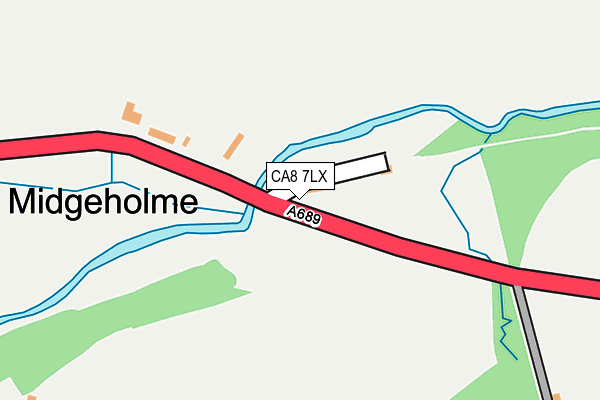
CA8 7LX is located in the Corby and Hayton electoral ward, within the unitary authority of Cumberland and the English Parliamentary constituency of Penrith and The Border. The Sub Integrated Care Board (ICB) Location is NHS North East and North Cumbria ICB - 01H and the police force is Cumbria. This postcode has been in use since June 2000.


GetTheData
Source: OS OpenMap – Local (Ordnance Survey)
Source: OS VectorMap District (Ordnance Survey)
Licence: Open Government Licence (requires attribution)
| Easting | 364064 |
| Northing | 558939 |
| Latitude | 54.923845 |
| Longitude | -2.562237 |
GetTheData
Source: Open Postcode Geo
Licence: Open Government Licence
| Country | England |
| Postcode District | CA8 |
| ➜ CA8 open data dashboard ➜ See where CA8 is on a map ➜ Where is Midgeholme? | |
GetTheData
Source: Land Registry Price Paid Data
Licence: Open Government Licence
Elevation or altitude of CA8 7LX as distance above sea level:
| Metres | Feet | |
|---|---|---|
| Elevation | 190m | 623ft |
Elevation is measured from the approximate centre of the postcode, to the nearest point on an OS contour line from OS Terrain 50, which has contour spacing of ten vertical metres.
➜ How high above sea level am I? Find the elevation of your current position using your device's GPS.
GetTheData
Source: Open Postcode Elevation
Licence: Open Government Licence
| Ward | Corby And Hayton |
| Constituency | Penrith And The Border |
GetTheData
Source: ONS Postcode Database
Licence: Open Government Licence
| Telephone Box (A689) | Midgeholme | 31m |
| Bridge (A689) | Midgeholme | 38m |
| Bridge (A689) | Midgeholme | 46m |
| High Midgeholme (A689) | Halton Lea Gate | 228m |
| High Midgeholme (A689) | Halton Lea Gate | 233m |
GetTheData
Source: NaPTAN
Licence: Open Government Licence
| Percentage of properties with Next Generation Access | 100.0% |
| Percentage of properties with Superfast Broadband | 100.0% |
| Percentage of properties with Ultrafast Broadband | 100.0% |
| Percentage of properties with Full Fibre Broadband | 100.0% |
Superfast Broadband is between 30Mbps and 300Mbps
Ultrafast Broadband is > 300Mbps
| Percentage of properties unable to receive 2Mbps | 0.0% |
| Percentage of properties unable to receive 5Mbps | 0.0% |
| Percentage of properties unable to receive 10Mbps | 0.0% |
| Percentage of properties unable to receive 30Mbps | 0.0% |
GetTheData
Source: Ofcom
Licence: Ofcom Terms of Use (requires attribution)
GetTheData
Source: ONS Postcode Database
Licence: Open Government Licence
| Last Collection | |||
|---|---|---|---|
| Location | Mon-Fri | Sat | Distance |
| Midgeholme | 17:00 | 11:45 | 146m |
| Halton Lea Gate | 17:00 | 11:45 | 1,003m |
| Tindale Fell | 17:15 | 11:00 | 2,392m |
GetTheData
Source: Dracos
Licence: Creative Commons Attribution-ShareAlike
| Facility | Distance |
|---|---|
| Haltwhistle Cricket Club Off A69, Haltwhistle Grass Pitches | 6.8km |
GetTheData
Source: Active Places
Licence: Open Government Licence
The below table lists the International Territorial Level (ITL) codes (formerly Nomenclature of Territorial Units for Statistics (NUTS) codes) and Local Administrative Units (LAU) codes for CA8 7LX:
| ITL 1 Code | Name |
|---|---|
| TLD | North West (England) |
| ITL 2 Code | Name |
| TLD1 | Cumbria |
| ITL 3 Code | Name |
| TLD12 | East Cumbria |
| LAU 1 Code | Name |
| E07000028 | Carlisle |
GetTheData
Source: ONS Postcode Directory
Licence: Open Government Licence
The below table lists the Census Output Area (OA), Lower Layer Super Output Area (LSOA), and Middle Layer Super Output Area (MSOA) for CA8 7LX:
| Code | Name | |
|---|---|---|
| OA | E00097174 | |
| LSOA | E01019225 | Carlisle 002D |
| MSOA | E02003988 | Carlisle 002 |
GetTheData
Source: ONS Postcode Directory
Licence: Open Government Licence
| CA8 7LT | 72m | |
| CA8 7LY | 93m | |
| CA8 7NB | 510m | |
| CA8 7LA | Lea Side | 1075m |
| CA8 7LB | Pennine Road | 1339m |
| CA8 7LD | Lane Terrace | 1386m |
| CA8 2QF | Riggfoot Cottages | 1927m |
| CA8 7NF | 1957m | |
| CA8 2QE | Woodend Cottage | 1980m |
| CA8 2QQ | 2294m |
GetTheData
Source: Open Postcode Geo; Land Registry Price Paid Data
Licence: Open Government Licence