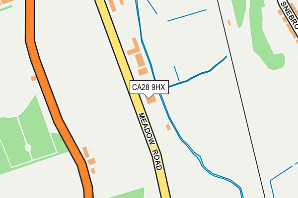
CA28 9HX is located in the Kells and Sandwith electoral ward, within the unitary authority of Cumberland and the English Parliamentary constituency of Copeland. The Sub Integrated Care Board (ICB) Location is NHS North East and North Cumbria ICB - 01H and the police force is Cumbria. This postcode has been in use since January 1980.


GetTheData
Source: OS OpenMap – Local (Ordnance Survey)
Source: OS VectorMap District (Ordnance Survey)
Licence: Open Government Licence (requires attribution)
| Easting | 297731 |
| Northing | 516569 |
| Latitude | 54.534039 |
| Longitude | -3.582008 |
GetTheData
Source: Open Postcode Geo
Licence: Open Government Licence
| Country | England |
| Postcode District | CA28 |
| ➜ CA28 open data dashboard ➜ See where CA28 is on a map ➜ Where is Whitehaven? | |
GetTheData
Source: Land Registry Price Paid Data
Licence: Open Government Licence
Elevation or altitude of CA28 9HX as distance above sea level:
| Metres | Feet | |
|---|---|---|
| Elevation | 10m | 33ft |
Elevation is measured from the approximate centre of the postcode, to the nearest point on an OS contour line from OS Terrain 50, which has contour spacing of ten vertical metres.
➜ How high above sea level am I? Find the elevation of your current position using your device's GPS.
GetTheData
Source: Open Postcode Elevation
Licence: Open Government Licence
| Ward | Kells And Sandwith |
| Constituency | Copeland |
GetTheData
Source: ONS Postcode Database
Licence: Open Government Licence
| December 2023 | Criminal damage and arson | On or near Burnmoor Avenue | 374m |
| September 2023 | Violence and sexual offences | On or near Burnmoor Avenue | 374m |
| September 2023 | Violence and sexual offences | On or near Burnmoor Avenue | 374m |
| ➜ Get more crime data in our Crime section | |||
GetTheData
Source: data.police.uk
Licence: Open Government Licence
| Cemetery (Meadow Road) | Mirehouse | 85m |
| Cemetery (Meadow Road) | Mirehouse | 97m |
| Cemetery Lodge (Low Road) | Whitehaven | 213m |
| Cemetery Lodge (Low Road) | Whitehaven | 220m |
| Meadow View (Meadow Road) | Mirehouse | 335m |
| Corkickle Station | 0.9km |
| Whitehaven Station | 2.1km |
| Parton Station | 4km |
GetTheData
Source: NaPTAN
Licence: Open Government Licence
GetTheData
Source: ONS Postcode Database
Licence: Open Government Licence


➜ Get more ratings from the Food Standards Agency
GetTheData
Source: Food Standards Agency
Licence: FSA terms & conditions
| Last Collection | |||
|---|---|---|---|
| Location | Mon-Fri | Sat | Distance |
| Whinlatter Road | 17:15 | 08:00 | 462m |
| Calder Avenue | 17:00 | 08:30 | 555m |
| Greenbank Avenue | 17:00 | 08:00 | 561m |
GetTheData
Source: Dracos
Licence: Creative Commons Attribution-ShareAlike
| Facility | Distance |
|---|---|
| The County Ground Coach Road, Whitehaven Artificial Grass Pitch, Grass Pitches | 572m |
| St Benedict's Rugby Union Football Club Newlands Avenue, Whitehaven Grass Pitches, Health and Fitness Gym, Artificial Grass Pitch | 590m |
| Whitehaven Rlfc Coach Road, Whitehaven Grass Pitches | 652m |
GetTheData
Source: Active Places
Licence: Open Government Licence
| School | Phase of Education | Distance |
|---|---|---|
| St Gregory and St Patrick's Catholic Infant School Esk Avenue, Corkickle, Whitehaven, CA28 8AJ | Primary | 421m |
| Monkwray Junior School Monkwray Brow, Monkwray Junior School, Monkwray Brow, Whitehaven, CA28 9DT | Primary | 721m |
| Valley Primary School and Nursery Whinlatter Road, Whitehaven, CA28 8DA | Primary | 930m |
GetTheData
Source: Edubase
Licence: Open Government Licence
The below table lists the International Territorial Level (ITL) codes (formerly Nomenclature of Territorial Units for Statistics (NUTS) codes) and Local Administrative Units (LAU) codes for CA28 9HX:
| ITL 1 Code | Name |
|---|---|
| TLD | North West (England) |
| ITL 2 Code | Name |
| TLD1 | Cumbria |
| ITL 3 Code | Name |
| TLD11 | West Cumbria |
| LAU 1 Code | Name |
| E07000029 | Copeland |
GetTheData
Source: ONS Postcode Directory
Licence: Open Government Licence
The below table lists the Census Output Area (OA), Lower Layer Super Output Area (LSOA), and Middle Layer Super Output Area (MSOA) for CA28 9HX:
| Code | Name | |
|---|---|---|
| OA | E00097554 | |
| LSOA | E01019301 | Copeland 005F |
| MSOA | E02004004 | Copeland 005 |
GetTheData
Source: ONS Postcode Directory
Licence: Open Government Licence
| CA28 9HU | Low Road | 164m |
| CA28 9JZ | Meadow Road | 251m |
| CA28 9JT | Uldale Road | 299m |
| CA28 9JS | Uldale Road | 305m |
| CA28 8DT | Snebro Road | 314m |
| CA28 9JX | Meadow Road | 327m |
| CA28 8DR | Duddon Close | 356m |
| CA28 9JW | Burnmoor Avenue | 361m |
| CA28 8DP | Snebro Road | 368m |
| CA28 8DU | Snebro Road | 370m |
GetTheData
Source: Open Postcode Geo; Land Registry Price Paid Data
Licence: Open Government Licence