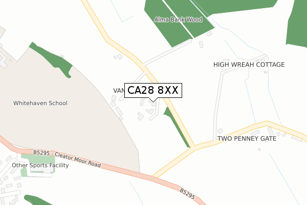
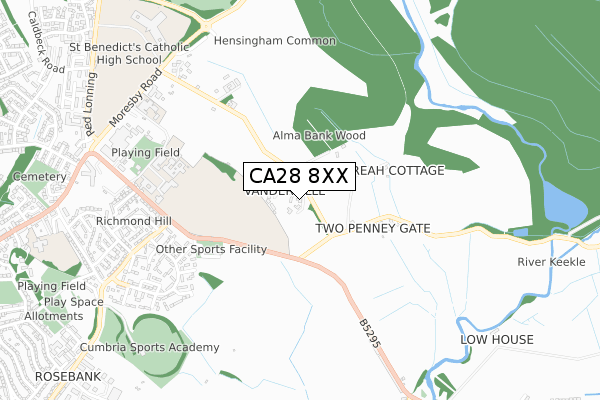
CA28 8XX is in Hensingham, Whitehaven. CA28 8XX is located in the Hillcrest and Hensingham electoral ward, within the unitary authority of Cumberland and the English Parliamentary constituency of Copeland. The Sub Integrated Care Board (ICB) Location is NHS North East and North Cumbria ICB - 01H and the police force is Cumbria. This postcode has been in use since January 1980.


GetTheData
Source: OS Open Zoomstack (Ordnance Survey)
Licence: Open Government Licence (requires attribution)
Attribution: Contains OS data © Crown copyright and database right 2024
Source: Open Postcode Geo
Licence: Open Government Licence (requires attribution)
Attribution: Contains OS data © Crown copyright and database right 2024; Contains Royal Mail data © Royal Mail copyright and database right 2024; Source: Office for National Statistics licensed under the Open Government Licence v.3.0
| Easting | 299951 |
| Northing | 517043 |
| Latitude | 54.538733 |
| Longitude | -3.547874 |
GetTheData
Source: Open Postcode Geo
Licence: Open Government Licence
| Locality | Hensingham |
| Town/City | Whitehaven |
| Country | England |
| Postcode District | CA28 |
| ➜ CA28 open data dashboard ➜ See where CA28 is on a map | |
GetTheData
Source: Land Registry Price Paid Data
Licence: Open Government Licence
Elevation or altitude of CA28 8XX as distance above sea level:
| Metres | Feet | |
|---|---|---|
| Elevation | 110m | 361ft |
Elevation is measured from the approximate centre of the postcode, to the nearest point on an OS contour line from OS Terrain 50, which has contour spacing of ten vertical metres.
➜ How high above sea level am I? Find the elevation of your current position using your device's GPS.
GetTheData
Source: Open Postcode Elevation
Licence: Open Government Licence
| Ward | Hillcrest And Hensingham |
| Constituency | Copeland |
GetTheData
Source: ONS Postcode Database
Licence: Open Government Licence
| October 2021 | Vehicle crime | On or near Sports/Recreation Area | 247m |
| June 2021 | Anti-social behaviour | On or near Sports/Recreation Area | 247m |
| May 2021 | Anti-social behaviour | On or near Sports/Recreation Area | 247m |
| ➜ Get more crime data in our Crime section | |||
GetTheData
Source: data.police.uk
Licence: Open Government Licence
| Patterdale Avenue (Overend Road) | Hensingham | 625m |
| Whitehaven School (Cleator Moor Road) | Hensingham | 630m |
| Whitehaven School (Cleator Moor Road) | Hensingham | 659m |
| The Haven (Cleator Moor Road) | Hensingham | 736m |
| The Keekle Inn (B5295) | Keekle | 767m |
| Corkickle Station | 2.2km |
| Whitehaven Station | 3km |
| Parton Station | 4.1km |
GetTheData
Source: NaPTAN
Licence: Open Government Licence
➜ Broadband speed and availability dashboard for CA28 8XX
| Percentage of properties with Next Generation Access | 100.0% |
| Percentage of properties with Superfast Broadband | 5.0% |
| Percentage of properties with Ultrafast Broadband | 0.0% |
| Percentage of properties with Full Fibre Broadband | 0.0% |
Superfast Broadband is between 30Mbps and 300Mbps
Ultrafast Broadband is > 300Mbps
| Median download speed | 6.2Mbps |
| Average download speed | 8.6Mbps |
| Maximum download speed | 17.98Mbps |
| Median upload speed | 0.8Mbps |
| Average upload speed | 1.3Mbps |
| Maximum upload speed | 7.82Mbps |
| Percentage of properties unable to receive 2Mbps | 0.0% |
| Percentage of properties unable to receive 5Mbps | 0.0% |
| Percentage of properties unable to receive 10Mbps | 5.0% |
| Percentage of properties unable to receive 30Mbps | 95.0% |
➜ Broadband speed and availability dashboard for CA28 8XX
GetTheData
Source: Ofcom
Licence: Ofcom Terms of Use (requires attribution)
Estimated total energy consumption in CA28 8XX by fuel type, 2015.
| Consumption (kWh) | 233,288 |
|---|---|
| Meter count | 10 |
| Mean (kWh/meter) | 23,329 |
| Median (kWh/meter) | 18,657 |
| Consumption (kWh) | 82,050 |
|---|---|
| Meter count | 14 |
| Mean (kWh/meter) | 5,861 |
| Median (kWh/meter) | 5,360 |
GetTheData
Source: Postcode level gas estimates: 2015 (experimental)
Source: Postcode level electricity estimates: 2015 (experimental)
Licence: Open Government Licence
GetTheData
Source: ONS Postcode Database
Licence: Open Government Licence


➜ Get more ratings from the Food Standards Agency
GetTheData
Source: Food Standards Agency
Licence: FSA terms & conditions
| Last Collection | |||
|---|---|---|---|
| Location | Mon-Fri | Sat | Distance |
| Keekle Terrace | 17:00 | 10:15 | 912m |
| Richmond | 17:15 | 08:00 | 934m |
| Carleton Drive | 17:15 | 08:00 | 1,118m |
GetTheData
Source: Dracos
Licence: Creative Commons Attribution-ShareAlike
| Facility | Distance |
|---|---|
| Copeland Swimming Pool And Fitness Centre Cleator Moor Road, Whitehaven Swimming Pool, Health and Fitness Gym, Studio | 418m |
| The Whitehaven Academy Cleator Moor Road, Whitehaven Sports Hall, Grass Pitches, Artificial Grass Pitch, Outdoor Tennis Courts, Athletics | 618m |
| Hensingham Amateur Rugby League Football Club Cleator Moor Road, Whitehaven Health and Fitness Gym, Grass Pitches | 683m |
GetTheData
Source: Active Places
Licence: Open Government Licence
| School | Phase of Education | Distance |
|---|---|---|
| The Whitehaven Academy Cleator Moor Road, Whitehaven, CA28 8TY | Secondary | 618m |
| Mayfield School Campus Whitehaven, Red Lonning, Whitehaven, CA28 8UG | Not applicable | 901m |
| St Benedict's Catholic High School Red Lonning, Hensingham, Whitehaven, CA28 8UG | Secondary | 1km |
GetTheData
Source: Edubase
Licence: Open Government Licence
The below table lists the International Territorial Level (ITL) codes (formerly Nomenclature of Territorial Units for Statistics (NUTS) codes) and Local Administrative Units (LAU) codes for CA28 8XX:
| ITL 1 Code | Name |
|---|---|
| TLD | North West (England) |
| ITL 2 Code | Name |
| TLD1 | Cumbria |
| ITL 3 Code | Name |
| TLD11 | West Cumbria |
| LAU 1 Code | Name |
| E07000029 | Copeland |
GetTheData
Source: ONS Postcode Directory
Licence: Open Government Licence
The below table lists the Census Output Area (OA), Lower Layer Super Output Area (LSOA), and Middle Layer Super Output Area (MSOA) for CA28 8XX:
| Code | Name | |
|---|---|---|
| OA | E00097332 | |
| LSOA | E01019256 | Copeland 004A |
| MSOA | E02004003 | Copeland 004 |
GetTheData
Source: ONS Postcode Directory
Licence: Open Government Licence
| CA28 8SQ | Glenridding Walk | 537m |
| CA28 8SA | Overend Road | 593m |
| CA28 8SG | Ullswater Avenue | 605m |
| CA28 8RZ | Cleator Moor Road | 613m |
| CA28 8RX | Patterdale Avenue | 629m |
| CA28 8SF | Ullswater Avenue | 650m |
| CA28 8SH | Glenridding Walk | 655m |
| CA28 8SB | Overend Road | 670m |
| CA28 8SL | Martindale Close | 670m |
| CA28 8RT | Patterdale Close | 693m |
GetTheData
Source: Open Postcode Geo; Land Registry Price Paid Data
Licence: Open Government Licence