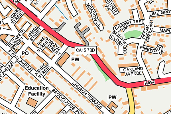
CA15 7BD is located in the Maryport North electoral ward, within the unitary authority of Cumberland and the English Parliamentary constituency of Workington. The Sub Integrated Care Board (ICB) Location is NHS North East and North Cumbria ICB - 01H and the police force is Cumbria. This postcode has been in use since January 1980.


GetTheData
Source: OS OpenMap – Local (Ordnance Survey)
Source: OS VectorMap District (Ordnance Survey)
Licence: Open Government Licence (requires attribution)
| Easting | 304481 |
| Northing | 536044 |
| Latitude | 54.710315 |
| Longitude | -3.484088 |
GetTheData
Source: Open Postcode Geo
Licence: Open Government Licence
| Country | England |
| Postcode District | CA15 |
| ➜ CA15 open data dashboard ➜ See where CA15 is on a map ➜ Where is Maryport? | |
GetTheData
Source: Land Registry Price Paid Data
Licence: Open Government Licence
Elevation or altitude of CA15 7BD as distance above sea level:
| Metres | Feet | |
|---|---|---|
| Elevation | 30m | 98ft |
Elevation is measured from the approximate centre of the postcode, to the nearest point on an OS contour line from OS Terrain 50, which has contour spacing of ten vertical metres.
➜ How high above sea level am I? Find the elevation of your current position using your device's GPS.
GetTheData
Source: Open Postcode Elevation
Licence: Open Government Licence
| Ward | Maryport North |
| Constituency | Workington |
GetTheData
Source: ONS Postcode Database
Licence: Open Government Licence
| January 2024 | Criminal damage and arson | On or near Laburnum Grove | 288m |
| November 2023 | Burglary | On or near Lime Grove | 359m |
| November 2023 | Vehicle crime | On or near Victory Crescent | 445m |
| ➜ Get more crime data in our Crime section | |||
GetTheData
Source: data.police.uk
Licence: Open Government Licence
| Ashby Street (A594) | Ellenborough | 50m |
| Elizabeth Terrace (A594) | Ellenborough | 126m |
| Ellenborough Road (Grasmere Terrace) | Ellenborough | 200m |
| Meadow Way | Maryport | 211m |
| Marsh Terrace (A594) | Ellenborough | 286m |
| Maryport Station | 0.7km |
| Flimby Station | 3.3km |
GetTheData
Source: NaPTAN
Licence: Open Government Licence
GetTheData
Source: ONS Postcode Database
Licence: Open Government Licence


➜ Get more ratings from the Food Standards Agency
GetTheData
Source: Food Standards Agency
Licence: FSA terms & conditions
| Last Collection | |||
|---|---|---|---|
| Location | Mon-Fri | Sat | Distance |
| Netherton | 17:15 | 12:00 | 237m |
| Cedar Crescent | 17:30 | 12:00 | 247m |
| Ellenborough | 17:30 | 12:00 | 298m |
GetTheData
Source: Dracos
Licence: Creative Commons Attribution-ShareAlike
| Facility | Distance |
|---|---|
| Ennerdale Road Playing Field Ennerdale Road, Maryport Grass Pitches | 408m |
| Maryport Arlfc Mealpot Road, Maryport Grass Pitches, Artificial Grass Pitch | 624m |
| Sandy Lonning Community Sports Field Sandy Lonning, Maryport Grass Pitches | 651m |
GetTheData
Source: Active Places
Licence: Open Government Licence
| School | Phase of Education | Distance |
|---|---|---|
| Ellenborough Academy Victory Crescent, Maryport, CA15 7NE | Primary | 237m |
| Netherton Infant School Rydal Avenue, Maryport, CA15 7LT | Primary | 289m |
| Ewanrigg Junior School Ennerdale Road, Maryport, CA15 8HN | Primary | 551m |
GetTheData
Source: Edubase
Licence: Open Government Licence
The below table lists the International Territorial Level (ITL) codes (formerly Nomenclature of Territorial Units for Statistics (NUTS) codes) and Local Administrative Units (LAU) codes for CA15 7BD:
| ITL 1 Code | Name |
|---|---|
| TLD | North West (England) |
| ITL 2 Code | Name |
| TLD1 | Cumbria |
| ITL 3 Code | Name |
| TLD11 | West Cumbria |
| LAU 1 Code | Name |
| E07000026 | Allerdale |
GetTheData
Source: ONS Postcode Directory
Licence: Open Government Licence
The below table lists the Census Output Area (OA), Lower Layer Super Output Area (LSOA), and Middle Layer Super Output Area (MSOA) for CA15 7BD:
| Code | Name | |
|---|---|---|
| OA | E00096507 | |
| LSOA | E01019095 | Allerdale 005A |
| MSOA | E02003969 | Allerdale 005 |
GetTheData
Source: ONS Postcode Directory
Licence: Open Government Licence
| CA15 7BQ | The Ghyll | 69m |
| CA15 7BG | Lowfield Bungalows | 73m |
| CA15 7BH | Chagford Villas | 81m |
| CA15 7NL | Ashby Street | 90m |
| CA15 7BZ | Beechwood Close | 115m |
| CA15 7NN | Boyd Street | 117m |
| CA15 7BB | Elizabeth Terrace | 128m |
| CA15 7PS | Church Terrace | 130m |
| CA15 7NP | George Terrace | 134m |
| CA15 7NR | Edith Terrace | 144m |
GetTheData
Source: Open Postcode Geo; Land Registry Price Paid Data
Licence: Open Government Licence