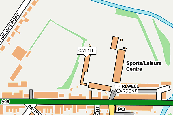
CA1 1LL is located in the Botcherby electoral ward, within the unitary authority of Cumberland and the English Parliamentary constituency of Carlisle. The Sub Integrated Care Board (ICB) Location is NHS North East and North Cumbria ICB - 01H and the police force is Cumbria. This postcode has been in use since January 1980.


GetTheData
Source: OS OpenMap – Local (Ordnance Survey)
Source: OS VectorMap District (Ordnance Survey)
Licence: Open Government Licence (requires attribution)
| Easting | 341448 |
| Northing | 556059 |
| Latitude | 54.895816 |
| Longitude | -2.914475 |
GetTheData
Source: Open Postcode Geo
Licence: Open Government Licence
| Country | England |
| Postcode District | CA1 |
➜ See where CA1 is on a map ➜ Where is Carlisle? | |
GetTheData
Source: Land Registry Price Paid Data
Licence: Open Government Licence
Elevation or altitude of CA1 1LL as distance above sea level:
| Metres | Feet | |
|---|---|---|
| Elevation | 10m | 33ft |
Elevation is measured from the approximate centre of the postcode, to the nearest point on an OS contour line from OS Terrain 50, which has contour spacing of ten vertical metres.
➜ How high above sea level am I? Find the elevation of your current position using your device's GPS.
GetTheData
Source: Open Postcode Elevation
Licence: Open Government Licence
| Ward | Botcherby |
| Constituency | Carlisle |
GetTheData
Source: ONS Postcode Database
Licence: Open Government Licence
| Brunton Park Football Ground (Warwick Road) | Warwick Road | 152m |
| Brunton Avenue (Warwick Road) | Warwick Road | 213m |
| Brunton Park Football Ground (Warwick Road) | Warwick Road | 231m |
| Brunton Avenue (Warwick Road) | Warwick Road | 233m |
| Brunton Park (Greystone Road) | St Aidens | 262m |
| Carlisle Station | 1.3km |
GetTheData
Source: NaPTAN
Licence: Open Government Licence
GetTheData
Source: ONS Postcode Database
Licence: Open Government Licence


➜ Get more ratings from the Food Standards Agency
GetTheData
Source: Food Standards Agency
Licence: FSA terms & conditions
| Last Collection | |||
|---|---|---|---|
| Location | Mon-Fri | Sat | Distance |
| Brunton Park | 19:00 | 12:15 | 187m |
| Tullie Street | 16:15 | 12:45 | 350m |
| Kingfisher Park | 17:20 | 12:15 | 422m |
GetTheData
Source: Dracos
Licence: Creative Commons Attribution-ShareAlike
| Risk of CA1 1LL flooding from rivers and sea | Low |
| ➜ CA1 1LL flood map | |
GetTheData
Source: Open Flood Risk by Postcode
Licence: Open Government Licence
The below table lists the International Territorial Level (ITL) codes (formerly Nomenclature of Territorial Units for Statistics (NUTS) codes) and Local Administrative Units (LAU) codes for CA1 1LL:
| ITL 1 Code | Name |
|---|---|
| TLD | North West (England) |
| ITL 2 Code | Name |
| TLD1 | Cumbria |
| ITL 3 Code | Name |
| TLD12 | East Cumbria |
| LAU 1 Code | Name |
| E07000028 | Carlisle |
GetTheData
Source: ONS Postcode Directory
Licence: Open Government Licence
The below table lists the Census Output Area (OA), Lower Layer Super Output Area (LSOA), and Middle Layer Super Output Area (MSOA) for CA1 1LL:
| Code | Name | |
|---|---|---|
| OA | E00097232 | |
| LSOA | E01019235 | Carlisle 006D |
| MSOA | E02003992 | Carlisle 006 |
GetTheData
Source: ONS Postcode Directory
Licence: Open Government Licence
| CA1 1LJ | Warwick Road | 148m |
| CA1 1LH | Warwick Road | 184m |
| CA1 2BX | Warwick Road | 211m |
| CA1 2AX | Brunton Crescent | 217m |
| CA1 2DU | Thirlwell Gardens | 230m |
| CA1 2BY | Greystone Road | 258m |
| CA1 1LS | St Aidans Road | 268m |
| CA1 1LP | Warwick Road | 275m |
| CA1 2DY | Threave Court | 288m |
| CA1 2AU | Brunton Avenue | 289m |
GetTheData
Source: Open Postcode Geo; Land Registry Price Paid Data
Licence: Open Government Licence