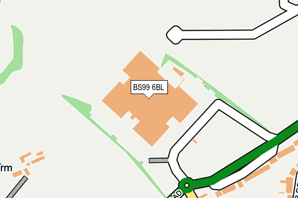
BS99 6BL is located in the Bishopsworth electoral ward, within the unitary authority of Bristol, City of and the English Parliamentary constituency of Bristol South. The Sub Integrated Care Board (ICB) Location is NHS Bristol, North Somerset and South Gloucestershire ICB - 15C and the police force is Avon and Somerset. This postcode has been in use since June 2010.


GetTheData
Source: OS OpenMap – Local (Ordnance Survey)
Source: OS VectorMap District (Ordnance Survey)
Licence: Open Government Licence (requires attribution)
| Easting | 356254 |
| Northing | 169547 |
| Latitude | 51.423234 |
| Longitude | -2.630547 |
GetTheData
Source: Open Postcode Geo
Licence: Open Government Licence
| Country | England |
| Postcode District | BS99 |
| ➜ BS99 open data dashboard ➜ Where is Bristol? | |
GetTheData
Source: Land Registry Price Paid Data
Licence: Open Government Licence
Elevation or altitude of BS99 6BL as distance above sea level:
| Metres | Feet | |
|---|---|---|
| Elevation | 60m | 197ft |
Elevation is measured from the approximate centre of the postcode, to the nearest point on an OS contour line from OS Terrain 50, which has contour spacing of ten vertical metres.
➜ How high above sea level am I? Find the elevation of your current position using your device's GPS.
GetTheData
Source: Open Postcode Elevation
Licence: Open Government Licence
| Ward | Bishopsworth |
| Constituency | Bristol South |
GetTheData
Source: ONS Postcode Database
Licence: Open Government Licence
| April 2023 | Anti-social behaviour | On or near Martha'S Orchard | 281m |
| April 2023 | Anti-social behaviour | On or near Martha'S Orchard | 281m |
| March 2023 | Anti-social behaviour | On or near Martha'S Orchard | 281m |
| ➜ Get more crime data in our Crime section | |||
GetTheData
Source: data.police.uk
Licence: Open Government Licence
| Bridgwater Road | Highridge | 222m |
| Kings Head Lane (Bridgwater Road) | Highridge | 224m |
| Bridgwater Road | Highridge | 227m |
| Kings Head Lane | Highridge | 297m |
| Kings Head Lane (Highridge Green) | Highridge | 338m |
| Parson Street Station | 1.9km |
| Bedminster Station | 3.1km |
| Bristol Temple Meads Station | 4.5km |
GetTheData
Source: NaPTAN
Licence: Open Government Licence
GetTheData
Source: ONS Postcode Database
Licence: Open Government Licence


➜ Get more ratings from the Food Standards Agency
GetTheData
Source: Food Standards Agency
Licence: FSA terms & conditions
| Last Collection | |||
|---|---|---|---|
| Location | Mon-Fri | Sat | Distance |
| South Liberty Lane | 18:30 | 12:00 | 924m |
| Ashton Drive | 17:15 | 12:00 | 1,031m |
| Cheddar Grove | 17:00 | 11:45 | 1,075m |
GetTheData
Source: Dracos
Licence: Creative Commons Attribution-ShareAlike
| Facility | Distance |
|---|---|
| Bedminster Down School Playing Fields Highridge Walk, Bristol Grass Pitches | 554m |
| Trojan Fitness South Liberty Lane, Bristol Health and Fitness Gym | 603m |
| City & County Of Bristol Indoor Bowls Club South Liberty Lane, Bristol Indoor Bowls | 679m |
GetTheData
Source: Active Places
Licence: Open Government Licence
| School | Phase of Education | Distance |
|---|---|---|
| Bedminster Down School Donald Road, Bedminster Down, Bristol, BS13 7DQ | Secondary | 719m |
| St Peter's Church of England Primary School (VC) Ellfield Close, Bishopsworth, Bristol, BS13 8EF | Primary | 959m |
| Cheddar Grove Primary School Cheddar Grove, Bedminster Down, Bristol, BS13 7EN | Primary | 1km |
GetTheData
Source: Edubase
Licence: Open Government Licence
The below table lists the International Territorial Level (ITL) codes (formerly Nomenclature of Territorial Units for Statistics (NUTS) codes) and Local Administrative Units (LAU) codes for BS99 6BL:
| ITL 1 Code | Name |
|---|---|
| TLK | South West (England) |
| ITL 2 Code | Name |
| TLK1 | Gloucestershire, Wiltshire and Bath/Bristol area |
| ITL 3 Code | Name |
| TLK11 | Bristol, City of |
| LAU 1 Code | Name |
| E06000023 | Bristol, City of |
GetTheData
Source: ONS Postcode Directory
Licence: Open Government Licence
The below table lists the Census Output Area (OA), Lower Layer Super Output Area (LSOA), and Middle Layer Super Output Area (MSOA) for BS99 6BL:
| Code | Name | |
|---|---|---|
| OA | E00073322 | |
| LSOA | E01014520 | Bristol 046C |
| MSOA | E02003057 | Bristol 046 |
GetTheData
Source: ONS Postcode Directory
Licence: Open Government Licence
| BS13 8AE | Bridgwater Road | 244m |
| BS13 7AX | Bridgwater Road | 275m |
| BS13 7BL | Oldmead Walk | 291m |
| BS13 7BW | Kings Head Lane | 291m |
| BS13 8BS | Martha's Orchard | 297m |
| BS13 7BN | Kings Head Lane | 321m |
| BS13 8AX | Kings Walk | 342m |
| BS13 7BP | Poplar Road | 369m |
| BS13 8AT | Highridge Green | 374m |
| BS13 8BB | Kings Walk | 380m |
GetTheData
Source: Open Postcode Geo; Land Registry Price Paid Data
Licence: Open Government Licence