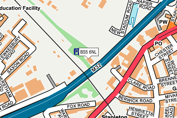
BS5 6NL is located in the Lockleaze electoral ward, within the unitary authority of Bristol, City of and the English Parliamentary constituency of Bristol North West. The Sub Integrated Care Board (ICB) Location is NHS Bristol, North Somerset and South Gloucestershire ICB - 15C and the police force is Avon and Somerset. This postcode has been in use since January 1980.


GetTheData
Source: OS OpenMap – Local (Ordnance Survey)
Source: OS VectorMap District (Ordnance Survey)
Licence: Open Government Licence (requires attribution)
| Easting | 360654 |
| Northing | 174644 |
| Latitude | 51.469384 |
| Longitude | -2.567839 |
GetTheData
Source: Open Postcode Geo
Licence: Open Government Licence
| Country | England |
| Postcode District | BS5 |
➜ See where BS5 is on a map ➜ Where is Bristol? | |
GetTheData
Source: Land Registry Price Paid Data
Licence: Open Government Licence
Elevation or altitude of BS5 6NL as distance above sea level:
| Metres | Feet | |
|---|---|---|
| Elevation | 10m | 33ft |
Elevation is measured from the approximate centre of the postcode, to the nearest point on an OS contour line from OS Terrain 50, which has contour spacing of ten vertical metres.
➜ How high above sea level am I? Find the elevation of your current position using your device's GPS.
GetTheData
Source: Open Postcode Elevation
Licence: Open Government Licence
| Ward | Lockleaze |
| Constituency | Bristol North West |
GetTheData
Source: ONS Postcode Database
Licence: Open Government Licence
| Berwick Road (Stapleton Road) | Eastville | 147m |
| Robertson Road | Eastville | 223m |
| Robertson Road | Eastville | 229m |
| Robertson Road (Stapleton Road) | Eastville | 241m |
| Oxford Place (Warwick Road) | Easton | 278m |
| Stapleton Road Station | 0.2km |
| Lawrence Hill Station | 1.3km |
| Montpelier Station | 1.5km |
GetTheData
Source: NaPTAN
Licence: Open Government Licence
GetTheData
Source: ONS Postcode Database
Licence: Open Government Licence

➜ Get more ratings from the Food Standards Agency
GetTheData
Source: Food Standards Agency
Licence: FSA terms & conditions
| Last Collection | |||
|---|---|---|---|
| Location | Mon-Fri | Sat | Distance |
| Easton Post Office | 17:00 | 12:00 | 214m |
| St Marks Church | 17:30 | 12:30 | 331m |
| Stapleton Roadpost Office | 17:00 | 11:30 | 341m |
GetTheData
Source: Dracos
Licence: Creative Commons Attribution-ShareAlike
| Risk of BS5 6NL flooding from rivers and sea | Low |
| ➜ BS5 6NL flood map | |
GetTheData
Source: Open Flood Risk by Postcode
Licence: Open Government Licence
The below table lists the International Territorial Level (ITL) codes (formerly Nomenclature of Territorial Units for Statistics (NUTS) codes) and Local Administrative Units (LAU) codes for BS5 6NL:
| ITL 1 Code | Name |
|---|---|
| TLK | South West (England) |
| ITL 2 Code | Name |
| TLK1 | Gloucestershire, Wiltshire and Bath/Bristol area |
| ITL 3 Code | Name |
| TLK11 | Bristol, City of |
| LAU 1 Code | Name |
| E06000023 | Bristol, City of |
GetTheData
Source: ONS Postcode Directory
Licence: Open Government Licence
The below table lists the Census Output Area (OA), Lower Layer Super Output Area (LSOA), and Middle Layer Super Output Area (MSOA) for BS5 6NL:
| Code | Name | |
|---|---|---|
| OA | E00074057 | |
| LSOA | E01014665 | Bristol 014D |
| MSOA | E02003025 | Bristol 014 |
GetTheData
Source: ONS Postcode Directory
Licence: Open Government Licence
| BS5 6NQ | Stapleton Road | 136m |
| BS5 0NL | Stapleton Road | 151m |
| BS5 6NE | Stapleton Road | 165m |
| BS5 0YA | Fox Road | 177m |
| BS5 0NN | Stapleton Road | 186m |
| BS5 6NF | Clare Road | 201m |
| BS5 6NG | Berwick Road | 208m |
| BS5 6HY | St Marks Road | 227m |
| BS2 9UH | Warminster Road | 238m |
| BS5 6NA | Stapleton Road | 238m |
GetTheData
Source: Open Postcode Geo; Land Registry Price Paid Data
Licence: Open Government Licence