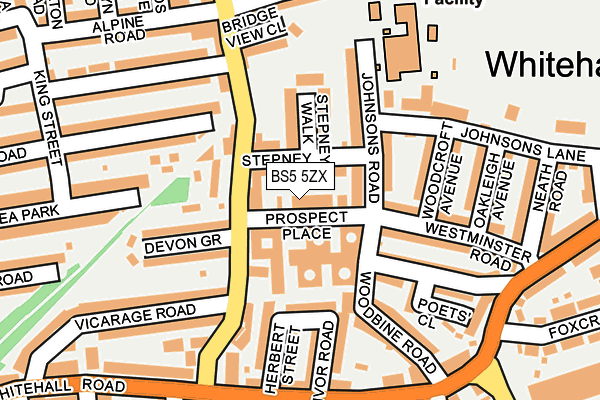
BS5 5ZX is located in the Easton electoral ward, within the unitary authority of Bristol, City of and the English Parliamentary constituency of Bristol West. The Sub Integrated Care Board (ICB) Location is NHS Bristol, North Somerset and South Gloucestershire ICB - 15C and the police force is Avon and Somerset. This postcode has been in use since April 2004.


GetTheData
Source: OS OpenMap – Local (Ordnance Survey)
Source: OS VectorMap District (Ordnance Survey)
Licence: Open Government Licence (requires attribution)
| Easting | 361426 |
| Northing | 173984 |
| Latitude | 51.463505 |
| Longitude | -2.556652 |
GetTheData
Source: Open Postcode Geo
Licence: Open Government Licence
| Country | England |
| Postcode District | BS5 |
| ➜ BS5 open data dashboard ➜ See where BS5 is on a map ➜ Where is Bristol? | |
GetTheData
Source: Land Registry Price Paid Data
Licence: Open Government Licence
Elevation or altitude of BS5 5ZX as distance above sea level:
| Metres | Feet | |
|---|---|---|
| Elevation | 30m | 98ft |
Elevation is measured from the approximate centre of the postcode, to the nearest point on an OS contour line from OS Terrain 50, which has contour spacing of ten vertical metres.
➜ How high above sea level am I? Find the elevation of your current position using your device's GPS.
GetTheData
Source: Open Postcode Elevation
Licence: Open Government Licence
| Ward | Easton |
| Constituency | Bristol West |
GetTheData
Source: ONS Postcode Database
Licence: Open Government Licence
| January 2024 | Criminal damage and arson | On or near Bloy Street | 281m |
| November 2023 | Criminal damage and arson | On or near Bloy Street | 281m |
| November 2023 | Criminal damage and arson | On or near Bloy Street | 281m |
| ➜ Get more crime data in our Crime section | |||
GetTheData
Source: data.police.uk
Licence: Open Government Licence
| Prospect Place (Devon Road) | Whitehall | 89m |
| Prospect Place (Devon Road) | Whitehall | 106m |
| Devon Road Bruce Road (Devon Road) | Whitehall | 191m |
| Lyppiat Road (Whitehall Road) | Whitehall | 220m |
| Lyppiat Road (Whitehall Road) | Whitehall | 224m |
| Stapleton Road Station | 0.8km |
| Lawrence Hill Station | 0.8km |
| Montpelier Station | 2.3km |
GetTheData
Source: NaPTAN
Licence: Open Government Licence
GetTheData
Source: ONS Postcode Database
Licence: Open Government Licence


➜ Get more ratings from the Food Standards Agency
GetTheData
Source: Food Standards Agency
Licence: FSA terms & conditions
| Last Collection | |||
|---|---|---|---|
| Location | Mon-Fri | Sat | Distance |
| Whitehall Road | 17:30 | 11:30 | 198m |
| Tudor Road | 16:00 | 11:45 | 335m |
| Cooperation Road | 16:00 | 11:45 | 415m |
GetTheData
Source: Dracos
Licence: Creative Commons Attribution-ShareAlike
| Facility | Distance |
|---|---|
| Whitehall Sports Ground Johnsons Road, Bristol Grass Pitches, Athletics | 262m |
| The City Academy Bristol Russell Town Avenue, Bristol Health and Fitness Gym, Sports Hall, Artificial Grass Pitch, Studio, Outdoor Tennis Courts | 531m |
| St George Park Lyndale Road, Bristol Outdoor Tennis Courts | 568m |
GetTheData
Source: Active Places
Licence: Open Government Licence
| School | Phase of Education | Distance |
|---|---|---|
| The Limes Nursery School Johnsons Road, Whitehall, Bristol, BS5 9AT | Nursery | 132m |
| Whitehall Primary School Johnsons Lane, Whitehall, Bristol, BS5 9AT | Primary | 169m |
| The City Academy Bristol Russell Town Avenue, Bristol, BS5 9JH | Secondary | 499m |
GetTheData
Source: Edubase
Licence: Open Government Licence
The below table lists the International Territorial Level (ITL) codes (formerly Nomenclature of Territorial Units for Statistics (NUTS) codes) and Local Administrative Units (LAU) codes for BS5 5ZX:
| ITL 1 Code | Name |
|---|---|
| TLK | South West (England) |
| ITL 2 Code | Name |
| TLK1 | Gloucestershire, Wiltshire and Bath/Bristol area |
| ITL 3 Code | Name |
| TLK11 | Bristol, City of |
| LAU 1 Code | Name |
| E06000023 | Bristol, City of |
GetTheData
Source: ONS Postcode Directory
Licence: Open Government Licence
The below table lists the Census Output Area (OA), Lower Layer Super Output Area (LSOA), and Middle Layer Super Output Area (MSOA) for BS5 5ZX:
| Code | Name | |
|---|---|---|
| OA | E00073576 | |
| LSOA | E01014564 | Bristol 055A |
| MSOA | E02006888 | Bristol 055 |
GetTheData
Source: ONS Postcode Directory
Licence: Open Government Licence
| BS5 9AU | Stepney Road | 28m |
| BS5 9AX | Stepney Walk | 85m |
| BS5 9AY | Devon Road | 90m |
| BS5 9AT | Johnsons Road | 90m |
| BS5 9BN | Ida Road | 108m |
| BS5 9AH | Devon Grove | 127m |
| BS5 9AD | Devon Road | 131m |
| BS5 9AW | Westminster Road | 137m |
| BS5 9AN | Westminster Road | 139m |
| BS5 9BL | Herbert Street | 141m |
GetTheData
Source: Open Postcode Geo; Land Registry Price Paid Data
Licence: Open Government Licence