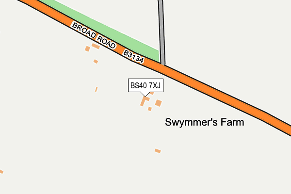
BS40 7XJ lies on Broad Road in Blagdon, Bristol. BS40 7XJ is located in the Mendip Hills electoral ward, within the unitary authority of Somerset and the English Parliamentary constituency of Wells. The Sub Integrated Care Board (ICB) Location is NHS Somerset ICB - 11X and the police force is Avon and Somerset. This postcode has been in use since December 1997.


GetTheData
Source: OS OpenMap – Local (Ordnance Survey)
Source: OS VectorMap District (Ordnance Survey)
Licence: Open Government Licence (requires attribution)
| Easting | 350243 |
| Northing | 157279 |
| Latitude | 51.312436 |
| Longitude | -2.715270 |
GetTheData
Source: Open Postcode Geo
Licence: Open Government Licence
| Street | Broad Road |
| Locality | Blagdon |
| Town/City | Bristol |
| Country | England |
| Postcode District | BS40 |
| ➜ BS40 open data dashboard ➜ See where BS40 is on a map | |
GetTheData
Source: Land Registry Price Paid Data
Licence: Open Government Licence
Elevation or altitude of BS40 7XJ as distance above sea level:
| Metres | Feet | |
|---|---|---|
| Elevation | 270m | 886ft |
Elevation is measured from the approximate centre of the postcode, to the nearest point on an OS contour line from OS Terrain 50, which has contour spacing of ten vertical metres.
➜ How high above sea level am I? Find the elevation of your current position using your device's GPS.
GetTheData
Source: Open Postcode Elevation
Licence: Open Government Licence
| Ward | Mendip Hills |
| Constituency | Wells |
GetTheData
Source: ONS Postcode Database
Licence: Open Government Licence
| Paywell Farm (B3134) | Charterhouse | 754m |
| Paywell Farm | Charterhouse | 764m |
| Church Street (Bath Road) | Blagdon | 1,392m |
| Dipland Grove (Bath Road) | Blagdon | 1,397m |
| Church Street (Bath Road) | Blagdon | 1,398m |
GetTheData
Source: NaPTAN
Licence: Open Government Licence
| Percentage of properties with Next Generation Access | 0.0% |
| Percentage of properties with Superfast Broadband | 0.0% |
| Percentage of properties with Ultrafast Broadband | 0.0% |
| Percentage of properties with Full Fibre Broadband | 0.0% |
Superfast Broadband is between 30Mbps and 300Mbps
Ultrafast Broadband is > 300Mbps
| Percentage of properties unable to receive 2Mbps | 0.0% |
| Percentage of properties unable to receive 5Mbps | 0.0% |
| Percentage of properties unable to receive 10Mbps | 0.0% |
| Percentage of properties unable to receive 30Mbps | 100.0% |
GetTheData
Source: Ofcom
Licence: Ofcom Terms of Use (requires attribution)
GetTheData
Source: ONS Postcode Database
Licence: Open Government Licence


➜ Get more ratings from the Food Standards Agency
GetTheData
Source: Food Standards Agency
Licence: FSA terms & conditions
| Last Collection | |||
|---|---|---|---|
| Location | Mon-Fri | Sat | Distance |
| Burrington Combe | 15:00 | 09:45 | 3,143m |
| Bellevue | 15:30 | 08:00 | 3,503m |
| Newbury Hill | 17:15 | 11:15 | 4,510m |
GetTheData
Source: Dracos
Licence: Creative Commons Attribution-ShareAlike
| Facility | Distance |
|---|---|
| Blagdon Cricket Club Bath Road, Blagdon Grass Pitches | 1.5km |
| Fairlands Middle School Masons Way, Cheddar Grass Pitches | 5.7km |
| Churchill C Of E Primary School Pudding Pie Lane, Langford, Bristol Grass Pitches | 5.9km |
GetTheData
Source: Active Places
Licence: Open Government Licence
| School | Phase of Education | Distance |
|---|---|---|
| Blagdon Primary School Bath Road, Blagdon, Bristol, BS40 7RW | Primary | 1.4km |
| Ubley Church of England Primary School The Street, Ubley, Bristol, BS40 6PJ | Primary | 2.9km |
| Burrington Church of England Primary School Burrington, Bristol, BS40 7AD | Primary | 3.2km |
GetTheData
Source: Edubase
Licence: Open Government Licence
The below table lists the International Territorial Level (ITL) codes (formerly Nomenclature of Territorial Units for Statistics (NUTS) codes) and Local Administrative Units (LAU) codes for BS40 7XJ:
| ITL 1 Code | Name |
|---|---|
| TLK | South West (England) |
| ITL 2 Code | Name |
| TLK2 | Dorset and Somerset |
| ITL 3 Code | Name |
| TLK23 | Somerset CC |
| LAU 1 Code | Name |
| E07000187 | Mendip |
GetTheData
Source: ONS Postcode Directory
Licence: Open Government Licence
The below table lists the Census Output Area (OA), Lower Layer Super Output Area (LSOA), and Middle Layer Super Output Area (MSOA) for BS40 7XJ:
| Code | Name | |
|---|---|---|
| OA | E00148002 | |
| LSOA | E01029060 | Mendip 005B |
| MSOA | E02006051 | Mendip 005 |
GetTheData
Source: ONS Postcode Directory
Licence: Open Government Licence
| BS40 7XY | Two Trees | 421m |
| BS40 7TU | Ellick Road | 932m |
| BS40 7XX | 995m | |
| BS40 7TY | 1058m | |
| BS40 7TX | Newfields | 1080m |
| BS40 7RX | Score Lane | 1185m |
| BS40 7SH | The Score | 1237m |
| BS40 7RP | Sladacre Lane | 1242m |
| BS40 7RU | West Croft | 1272m |
| BS40 7XN | Ubley Drove | 1295m |
GetTheData
Source: Open Postcode Geo; Land Registry Price Paid Data
Licence: Open Government Licence